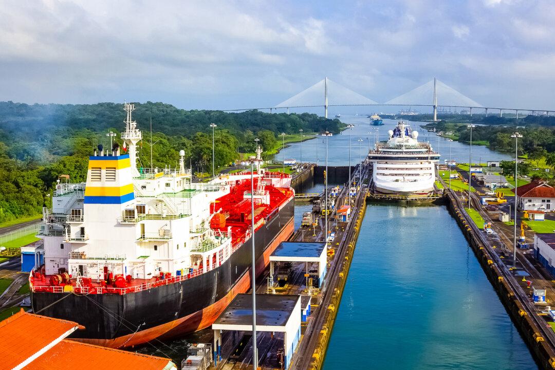
From the sky, the first thing you notice is the ships. So many of them. Lined up, as if they’re stalled, bumper to bumper, in a big city’s rush-hour traffic jam. Huge cargo vessels and their multicolored shipping crates, with wares from all over the world, piled up to the height of a high-rise.
On board: hundreds of millions of metric tons of brand-new vehicles and heaps of grains and cereals, along with loads of energy, coal, oil, and much more. The lifeblood of the world, waiting to pass from sea to sea.
Perhaps the most vital waterway on earth, the Panama Canal slices through a little more than 50 miles of lush, Central American rainforest, the water dividing two continents. Located at one of the narrowest points of land in the Americas, the importance of the opening of the canal in 1914 can’t be understated. It literally shaved weeks off of often-hazardous ocean voyages.
Previously, ships would have to sail “around the horn,” down at the bottom of South America. Proceeding around Cape Horn, these vessels were routinely rocked by the infamous winds and waves of the Drake Passage, one of the world’s most tempestuous stretches of sea.
Now, maritime traffic passes easily back and forth here, gliding without drama between the Atlantic and the Pacific. In the service of such a grand task, I think I’d expected something a little more magnificent when I first saw it. Towering gates, maybe. Perhaps a really tall archway of some sort, emblazoned with a neon sign proclaiming “Welcome to the only waterway to link two oceans and two continents.”
Instead, I saw that the land just opens up. Gunmetal-gray water flows between verdant shores, disappearing into dark mountains. The Bridge of the Americas links the two sides. Nearby, Panama City rises, with endless white towers on a broad crescent of the Pacific—this capital city of more than 2 million people looks so much like Miami and contains about half of Panama’s population.
First Attempts
Building the canal was more than monumental and was hundreds of years in the making. All the way back in the 1500s, King Charles I of Spain commissioned a survey to explore its possibility. Explorer Vasco Núñez de Balboa had recognized the relatively short distance between oceans here, but a route along the Chagres River was ultimately deemed too difficult to excavate with the technology of the time.Centuries later, in 1880, France finally broke ground. The workers had a capable leader in Count Ferdinand de Lesseps. A member of the French aristocracy born at Versailles, he had spectacular success building the Suez Canal, which opened in 1869 and linked the Red Sea with the Mediterranean. (Lesseps also formally presented a grand gift to the United States from France—the Statue of Liberty.)
Realizing the Dream
But the prospect of a canal here was too tempting to leave for long. Panama formally separated from Colombia in 1903, becoming an independent nation backed by the U.S. military. In 1904, the U.S. Army Corps of Engineers restarted the work the French has started.
One of the unlikely heroes was a man named William Crawford Gorgas. An Army doctor, he had seen yellow fever before, during his long career serving all over the world. He recovered from a nearly deadly bout himself during a posting in Texas, then later encountered it again while serving in Havana during the Spanish–American War. While many didn’t believe him, Gorgas knew mosquitos spread the disease. He ordered ponds drained, fumigated work areas, and covered the windows of homes and bunkhouses with nets. His efforts saved thousands of lives.
The Americans (with laborers mostly from the West Indies) built a canal that climbs to a height of 85 feet. Locks lift ships up to the artificial Gatun Lake, then lower them back down on the other side. It was, at the time, the most expensive construction project in U.S. history. Workers excavated almost a quarter-billion cubic yards of soil and rock to make it happen.
For decades, the canal was legally American soil. An unincorporated territory, the Panama Canal Zone extended for five miles from the center line of the waterway, covering 553 square miles and operating as a whole separate world from the Central American country that completely surrounded it. The U.S. government operated everything from post offices to movie theaters and bowling alleys in the towns within. In 1979, the Zone was abolished with the advent of joint U.S.–Panamanian control, and ownership of the canal was passed wholly to Panama in 1999.
While few of its wonders are visible from ground level, the Panama Canal remains an exceptional place. Crossing the Bridge of the Americas, I peered down at cargo ships and pilot boats passing underneath. Just beyond rose the docks of the Port of Balboa, the busiest container port in Latin America.