“Hidden away by the Gods, like a necklace of pearls, among the crags and vastness of the Swan Mountains, lies the Jewel Basin; the enchanted land of this, our Montana. Friends, I have seen the sun set on the minarets of Spain, and make splendid the dome of St. Sophia in Constantinople. I have watched the play of color upon the desert of Egypt with the Sphinx and pyramids. I have made a trail through the hinterland of the Canadian Rockies to where the Aurora Borealis from the polar skies make the northern night glorious ... but for kaleidoscopic lights and shadows, for octaves of tone and color, for unending variety of the moods and forms of nature, Jewel Basin is the most charmed and charming spot in all the world.”—From “The Secret of Wilderness,” by the Rev. Eugene Cosgrove, 1919.
The crown of the continent sits regally upon the rocky outcrop and snow-capped peaks of the Rocky Mountains shared between Canada and the United States. Glittering lakes reflect the beauty of the golden halo that encompasses more than 10 million acres surrounding Waterton, Canada, Glacier National Park, and the Bob Marshall Wilderness in Montana.
This is a wild, expansive ecosystem that comprises national parks, Forest Service land, private land, and tribal territories. Jewel Basin is but one gemstone that sits within the crown.
Getting There
Getting to Jewel is the initial adventure. I have to say that I am thrilled by wild roads. Four of us pack ourselves into a Can-Am Defender, girls in the front and guys in the back. We begin the ascent up the narrow, winding gravel road, unsure of whether or not we will be blocked by the impact of seasonal storms. The road is barely wide enough to hold one vehicle, so being in the Can-Am feels comforting, considering the cliffside drops.On our left side, the Flathead Valley plays peek-a-boo with the tree-covered slopes of Jewel and our collective delight. It takes about 20 minutes to make the bumpy, seven-mile journey, only to be stopped in our tracks by the depth of snow that blankets the road. We have no ability to charge through this obstacle—not likely for another month, pushing forward into July.
Having been hiking in Jewel before, we know that we are approximately one mile from the trailhead, aptly named Camp Misery. Folklore weaves stories of a local tribe giving the trail its namesake after spending a horrific winter up there at 5,717 feet. One can imagine the challenges of living in a place trying to source the necessities of life in deep snow for eight months of the year.
Up to Mount Aeneas
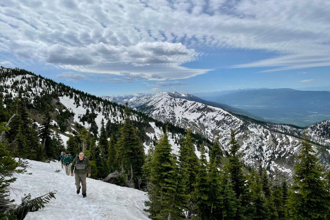
We put our boots on the ground and decide to trudge through the snow en route to Jewel’s highest peak, Mount Aeneas (7,528 feet).During this season, however, caution has to be exercised; a slide down steep slopes and the strict avoidance of unstable cornices become a part of this June adventure. Not to mention that this is grizzly country and the waking of winter skinny, hungry bears is a trail reality.
My party of four becomes mesmerized and argumentative as to what mountain creature leaves the large catlike footprints in the snow, just steps ahead of us. Mountain lions and bears now become part of our radar. We find some reprieve when our snowbound trail gives way to dirt, but within minutes, we are walking upon snow once again.
Snowbound Trails
Most sources say that early July is a better time to explore this area. But what we get with snowbound trails is a vast wilderness to ourselves and the heavy, clawed animal walking the trail before us. The summit is approximately 3.5 miles from the Camp Misery trailhead. Trail 717 becomes a mile of switchbacks and offers a wide-open view of the turquoise and glitter of Flathead Lake. The blackened remnants of the 2006 burn are hauntingly beautiful and a reminder of the restoration that is possible following trauma.After a couple of hours, we arrive at the microwave tower. We sit down, out of the cold wind, and eat our lunch, blessed by the magic and expanse of the mountain range.
Mount Aeneas exists now just a short, steep walk to the right. The trail is obscured by snow and steep cornices. Four men have skinned to the summit with three Bernese Mountain dogs in tow. We take a look at the massive footprints left by the dogs and understand the prints that we have been following all morning. As we assess the safety implications of reaching the summit without poles, I envision early American Indians who have set up their camps, hunting for their food and braving the long winter. Mount Aeneas would be the perspective from which to survey food and safety.
The sweeping views are majestic, lightly touched, and serene. There is movement off the summit, as a snowboarder makes his turns in fresh snow, with three dogs trailing behind him.
As I stand and gaze out over this snow-kissed valley, I can’t help but feel such gratitude for my legs, lungs, and a curiosity to explore the wonder of our world. There is always some suffering during the work to get to lofty heights, but we are always rewarded with magnificent beauty and a renewed appreciation for what it means to be alive.
With 27 lakes and 35 miles of trails, one could spend weeks hiking and camping in this beautiful basin. Today, however, our summit push feels threatened by dangerous cornices and a poorly marked, wintery trail. We let our experience guide us back down the trail to Camp Misery and vow that we will return with the sunshine and Indian paintbrush coloring the land.
They say that diamonds are a girl’s best friend, but I know I’d rather have the Jewel.