5 South Carolina Waterfalls With Spectacular Views and How to Find Them

5 South Carolina Waterfalls With Spectacular Views and How to Find Them
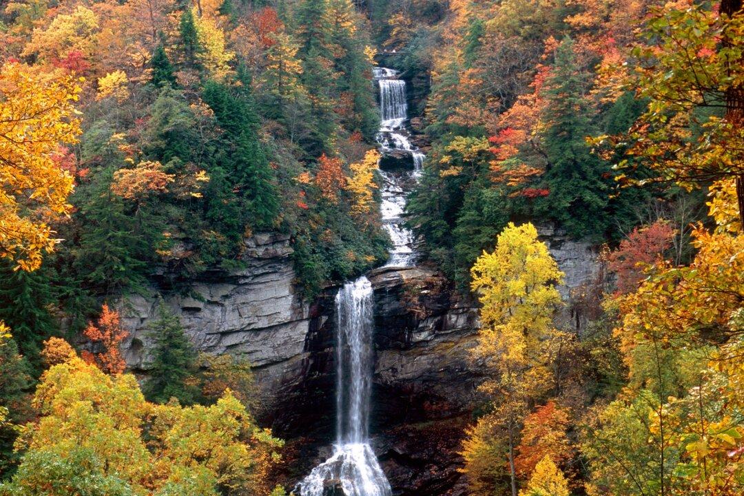
At 400 feet, Raven Cliff Falls are the highest in South Carolina. The trail to the falls, located in Caesars Head State Park, is a moderate 2.2-mile hike. Lyle Fink/Dreamstime/TNS
Tribune News Service
Updated:
By Patrick McCreless From The Charlotte Observer

Summertime is in full swing, opening the doors for hiking and camping trips on trails and through parks in South Carolina.
With the summer heat in full swing too though, it would be nice to reach a cool waterfall or two at the end of those hiking and camping trips. Many of those waterfalls and their spectacular views, however, are tucked away in the wilderness, with clear directions to them not always easy to find.

But don’t get discouraged just yet.

Below are detailed directions to five South Carolina waterfalls with spectacular views.

Lower Whitewater Falls

Location: Oconee County
Lower Whitewater Falls, just above Lake Jocassee in Salem, S.C. (Cavan-Images/Shutterstock)
Lower Whitewater Falls, just above Lake Jocassee in Salem, S.C. Cavan-Images/Shutterstock

The Lower Whitewater Falls comprises a dramatic 200-foot drop. It’s part of the Whitewater Falls chain, which comprises six waterfalls along the North and South Carolina border. A 1-hour, 2-mile hike along the Foothills Trail and a spur trail can get visitors to an amazing overlook.

Directions: From Walhalla, drive north on SC 11 (Cherokee Foothills Scenic Highway) for 14 miles and turn left onto SC 130. Drive north on SC 130 for 10.5 miles and turn right (east) at the entrance to Duke Power’s Bad Creek Hydroelectric Station. Pass through the automatic gate. (Entrance onto the property is allowed only during daylight hours. Exiting the property through this gate is allowed at all hours.)

Drive approximately 2 miles to the parking area for the Foothills Trail/Whitewater River. (This is a lighted parking lot with a public telephone and portable toilets.) From the trailhead at the far end of the parking area, walk. Follow the blue blazes of the Lower Whitewater Falls overlook spur. At 0.6 mile the spur will cross over the Whitewater River.

Turn right (northeast). At this point the spur is concurrent with the Jocassee Gorges Segment of the Foothills Trail bound for Laurel Valley. (The Foothills Trail is marked with white blazes.)

When the trail intersects a gravel road, follow the gravel road briefly (about 200 yards) and then resume your hike on the trail. A blue blaze and an arrow sign on the right point the way. Continue to the overlook.

Rainbow Falls

Location: Jones Gap State Park in Greenville County
Rainbow Falls in South Carolina. (Jlpphoto/Shutterstock)
Rainbow Falls in South Carolina. Jlpphoto/Shutterstock

Rainbow Falls drops 100 feet over steep walls. Reaching Rainbow Falls requires a tough 5-mile, round-trip hike.

Directions: Departing Jones Gap, travel approximately 0.75 miles along the blue-blazed Jones Gap Trail, then veer to the right onto the red-blazed Rainbow Falls Trail. From here, climb approximately 1,000 feet over a distance of 1.6 miles to the base of Rainbow Falls. After relaxing at the base of the falls, you can return to Jones Gap along the trails you traveled and gaze upon the amazing vistas of the Jones Gap valley that open up as you descend.

Raven Cliff Falls

Location: Caesars Head State Park in Greenville County
At 400 feet, Raven Cliff Falls are the highest in South Carolina. The trail to the falls, located in Caesars Head State Park, is a moderate 2.2-mile hike. (Lyle Fink/Dreamstime/TNS)
At 400 feet, Raven Cliff Falls are the highest in South Carolina. The trail to the falls, located in Caesars Head State Park, is a moderate 2.2-mile hike. Lyle Fink/Dreamstime/TNS

At 400 feet, Raven Cliff Falls is the highest waterfall in South Carolina. The trail to the falls is a moderate 2.2-mile hike. The Gum Gap/Foothills Trail leads to the top of the falls. Visitors can hike to views of Raven Cliff Falls before heading to the suspension bridge at the top.

Directions: The trail begins on the other side of the highway from the parking lot. This hike follows the Raven Cliff Falls Trail (#11, Red), the Gum Gap Trail (#13, Blue), and the Naturaland Trust Trail (#14, Pink).

Follow the Raven Cliff Falls Trail to the end before hiking out to the suspension bridge to cat a long distance view of the falls from across the gorge.

Backtrack to the first intersection you passed to take the Gum Gap Trail, which is the easiest section of the hike. Turn left on the Naturaland Trust Trail. Just before the bridge, the trail follows closely along Matthews Creek with a few side trails to explore around smaller falls.

Once you arrive at the suspension bridge over Raven Cliff Falls, you’ll get another view to the opposite side of the gorge.

Brasstown Falls

Location: The southern edge of Sumter National Forest in Oconee County
(Alex H Murrell/Shutterstock)
Alex H Murrell/Shutterstock

At Brasstown Falls, visitors have the option of checking out four good views.

The trails have been improved, along with a pedestrian bridge. Several new observation platforms were added so visitors can see four different sections of the waterfall. Reaching this waterfall was once considered a difficult hike that required a steep descent on an unmarked trail. Now there are wooden steps, rock bridges, and a log ladder to help visitors climb down to the lower falls.

The entire hike to the falls is a mile long.

Directions: You can access the trailhead from Brasstown Road in Long Creek, SC. More specifically, drive 2.6 miles down Brasstown Road, then when the pavement ends, continue 1.3 miles on the dirt road. Go right when the road forks, then go 0.4 miles to the parking area and you’ll see the trailhead.

From the parking lot, you’ll walk about five minutes along a flat path before you reach a fork in the trail. To the left is Little Brasstown Falls. A pedestrian bridge now makes the quarter-mile passage to the falls virtually effortless.

Retrace your steps back to the fork in the trail and take the right leg to see the other three major drops.

The first waterfall you’ll come to is Brasstown Cascades. It tumbles 50 feet down rock ledges into a calm swimming hole. From there, the path narrows and descends along the creek. With the new steps, it’s now much easier to make it down to the next section of the falls where the water plunges 35 feet from a long flat ledge.

More steep steps and a log ladder will get you to Brasstown Sluice, the final section of Brasstown Falls.

King Creek Falls

Location: Sumter National Forest, Oconee County
King Creek Falls, South Carolina. (Ponch Valinzuela/Shutterstock)
King Creek Falls, South Carolina. Ponch Valinzuela/Shutterstock

King Creek Falls is a 70-foot waterfall near Burrells Ford on the Chattooga River. This waterfall offers an easy hike and photogenic falls. This hike is a 30-minute, moderate half-mile one-way trip.

Directions: Heading north on Highway 107, travel for approximately 10 miles and turn left onto FS708 (Burrell’s Ford Road). In approximately 2.3 miles, turn left into the Burrell’s Ford parking area, GPS 34.97148, -83.11451.

From there, the hike to King Creek Falls is approximately 1.7 miles round trip. It begins by walking behind the gate and down the road and then takes a left onto a narrow, well-defined trail. There are signs along the trail that indicate the way to King Creek Falls.

©2022 The Charlotte Observer. Visit at charlotteobserver.com. Distributed by Tribune Content Agency, LLC.
Related Topics