Updating Canada’s Flood Maps Would Help Mitigate Risk, Prof Says

Updating Canada’s Flood Maps Would Help Mitigate Risk, Prof Says
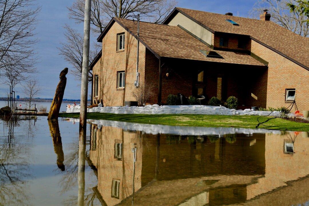
A flooded home next to the Ottawa River near Saratoga, Gatineau in Quebec on April 30, 2019. Jonathan Ren/The Epoch Times
Margaret Wollensak
Updated:

Over the past few weeks, severe flooding in Ontario, Quebec, and New Brunswick due to melting snow and heavy rains has forced thousands of people to abandon their homes. Communities in the Prairies and British Columbia often have to deal with the travails of the spring flood season as well.

According to federal government figures, floods are the most common natural hazard in Canada, with flooding costing taxpayers $20 billion in damages between 2003 and 2012.
But one expert says that updating Canada’s flood risk maps and making those maps more easily accessible to the public is an important part of helping homeowners determine if they’re at risk from flooding.

A study of Canada’s flood maps co-authored by Jason Thistlethwaite, a professor of environment and economics at the University of Waterloo, found that most flood maps across the country are out of date, which means homes end up getting built in flood-prone areas.

Titled Flood Risk Mapping in Canada, the policy brief also found that Canadians in most parts of the country lack access to high-quality flood risk maps, and that the availability of flood maps is grossly uneven across the 10 provinces.

“In Canada right now, we’re ignorant of this risk, so we’re not even able to defend our property,” Thistlethwaite said on the CBC radio program “Day 6.”

“It’s absurd as an industrialized country, we actually don’t have high-quality flood maps to let people know about their exposure to flood risk.”

Thistlethwaite told Globe and Mail that as many as a third of Canadians live in flood-prone areas but don’t have flood maps they can consult, either because they are out of date or don’t exist.

Houses and streets are flooded near Saratoga, Gatineau in Quebec on April 30, 2019. (Jonathan Ren/The Epoch Times)
Houses and streets are flooded near Saratoga, Gatineau in Quebec on April 30, 2019. Jonathan Ren/The Epoch Times

Flood maps typically show elevations and flood extents, with flood lines showing the boundaries of actual or potential floods. The maps can serve as a decision-making tool in flood mitigation, land use planning, emergency management, as well as public awareness. They can also help identify specific impacts of floods on things such as structures, people, and assets.

The federal government’s Flood Damage Reduction Program ended its active mapping phase in 1997, after which provinces and other levels of government had to use their own resources to continue updating or mapping areas.

In recent years, however, Ottawa has taken steps to update existing maps or create new ones to mitigate flood risk by establishing the Federal Flood Mapping Framework. It provides the background and context on flood mapping in Canada, which is intended to be adapted as technology and science develops.

Some other countries grappling with flooding have made efforts to make their flood maps more easily accessible to the public.

In Australia, after major flooding in 2011, the government launched an online database of flood maps and studies the following year. The United Kingdom has made detailed flood maps publicly available through the National Flood Information Service that include explanations and advice.

In a separate brief, Thistlewaite and co-author Daniel Henstra found that low public awareness of flooding risk is a common problem in many areas of Canada, and up-to-date, publicly available flood maps would help change that.

“This lack of awareness often underpins a broader perception that governments are responsible for managing flood risk while property owners have no role to play,” the brief says.

The brief identified three core objectives of flood risk management—resilience, efficiency, and legitimacy—but acknowledged that the objectives need to be balanced with local contexts, including regulations, resources, proximity to water, and risk perceptions.

For example, for communities with high exposure to flood risk, policies that prioritize resilience are likely to be more suitable. One policy example would be property buyouts, although the property owner would bear the burden of moving.

Quebec Premier Francois Legault has taken this approach, offering $200,000 to Quebecers with homes built on flood plains to move to an area less prone to flooding. Many homeowners are reluctant to move, however, as they believe the value of their homes to be much greater than that.

As of May 1, over 10,000 people have been evacuated across the province due to the severe flooding taking place, according to the latest numbers from Urgence Quebec.