Reinforcements Sent After More Rain, Flash Flooding

Reinforcements Sent After More Rain, Flash Flooding
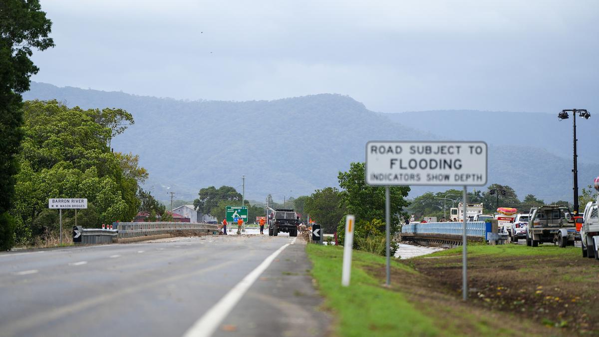
Barron Bridge along the Captain Cook Highway is closed due to flooding in Cairns in Far North Queensland on Dec. 18, 2023. AAP Image/Nuno Avendano
AAP
By AAP
Updated:
0:00

Reinforcements have been sent and the army is on standby after heavy rain again lashed a region on cyclone watch, sparking “life-threatening” flash flooding fears.

Extra emergency services were deployed to north Queensland on Jan. 31 as three tropical lows loomed off the coast, bringing more rain after a week-long deluge.
The low-pressure system off Cairns is unlikely to develop into a cyclone but has brought “intensely” heavy rainfall to the north tropical coast, sparking road closures, and multiple rescues.

There were claims crocodiles had been spotted in floodwaters in Townsville after the sodden region copped a battering from Cooktown to Mackay.

The Bruce Highway—Queensland’s major arterial road—was closed on Friday north of Bowen after severe flash flooding.

Another low in the Gulf of Carpentaria was set to weaken but the other system in the Coral Sea near Vanuatu could develop into a cyclone from Feb. 2.

Remarkably, another two tropical lows lie off Western Australia’s (WA) north coast.

Queensland authorities’ focus has been the low off Cairns which has been the driving factor behind torrential downpours this week, with no relief in sight.

The Cassowary Coast received seven-day totals of between 400 millimetres and 700 millimetres, with more than 800 millimetres in isolated areas.

Renewed heavy-to-intense rainfall is expected across the weekend, with daily totals of 200 millimetres to 300 millimetres.

A severe weather warning is current with conditions that could bring dangerous and “life-threatening” flooding, the Bureau of Meteorology said.

It prompted authorities to send almost 40 police officers north from Brisbane on Jan. 31.

Rescue boats have been positioned in Townsville, Ingham, Cardwell, and up to Cairns, with about 300 power company staff on standby.

The Australian Defence Force has also been briefed as authorities brace for more wet weather.

“I’m very comfortable with the resourcing I have on the ground for this event,” state disaster co-ordinator Shane Chelepy said.

“It is my job to plan for worst-case scenarios to make sure I have all resources available to me to keep Queenslanders safe.”

Emergency services responded to 26 calls for assistance on Jan. 31 after receiving 36 calls overnight during heavy rainfall.

Premier David Crisafulli said authorities would keep a close eye on the north Queensland deluge before deciding their next move.

“There is the prospect of a lot of rain in the next few days, and I want Queenslanders to know we are well prepared for that and I’m asking individuals to do the same,” he said.

Rain is expected to ramp up between Cairns and Bowen from Jan. 31 night with the risk of “life-threatening” flash flooding and damaging winds.

Potential six hourly rainfall totals of up to 180 millimetres have been forecast.

“That’s an incredible amount of rain to fall in such a short space of time,” the bureau’s Miriam Bradbury said.

“As we move into the weekend we’re going to see those rain rates only increasing.”

The two lows off the WA coast—northwest of the Kimberley and near Christmas Island respectively—could form cyclones on Feb. 3.