Provinces and Territories Need to Improve Flood Preparedness, New Report Finds

Provinces and Territories Need to Improve Flood Preparedness, New Report Finds
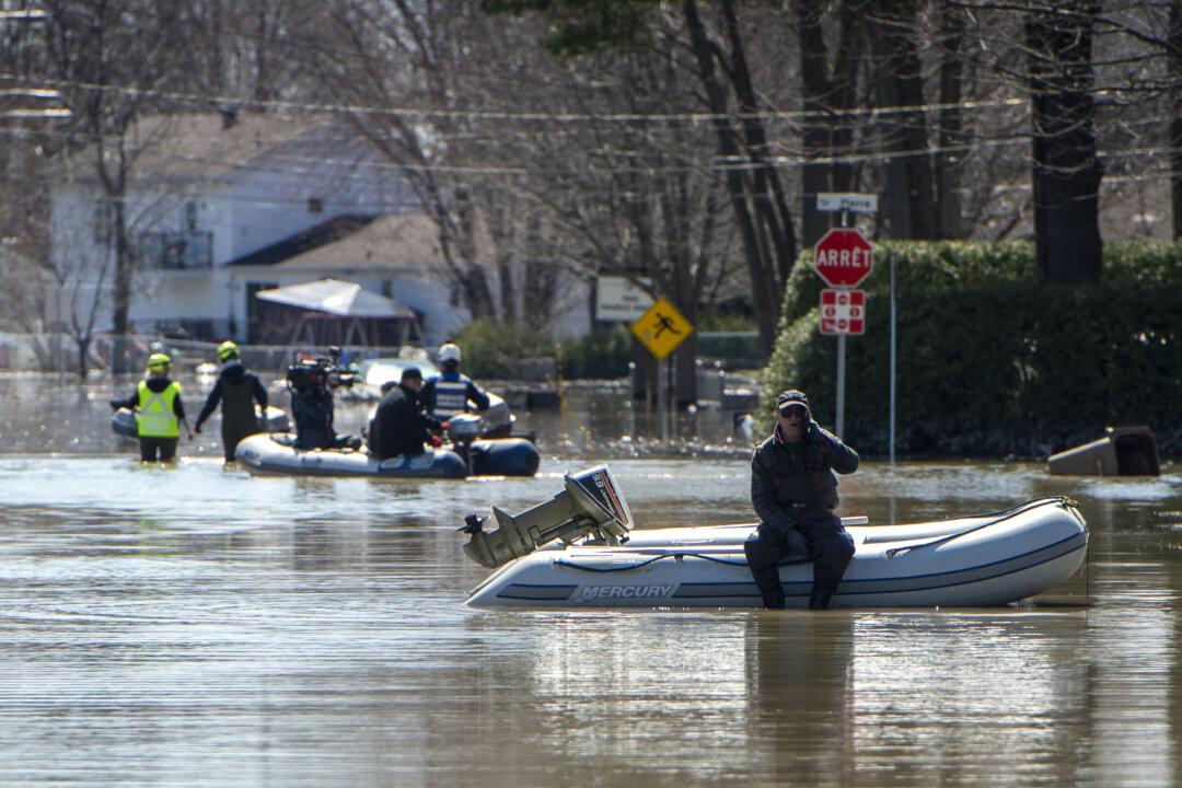
An operation to rescue pets from homes that had to be abandoned during evacuations is underway on a flooded street in the Montreal suburb of Sainte-Marthe-sur-le-Lac, Quebec, on April 29, 2019. SEBASTIEN ST-JEAN/AFP via Getty Images
Hongyan Lu
Updated:
A new report on how Canada’s provinces and territories can better mitigate flood risk gives a grade of C on average to governments for flood preparedness in 2019. 
The report, from the University of Waterloo’s Intact Centre on Climate Adaptation, says flooding is currently Canada’s costliest natural disaster, noting that the number and frequency of floods has increased in recent years.
The 2019 grade is an improvement on the C-minus given in a similar report in 2016, says the research centre’s chair Blair Feltmate, but more progress is needed.
“If the question is ‘are we moving in the right direction on flood risk mitigation?’ the answer is yes. [If it’s] ‘are we moving fast enough?’ the answer is no,” he said.
The report is based on interviews with 139 provincial and territorial officials, and assesses nine categories including emergency plans, flood mapping, critical infrastructure protection, land-use planning, and critical infrastructure protections.
The report aims to show that the provincial and territorial governments could improve on the “four pillars of emergency management: mitigation, preparedness, response, and recovery.”
Feltmate says provincial governments should be updating their flood maps every five to seven years, noting that Newfoundland and Labrador is the only province that has fully updated its river, coastal, and rainfall risk maps since 2015.
“We need to do more work almost universally across the country to update floodplain maps on a regular basis, and we need to make these maps publicly available and user-friendly,” he said. 
The report also points out that many jurisdictions lack regulations that would prohibit new development within floodplain areas identified as “high risk,” therefore provinces and territories should consider exercising greater enforcement of their land use policies.
“Moreover, nearly all Canadian provinces and territories reported that they do not oversee dam safety reviews nor the update of dam failure inundation maps for non-provincially owned dams,” the report reads.
The researchers suggest “the provinces and territories might consider forming flood risk task forces to examine interdependencies across multiple aspects of infrastructure resiliency.”
Feltmate said that the research and knowledge exist to mitigate high risks, either with public infrastructure like berms, or individual homeowner efforts such as sloping the ground away from foundations and installing proper backwater valves in basements to keep drains from backing up when sewers overflow.
The report emphasized that the provincial and territorial governments should also consider the aspects including better land use planning, critical infrastructure assessment, and public health and safety.
A report released by the World Resources Institute earlier this year predicted the number of Canadians affected by floods will grow from 200,000 in 2010 to 350,000 in 2030.
Public Safety Canada’s disaster-aid program averaged payouts of more than $430 million between 2016 and 2019, $360 million between 2011 and 2015, and $120 million between 2006 and 2010. Most of the events requiring disaster aid in the last three years were rainstorms and spring flooding.
According to the Insurance Bureau of Canada, insured costs for extreme weathera majority of which is for floodingaveraged $400 million between 1983 and 2008. Between 2009 and 2017, however, that cost ballooned to over $1 billion. The bureau said for every dollar in insurance paid out for disasters, governments, home, and business owners pay three to four dollars more.
With files from The Canadian Press.