More Heavy Rain and Flooding Expected Across NSW

More Heavy Rain and Flooding Expected Across NSW
A family is seen on the banks of the Lachlan River as it begins to spill ahead of expected major flooding later tonight on November 16, 2021 in Forbes, Australia.Photo by Brook Mitchell/Getty Images
Steve Milne
Updated:

A trough of low pressure over the Australian state of New South Wales (NSW) is likely to bring continued heavy rainfall, with many regions expected to receive up to 50 millimetres on Friday, leading to renewed flooding.

According to the Bureau of Meteorology (BOM), more flooding is expected, especially in the inland rivers and Hunter River regions, both of which have already been impacted by recent flooding.
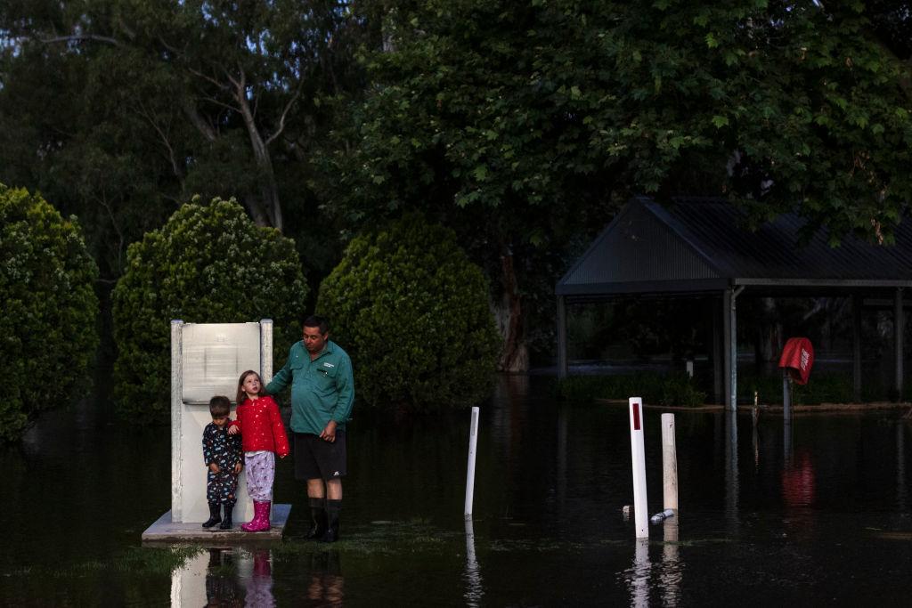
This comes after heavy rain and saturated catchments have sparked major flooding in western NSW and the mid-north coast in recent weeks.

Major flooding is currently occurring around the town of Scone, with moderate rainfall across the upper Hunter River catchment on Thursday night into Friday morning.

The New England region is also experiencing different levels, with major flooding happening now at Wee Waa, and moderate flooding expected at Narrabri and Tamworth on Friday afternoon and Friday night respectively.

Gunnedah is also experiencing moderate flooding, but this may become more severe into the weekend.

A moderate flood warning has been issued for Bathurst, with significant rainfall over the Macquarie River catchment on Thursday night. The river level at Bathurst is expected to reach 4.5 metres at around 6 p.m. on Friday.

Further west, severe slow-moving thunderstorms are likely to generate heavy rainfall that may result in flash flooding, with towns including Dubbo, Parkes, and Wellington potentially affected.

Meanwhile, gale-force winds are expected along the Illawarra Coast from Friday through Saturday, with strong wind warnings for Sydney, and the rest of the state’s coast.

A hazardous surf warning is in place for Sydney and the NSW South Coast on Friday, and this will extend to the whole NSW coast on Saturday.

According to the SES, with meteorologists declaring a La Nina climate condition, NSW communities should be prepared for the increased risk of severe weather events this storm season.

BOM defines La Nina as increased rainfall across much of the country, with cooler daytime temperatures south of the tropics, but warmer overnight temperatures in the north. There is a shift in temperature extremes and a decreased risk of frost. Tropical cyclones become more frequent and the onset of monsoon is earlier.

Commissioner of NSW SES, Carlene York, said that communities right across NSW are likely to see adverse weather conditions for months to come, and that the SES had already been busy since the start of storm season.

“Since Storm Season began (1 October 2021), our volunteers have responded to over 6,715 requests for assistance from the community,” she said.

She stressed the importance of people being aware of their risks and that they should have a sense of urgency in being prepared.

“Simple things like preparing an emergency evacuation kit can be incredibly useful and help you in the event you need to evacuate your home,” she said.

“Our website has a lot of useful information for anyone needing assistance to prepare or learn about their risks.”
Steve Milne
Steve Milne
Writer
Steve is an Australian reporter based in Sydney covering sport, the arts, and politics. He is an experienced English teacher, qualified nutritionist, sports enthusiast, and amateur musician. Contact him at [email protected].
twitter
Related Topics