China’s Grab for Mineral, Water Resources Along the Indian Frontier: Ladakh and Aksai Chin

Water, mineral resources are pawns in a high-altitude struggle along the Indo–China border.
China’s Grab for Mineral, Water Resources Along the Indian Frontier: Ladakh and Aksai Chin
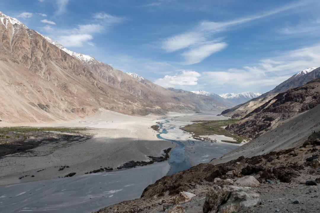
The Shyok River, running through the Nubra Valley in the Ladakh region of India, on May 7, 2015. Alex Ogle/AFP via Getty Images
Venus Upadhayaya
Updated:
0:00

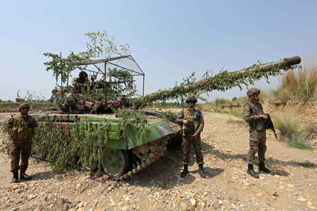
NEW DELHI—There’s much at stake in the border conflict between India and China. The disputed border regions, which start from high-altitude trans-Himalayan tracts and stretch all along the massive mountain range, are home to significant mineral, water, and forest resources.

These include rare earths and water reserves—important both for the extraction of minerals and for powering China’s strategic and economic interests.
India divides the massive, disputed border of 2,167 miles into western, central, and eastern sectors. This article, the first in a series on China’s theft of mineral and water resources along the Indian frontier, focuses on the western sector, which runs along the Indian territories of Jammu and Kashmir and Ladakh and includes the frigid desert of Aksai Chin.

On China’s side, the stretch consists of Xinjiang’s Hotan and Kashgar Prefectures and Tibet’s Ngari Prefecture, both administered by the People’s Liberation Army (PLA) Western Theatre Command. On India’s side, the western sector is under the governance of India’s Northern Command.

The military significance of mineral reserves along the India–China border can be gauged from the fact that, according to China’s Mineral Resources Law, all mineral resources belong to the state, with the rights of state ownership being exercised by China’s State Council.

Likewise, China’s water resources—which on the disputed border can be claimed by India—are also state-controlled. During the 14th Five-Year Plan period (2021–2025), the Chinese regime aims to improve its capability to safeguard its water security. In this context, its first “umbrella plan,” superseding all its earlier water policies, is the five-year plan for water security that was released in January 2022.

The plan’s policy framework, which aims to deal pragmatically with China’s water-related challenges at home, takes on a strategic connotation in border areas, because they involve resources that are disputed and infrastructure that is being developed in contested areas.

Chinese policies pertaining to these disputed resources—with Chinese claims dating back to the 1950s in some cases—continue to be a significant concern for India.

A graphic showing the three sectors of the Indo-China boundary, according to the Indian perception of the border. (Illustration by The Epoch Times, Shutterstock)
A graphic showing the three sectors of the Indo-China boundary, according to the Indian perception of the border. Illustration by The Epoch Times, Shutterstock

Western Sector: From Civilizational Conduit to Contested Territory

More than 1,300 miles long, according to India’s perception of the border, the western sector is one of the most high-altitude and inhospitable regions in the world. Yet in the past decade, it has become extremely militarized, which has in turn coincided with increased infrastructure construction, mineral exploration (including exploration for rare earths), and concern over controlling water resources, particularly on the Chinese side.

The western sector was originally a civilizational conduit on the Silk Road—the complex network of trade routes that connect Asia, Africa, and Southern Europe. The seventh-century monk Xuanzang traveled through the region as he moved between China and ancient India, spreading Buddhist teachings in China upon his return.

The region became a strategic front during the late 19th century, when in the context of “the Great Game,” it found itself at the junction of three great powers: the Russian empire, the British Empire, and China’s Qing Dynasty.

When India became independent from the British in 1947, the western sector was wholly acceded to India by Maharaja Hari Singh, a sometime British ally and the last ruler of the Dogra dynasty to sit on the throne of Jammu and Kashmir. The kingdom was almost at the center of the strategic world then, sharing borders with Pakistan, Afghanistan, Russia, Tibet, and India.

Despite inheriting the strategic hotspot of Jammu and Kashmir from the Dogra rulers, India today controls only 55 percent of the territory that was acceded to it. After four wars with Pakistan, a full-fledged war with China in 1962 and decades of “salami slicing” by Chinese communists, 30 percent of the territory is controlled by Pakistan and 15 percent by China.

Within the percentage controlled by China, there are three territories: the Trans-Karakoram or Shaksgam Tract (2,000 square miles), Aksai Chin (almost 15,000 square miles), and about 380 square miles of Ladakh.

In the western sector, China’s salami slicing—the practice of using a series of small actions to produce a result that would be unlawful to perform all at once—began with Mao Zedong’s designs for conquest in Xinjiang and Tibet, which shared borders with India and Pakistan after Britain left the sub-continent.

Shortly after Mao came to power in October 1949, the PLA marched into the region. It took only two months for it to take over Xinjiang and come to India’s doorstep.

The bloody Galwan conflict in June 2020, in which 20 Indian soldiers and an undisclosed number of Chinese soldiers were killed in hand-to-hand combat, saw a military escalation along the eastern Ladakh border. Since then, 21 commander-level military talks between the two countries have failed to produce a consensus.

Today, the largely uninhabited, ultra-high-altitude regions—claimed by India and controlled by China—are known for the very visible military stand-off between the two powers. However, their strategic and geopolitical value goes further. Behind China’s expansionism in the regions lies its desire for minerals and precious water resources.

Retired Col. Vinayak Bhat, a former Indian military intelligence officer, told The Epoch Times that the Chinese road and railway network in the inhospitable area has been established and improved for the purpose of stealing mineral resources.

“The [Chinese] companies working at various lakes and rivers are producing rare earth minerals and other minerals with the cheapest possible labor,” Mr. Bhat said. Information flow about such operations is slow or nonexistent, he added, because the area is sparsely populated.

Neeraj Singh Manhas, special adviser for South Asia at the South Korean think tank Parley Policy Initiative, told The Epoch Times in an email that the extraction of minerals and water resources—vital resources for communities on the border—further raises geopolitical tensions and threatens India’s national security.

“The systematic extraction of minerals and diversion of water resources from border regions by China poses a threat against the economic sovereignty and stability of India,” he said.

A graphic of the western sector of the Indo-China border, showing the three disputed territories of Trans-Karakoram tract, Aksai Chin, and the other regions of Ladakh—victims of "salami slicing," post 1962. (Illustration by The Epoch Times, Shutterstock)
A graphic of the western sector of the Indo-China border, showing the three disputed territories of Trans-Karakoram tract, Aksai Chin, and the other regions of Ladakh—victims of "salami slicing," post 1962. Illustration by The Epoch Times, Shutterstock

Aksai Chin: Mineral Resources

At the junction of India-, China- and Pakistan-controlled territories today is a cold desert called Aksai Chin—the only land connection between Xinjiang and Tibet.

Aksai Chin is the southwestward extension of the Tibetan plateau. After Mao’s conquest, it became the southernmost part of Xinjiang’s Uygur Autonomous Region, with a small portion situated within the extreme western limit of the Tibet Autonomous Region on the southeast and the southern sides.

Aksai Chin is virtually uninhabited. Mountain ranges block the plateau from the rains of the Indian monsoon, leaving it devoid of rain or snow.

Europe-based sinologist Frank Lehberger spoke with The Epoch Times about Aksai Chin and its significance. China’s rare earth mine of Dahongliutan is just a few kilometers away from India’s claim line in the area, he noted. On Chinese maps, this “barren place” is in Hotan County, which administers Chinese-occupied Aksai Chin.

Mr. Lehberger called the mining of Aksai Chin’s mineral deposits much more “consequential and detrimental” to India than China’s infrastructure development in the Shaksgam valley—the subject of recent complaints from India. Mineral deposits have been discovered throughout northern Aksai Chin, and it’s likely that more will be discovered.

The Dahongliutan rare metal mining, dressing, and smelting project, with an estimated capacity of 3 million tons, “is a key project of the 14th Five-Year Plan of Xinjiang,” he said, and is expected to produce 600,000 tons of high-quality lithium concentrate per year.

The Kungang Economic and Technological Development Zone, an industrial park for processing and refining rare earth metals and non-ferrous metals, began operating last year in adjacent Hop County. The development is of consequence to India, Mr. Lehberger said.

“The Kungang Zone is where the ores extracted now and in [the] future from all over northern Aksai Chin will be processed or refined in the near future,” he said.

Meanwhile, Chinese state media touts the Dahongliutan mine project as being on the verge of becoming “the second largest pegmatite-type spodumene single deposit in Asia.”

Xinjiang Nonferrous Metal Group—a company that has come under scrutiny for forced labor concerns—won the prospecting rights for rare metals in Hotan for $287 million, according to Chinese state media outlet Yicai Global, which boasted that the project would be the “world’s biggest lithium mining, extraction hub.”

Many deposits of granite pegmatite, an important source of rare metals, have been recently discovered in the Western Kunlun orogenic belt (WKOB), according to a scientific paper published in April.

“These deposits make WKOB an emerging world-class rare metal resource,” according to the paper, written by seven Chinese metallurgists including five from the Xinjiang Research Center for Mineral Resources. The WKOB extends from southern Xinjiang eastward into the northern part of Aksai Chin.

“By letting China illegally occupy Aksai Chin in 1962 and not trying to retake it, successive Indian governments since 1962 basically allowed China to rob India of world-class rare earth metal deposit sites,” Mr. Lehberger said.

Those sites included “metal and mineral deposits which are of crucial importance for India [to speedily achieve] resource independence in strategic natural resources as well as [the future] status of global high-tech superpower,” according to Mr. Lehberger.

A map (not to scale) shows the Chinese mining sites (red dots) Dahongliutan and Huoshaoyun, as well as Kungang Economic and Technological Development Zone, an industrial site for processing and refining rare earth metals, in Aksai Chin, a region claimed by India. (Illustration by The Epoch Times, Shutterstock)
A map (not to scale) shows the Chinese mining sites (red dots) Dahongliutan and Huoshaoyun, as well as Kungang Economic and Technological Development Zone, an industrial site for processing and refining rare earth metals, in Aksai Chin, a region claimed by India. Illustration by The Epoch Times, Shutterstock

Increasingly Precious Zinc Reserves

Mr. Manhas also cited the Huoshaoyun lead-zinc mine, located within the disputed territory of Aksai Chin and touted as the largest zinc-lead deposit in China. The reserve contains deposits of extremely high-grade zinc (23.95 percent) and lead (4.67 percent), according to FastMarkets, a metals, mining, and new generation energy markets magazine.

Notably, just a month before the Galwan conflict, at China’s annual “Twin Sessions” meeting in May 2020, the development of the Huoshaoyun deposit was itemized as part of a grand plan to raise southern Xinjiang from poverty.

After acquiring the rights to the mine for a record 25 billion yuan ($3.5 billion) in early 2023, the Xinjiang Geological Investment Group invested 180 million yuan ($25 million) to explore the mine.

A report in Shanghai Metals Market described the new reserve as the sixth largest lead-zinc mine in the world, with zinc and lead metal contents exceeding 21 million tons. Since COVID-19 forced the closure of some of the world’s top exporting mines in South America, competition in the zinc market has intensified, making the Huoshaoyun development even more important to China.

China is the world’s largest producer and consumer of zinc, accounting for more than half of global output and demand. The metal is used for alloys, chemicals, and pharmaceuticals and to galvanize iron and steel. Along with India, China needs the metal for use in fertilizers to grow crops to feed its huge population.

In addition, zinc is making headlines in the new energy sector, as companies such as Sydney-listed startup Redflow use the metal for zinc-bromine flow technology batteries, aiming to supply power to the 2.7 million telecommunications towers in off-grid or weak-grid locations in the Asia-Pacific region. China has 1.75 million such towers, India has 450,000, Japan has 220,000, and Indonesia has 86,000.

Ladakh’s Strategic Resources

India’s Ladakh region is a frigid desert. Nonetheless, it is rich in both mineral and water resources. Its mineral resources include platinum group metals, which are listed among the rarest and most valuable metals in nature. A key regional source of water, Ladakh is drained by the Indus River and its major tributaries. The Indus watershed supports about 120 million people in India and about 93 million in Pakistan.

The Ladakh that India governs today shares contested boundaries with its neighbors because of the extensive militarization of the region. Pakistan-controlled Kashmir is to its north, and India-controlled Jammu and Kashmir, claimed by Pakistan, to its west. To the east lies Aksai Chin, controlled by China and claimed by India. Continuing Chinese intrusions have only increased tensions.

“Despite these territorial disputes, what Ladakh shares with these neighboring territories are the headwaters and upper streams of rivers that supply water to hundreds of millions of people across South Asia and [northeastern] China,” Mr. Manhas said.

“This underscores the strategic importance of water resources in the region and the potential for water-related infrastructure development.”

Moreover, in the high-altitude, inhospitable regions, rivers and mountain passes have additional strategic value because they mean natural connectivity in otherwise tough terrain. In particular, eastern Ladakh’s Galwan River is relatively short but of great strategic importance, centrally located and providing access to the region.

The Galwan Valley has thus been a flash point in various conflicts, including the war of 1962 and the more recent 2020 incident.

Chinese exploitation of mineral and water resources in these regions goes hand in hand with its expansionist agenda. For instance, China extended its G695 road from the Huoshaoyun mine all the way to Pangong Tso, a remote lake that straddles the India–China border and was the site of a major standoff between Indian and Chinese troops in 2020.

In 2022, China finished two bridges connecting the north and south banks of the strategically located lake, which will “make it easier for mechanized and motorized formations to be introduced quickly,” according to a November 2022 article in The Eurasian Times.

In another instance, in April 2020, the PLA established a presence in Gogra, a former pasture and campsite in the Kugrang river valley close to the disputed border in Ladakh and on the old caravan route to Central Asia.

Mr. Bhat, the former military intelligence officer, is also a satellite imagery officer and has done a remote analysis of the site. He speculated that in a “greedy overture,” the Chinese were aiming to capture the site because of its massive gold deposits. The PLA retreated later under Indian pressure.

The major water resources of Aksai Chin, the barren land of old caravan routes between Ladakh and Central Asia. (Illustration by The Epoch Times, Shutterstock)
The major water resources of Aksai Chin, the barren land of old caravan routes between Ladakh and Central Asia. Illustration by The Epoch Times, Shutterstock

Aksai Chin’s Water Resources: Fragile but Vital

Author and Tibet expert Claude Arpi told The Epoch Times in an earlier interview that by the time China finished its conquest of Tibet in 1950 and 1951, Mao realized that Aksai Chin, the desert area in the north of Ladakh, was strategically extremely important for the communist regime’s future.

“It was an uninhabited area, nobody could live there, but the Chinese decided to build a road there because it was the easiest way to connect the two new provinces [of Tibet and Xinjiang],” Mr. Arpi, who was born in France but now lives in India, said.

“That’s how, in Aksai Chin, today’s Chinese Highway G219 came into being. [It] was surveyed in 1952–53; China started building it in 1954, and it was inaugurated in July 1957.”

After marking the road in 1952, the CCP didn’t stop there.

“In 1956, China agreed to a map that gets more or less half of the Aksai Chin, and in 1959 it pushed it further south,” Mr. Arpi said.

Aksai Chin is surrounded north and south by high mountains, Mr. Lehberger noted. There’s only one major river that cuts through the mountains northward into Xinjiang: the Karakash River, which also enters Aksai Chin.

Water resources in Aksai Chin are sparse, with the aging Wuluwati Hydropower Project farther upstream and a number of brackish lakes. The lakes in the high-altitude desert region are generally endorheic, cut off from outside sources of water and therefore saline.

“These water sources are crucial in such a dry area, supporting any local needs and potentially serving mining operations. The presence of water resources, while not abundant, is critical for the sustainability of both ecological balance and industrial activities in such a harsh environment,” Mr. Lehberger said.

Abhijit Iyer-Mitra, a defense economist by training and a senior fellow at the New Delhi-based Institute of Peace and Conflict Studies, told The Epoch Times that the brackish lakes are “water sinks” and have a partial cooling effect on the local climate.

The Chinese appear to have a basic desalination facility at Pangong Tso, but it’s not a major one, he said.

Moreover, there’s a Chinese military base at Spanggur Tso lake, close to Pangong Tso lake, that supports Chinese military operations in the region. Mr. Iyer-Mitra called PLA bases at the two lakes “market posts,” built to show “territorial control.”

This article is Part 1 of a special series on China’s mineral and water resources grab along the Indian frontier.

Venus Upadhayaya
Venus Upadhayaya
Reporter
Venus Upadhayaya reports on India, China, and the Global South. Her traditional area of expertise is in Indian and South Asian geopolitics. Community media, sustainable development, and leadership remain her other areas of interest.
twitter