Bermuda Prepares for 36 Hours of Life-Threatening Winds as Ernesto Closes In

The Category 2 hurricane bears down on Bermuda as authorities warn of serious dangers.
Bermuda Prepares for 36 Hours of Life-Threatening Winds as Ernesto Closes In
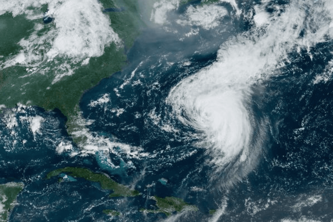
Satellite imagery of Hurricane Ernesto as it closes in on Bermuda taken at 10:10 a.m. (EDT) on Aug. 16. Screenshot/NOAA/NESDIS/Star-Goes-East
T.J. Muscaro
Updated:
0:00

Bermuda began locking down on Aug. 16 in the final hours before Hurricane Ernesto’s arrival.

“This is not a storm to be taken lightly,” Bermuda’s Minister of National Security Michael Weeks said in an address to the island’s residents on Aug. 16.
“We are about to endure at least 36 hours of hurricane and tropical storm force winds.”

Weeks said the situation presents a “considerable risk to life and property.”

“If you do not take these warnings seriously, you are putting yourself in danger and the lives of our emergency personnel who may be called to assist you.”

Tropical-storm-force winds began affecting the island around 2 p.m. local time. Ernesto is expected to reach Bermuda around 8 a.m. local time on Aug. 17, with its eye passing over part or all of the island.

Weeks announced that Bermuda’s airport would close at 8 p.m., and the Causeway—a narrow strip of reclaimed land turned into a road connecting the northern part of Bermuda to its center—would shut an hour later.

Shelters at different points of the island are set to open.

All public transportation would cease, and residents were told to expect no deployment of first responders—such as ambulances—if sustained wind exceeded 57 mph.

On Aug. 16, Hurricane Ernesto showed very little sign of weakening, according to the National Hurricane Center (NHC), and was still a strong Category 2 event.

“Ernesto [is] moving to the north-northeast with little change in strength,” the NHC stated in its 5 p.m. advisory.

“Strong winds, dangerous storm surge, and life-threatening flooding expected to begin over Bermuda shortly.”

As of the NHC’s 5 p.m. advisory, the storm’s center was 125 miles from the island.

Dangerous winds will be joined by heavy rain.

The Bermuda Weather Service reported that 3.5 inches of rain had already fallen on the island before noon on Aug. 16, and Ernesto was expected to bring another five to eight inches.

“Please do not be fooled by the calm [when] the eye of the storm passes over us tomorrow. This [lull] in the winds does not indicate that the danger has passed,” Weeks said.

“The storm is expected to move just west of Bermuda, and as the eye moves away, the winds will rapidly and dangerously pick up again with full force.”

The official said those venturing outside could be putting their lives at serious risk.

“The second half of the storm will be just as intense, if not more so, than the first,” he said.

After passing Bermuda, the NHC predicts Ernesto will retain its hurricane status as it continues north.

The cone of uncertainty has it passing close to Newfoundland, Canada, late on Aug. 19 and it won’t downgrade to a tropical storm until Aug. 20.