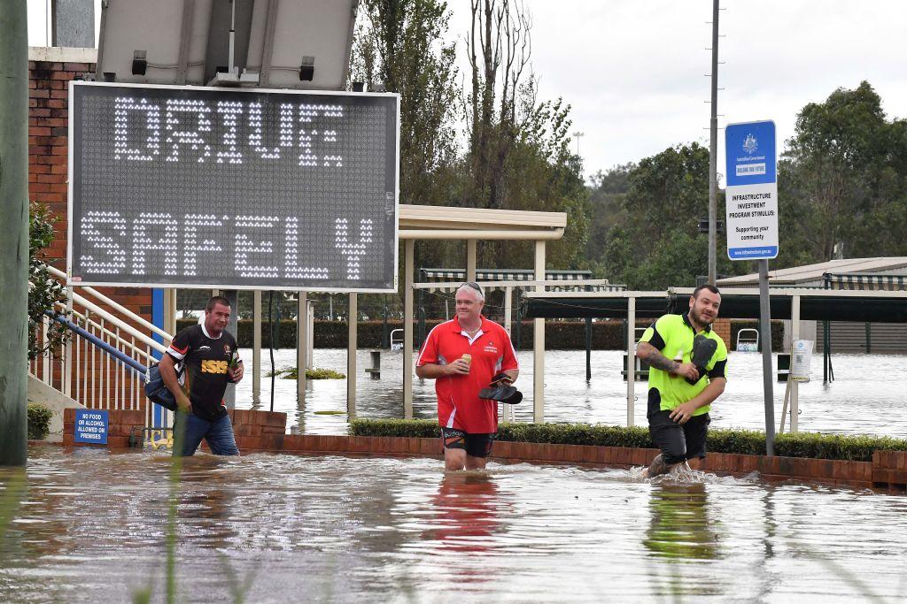
Australian Prime Minister Scott Morrison declared the flooding disaster in northern New South Wales (NSW) a national emergency and a “one-in-500 year” event.
Morrison will formally meet the governor-general on Friday to recommend a National Emergency Declaration for the natural disaster.
This is the first time the national emergency powers, established after the 2019-20 Black Summer bushfires, have been used.
It cuts the red tape between state and federal governments, such as allowing the deployment of the Australian Defence Force (ADF) without a formal request from the states.
The rain began easing on Wednesday, but around 40,000 people remain under evacuation orders across the state.
The weather event has claimed 21 lives as of Wednesday, of which 13 are Queenslanders and eight from NSW.
The declaration comes after Sydney’s northern beaches were inundated by flooding on Tuesday and the Manly Dam began overflowing on Tuesday evening.
A high student who attends a school located in a low lying area near Manly Dam told The Epoch Times on Tuesday that only a tiny part of the oval across the road had been flooded when she arrived at school.
However, the ground floor classrooms were flooded up to students’ shins by afternoon, and the car park had inundated.
River water levels are also still rising despite the reprieve in the rain. Major flooding is also occurring along the Hawkesbury River, which peaked at 14.1 metres (46 feet).
The NSW State Emergency Services (SES) also warned communities in parts of north-western NSW, including Mungindi and Collarenebri, of potential flooding as floodwater travel down river systems from Queensland.
Meanwhile, residents of Sydney have been told that although the heavy rainfall will be easing, the weather system will be replaced by dangerous winds of up to 111 kilometres per hour (69 miles) in some areas along the east coast, from the Hunter to Illawarra and the South Coast.
“Damaging wind gusts with peak gusts in excess of 90 km/h are possible about the coast and adjacent hinterland from northern parts of the South Coast district to southern parts of the Mid North Coast. The risk of damaging wind gusts will continue today, but will likely ease later in the day,” the Bureau of Meteorology said on Wednesday.
Sydney Trains is advising people to avoid any non-essential travel as the network experiences significant disruptions due to flooding.
NSW Minister for Roads Natalie Ward also urged people to stop driving around barriers and into floodwaters.
“Please take care, slow down, there may be additional hazards that can arise very quickly,” Ward told reporters.
Ward also addressed the growing number of potholes, saying they could only conduct temporary repairs until the weather dries.
“There will be a lot of them out there. It is going to take a long time to get them fixed,” she said.
This will supplement around 1,600 SES and government personnel who have been on the ground helping communities recover.
Why Has There Been So Much Rain?
A team of researchers investigated why Australia was experiencing so much wet weather in the past few months and found that the simultaneous occurrence of two climate factors has caused all the rainfall—La Niña and a positive Southern Annular Mode (SAM).La Niña and its opposite phase, El Niño, involves cycling weather patterns across the tropical Pacific Ocean. During La Niña, moisture from the ocean is transported to the land and is more easily converted to rain.
SAM is the north-south movement of westerly winds over the Southern Ocean. A positive SAM occurs when the usual westerly winds shift southward, bringing moisture-filled winds into eastern Australia.
Individually, both climate oscillations bring more rain, but Australia is currently experiencing both at the same time, triggering the “rain bomb.”
“The current La Niña event is past its peak and is predicted to dissipate in autumn,” Chiara Holgate, hydroclimatologist at the Australian National University, said. “But because our catchments are so full of water, we still need to be on alert for extreme weather.”