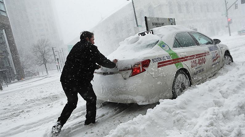
Winter storm watches have been issued for the mid-Atlantic and parts of New England ahead of a powerful combination of heavy snow and strong winds over the weekend that could lead to power outages and coastal flooding in Massachusetts, Rhode Island, and possibly Connecticut.
“While uncertainty continues with the track and intensity of this system, it is becoming more likely that it will bring significant snow, sleet, and freezing rain to the region, including the I-95 metropolitan areas,” NWS said.
The weather service also warned that the storm could create hazardous travel conditions due to the combination of heavy snow, sleet, freezing rain, and wind.
Meanwhile, areas close to the Atlantic coastline are set to experience strong winds and high tides which may lead to flooding.
“Everything is on the table with this storm,” AccuWeather Chief On-Air Meteorologist Bernie Rayno.
Rayno added that eastern New England and the eastern tip of Long Island are likely to see more than a foot of snow.
AccuWeather meteorologists expect that there will be over three feet of snowfall near Boston, Worcester, Islip, Hartford, Connecticut, Massachusetts, all the way up to Portland and Bangor, Maine.
Providence, Rhode Island, Portsmouth, and New Hampshire are also likely to see plenty of snowfall.
The snowfall will also be accompanied by winds of 40 mph or more which will reduce visibility to a quarter of a mile or less for several hours and trigger blizzards in parts of New England, AccuWeather meteorologists said.
Travel could be shut down in Boston, with Boston’s Logan International Airport potentially closing temporarily while flight cancellations may also be seen in New York City, Philadelphia, and Washington, D.C., meteorologists warned.
“Blizzard conditions are forecast from eastern Long Island through much of coastal New England, particularly from southeast Maine to Cape Cod. This will make travel nearly impossible. Significant beach erosion and coastal flooding will also be a concern,” the weather service added.
The NWS has issued winter storm watches and warnings for most of the coastal Mid-Atlantic parts up into the coastal Northeast, as well as parts of the Central/Southern Appalachians.
“We are monitoring forecasts and making emergency response preparations for whatever this storm system throws our way. As we head into the weekend, I encourage New Yorkers to closely follow their local weather forecasts, stay off the roads and avoid unnecessary travel,” Hochul said.
“We have already started planning and mobilizing resources needed to protect the Commonwealth,” Youngkin said in a statement. “We are very concerned with the forecasted impacts to our Eastern Shore region and have started pre-positioning resources to ensure a timely response to that area. The most important thing everyone can do to minimize the risks is to prepare yourself and your family.”