Hurricane Idalia, which made landfall along Florida’s Big Bend region on Aug. 30, could top records in its intensification rate, hurricane experts have warned.
The hurricane eventually touched down as a Category 3 storm near Keaton Beach, along the Apalachee Bay, at around 7:45 a.m. ET, after experts had warned overnight it could intensify into an “extremely dangerous” Category 4 storm.
Hurricanes, which are not an uncommon occurrence in Florida, typically form over warm ocean waters; building up energy as they suck up hot air from those waters while forming an area of low pressure underneath.
Hurricane Professor Kerry Emanuel, who teaches at the Massachusetts Institute of Technology (MIT), said that Idalia “stands a chance of setting a record for intensification rate because it’s over water that’s so warm.”
“Right now I’m pretty sure Idalia is rapidly intensifying,” Mr. Emanuel said.
At the time Emanuel said that, Idalia was clocking 80 mph winds. A couple hours later it was up to 90 mph, and by 10 p.m. Idalia was a Category 2 hurricane with 110 mph winds, having gained 40 mph in wind speed in 21 hours.
‘Rocket Fuel for the Storm’
Colorado State University hurricane researcher Phil Klotzbach also believes the hotter water temperatures are fueling up the storm, which will likely see it intensify.“It’s 88, 89 degrees (31, 32 degrees Celsius) over where the storm’s going to be tracking, so that’s effectively rocket fuel for the storm,” Mr. Klotzbach said.
“It’s basically all systems go for the storm to intensify,” he added.
Elsewhere, University at Albany atmospheric sciences professor Kristen Corbosiero cited warmer waters as one of the reasons for Idalia’s intensification, noting that the storm has been parked at times over the Loop Current—a warm ocean current that flows northward between Cuba and the Yucatán Peninsula—and circular currents of water from that current known as “eddies.”
This would likely fuel its intensity even more, she explained.
Within the past 24 hours, Hurricane Idalia has intensified rapidly, data from NHC shows, initially clocking in winds of 75 mph before shooting up to winds of nearly 130 mph.
2 Dead in Weather-Related Accidents
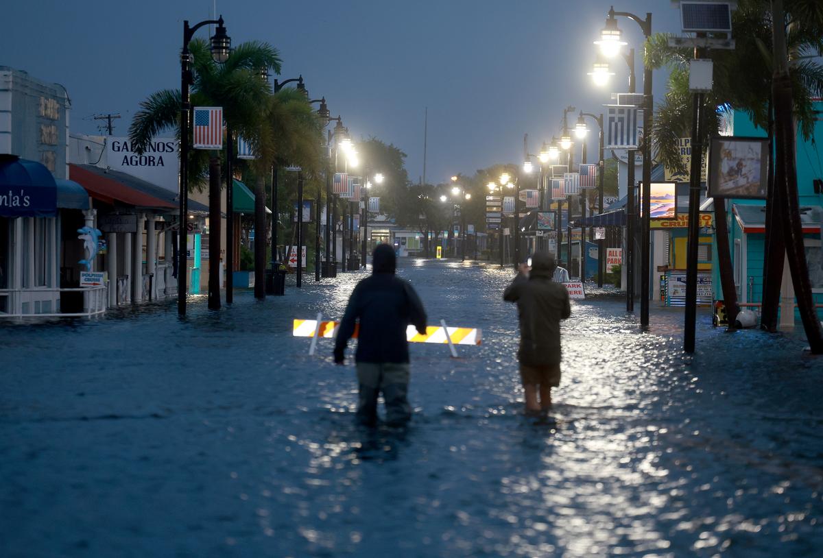
Widespread flooding this morning has already left homes and buildings in Florida submerged and rendered some roads unusable, with flood water inundating runways at Tampa International Airport, which has canceled all flights.Prior to Hurricane Idalia touching down, Florida Gov. Ron DeSantis, who is seeking the Republican nomination in the 2024 presidential election, urged residents to shelter in place.
The governor also declared a state of emergency and placed 49 of the state’s 67 counties under mandatory evacuation orders.
“Do not go outside in the midst of this storm,” the governor said. “If it’s calm where you are, it may be because you are in the eye of the storm and those conditions will change very, very quickly.
“So wherever you are, hunker down and don’t take anything for granted here, this is a very, very powerful storm,” Mr. DeSantis added.
Some analysts noted that Hurricane Idalia is the most powerful storm to make landfall along the Big Bend region, which historically doesn’t see a lot of hurricane activity, in 127 years. A hurricane in 1896 hit the region with 125 mph winds.