Vermont Hit With More Flooding as Beryl Recovery Continues

Some parts of the Green Mountain State reported getting seven to eight more inches of rain in an overnight period.
Vermont Hit With More Flooding as Beryl Recovery Continues
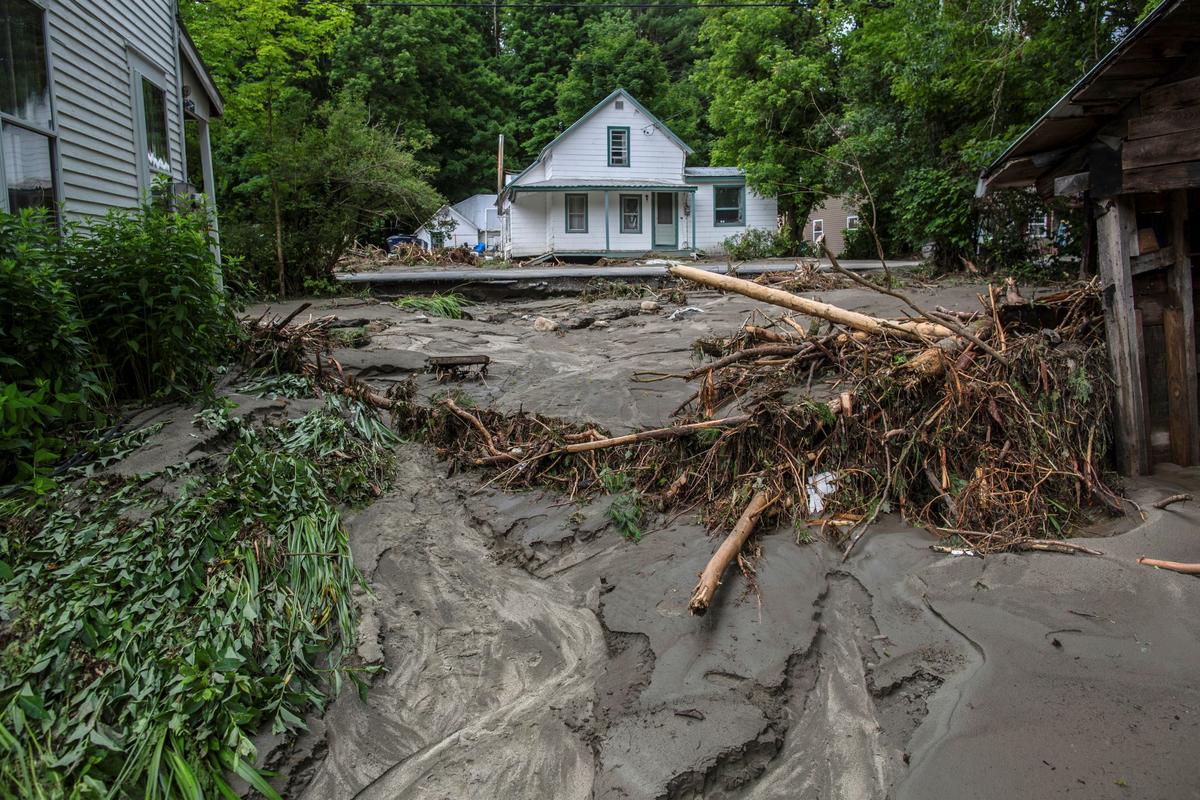
Debris in Plainfield, Vermont, after flash flooding on July 10, 2024. (Dmitry Belyakov/AP Photo)
T.J. Muscaro
Updated:
0:00

Strong storms that hit Vermont this week have caused more major flooding in the state as residents continue to recover from deadly flooding caused by the fragments of Hurricane Beryl, which dropped torrential rain on the state last month.

Severe, slow-moving storms delivered heavy rainfall overnight from July 29 through the morning of July 30, with some parts of the state receiving as much as seven to eight inches, the National Weather Service (NWS) station in Burlington, Vermont, told The Epoch Times.
The area most affected was a northeast corner of the state referred to as the Northeast Kingdom, which includes the towns of Lyndon and St. Johnsbury.

Major flash flooding hit those areas, and landslides were reported.

The Vermont Emergency Management Agency made more than two dozen boat rescues during the night.

Some residents were able to rescue themselves, while others had to shelter in place.

St. Johnsbury resident Vanessa Allen recounted having to stay inside as the two roads surrounding her home were washed out. She said she saw one nearby house lifted off its foundation, blocking a road.

“It looks apocalyptic. There are huge craters. ... And the water is still rushing down the road now,” she told The Associated Press on July 30. “It’s just all unbelievable how bad the roads are. We’re trapped. We can’t go anywhere.”

As of 11 a.m. on July 31, most of Vermont remained under a flood watch, and the NWS continued to monitor potential storms across the area. No new flood-related fatalities had been reported.

NWS meteorologist Jessica Neiles told The Epoch Times that floods are one of the biggest threats facing the state, with different types of flooding throughout the year. The NWS said it continues to work on improving flood forecasting while raising awareness of flood risks.

The state is working to establish floodplain standards.

Because of the topography, flood waters run off into lower watersheds such as Lake Champlain, which Neiles said wasn’t even close to its flooding stage.

However, she also told The Epoch Times that it’s unusual to have so much flooding in July, and this recovery comes on the heels of the remnants of Beryl, which hit the state hard on July 10.

Roads have been washed away, bridges and homes destroyed, and farms inundated; during the earlier flooding caused by Beryl, two people drowned.

“The last storm was a wake-up call,” Lyndonville, Vermont, resident Deryck Colburn told The Associated Press about the flooding earlier in July.

“I thought I would never see anything like that again. I don’t think that holds a candle to this. Not even close.

“There’s a lot of broken hearts.”

Neiles told The Epoch Times that the final numbers for July in terms of rainfall and flooding would be released on Aug. 1 but that she thinks that several parts of the state have had their wettest July on record.

The Associated Press contributed to this report.
Born and raised in Tampa, Florida, T.J. Muscaro covers the Sunshine State, America's space industry, the theme park industry, and family-related issues.