US to Endure Another Day Below Freezing Before Relief Comes

US to Endure Another Day Below Freezing Before Relief Comes
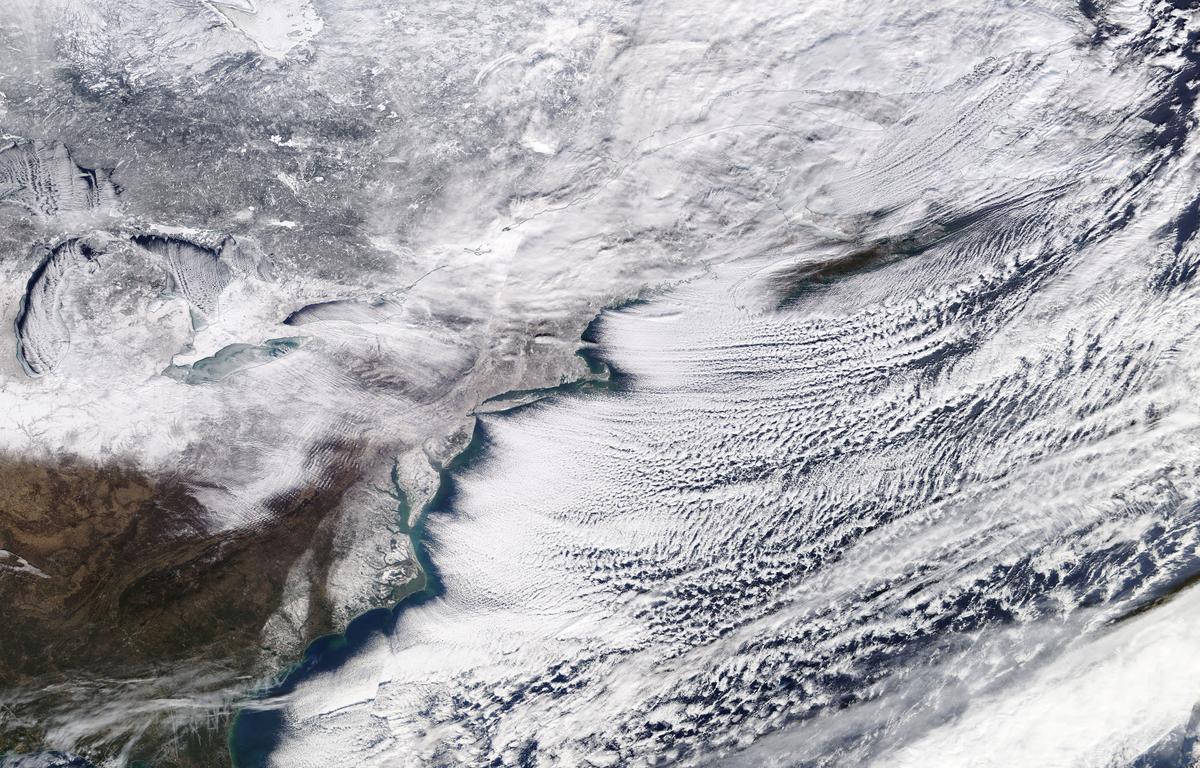
A winter storm sweeping across Ontario, eastern Canada and the northeastern United States is pictured in a NASA handout satellite photo Jan. 6, 2018. NASA/Handout via Reuters
Reuters
Updated:

The bitter cold that has gripped much of the United States since the new year will last another day, forecasters said on Sunday, predicting an end to a frigid spell that featured a “bomb cyclone” snowstorm and frozen iguanas falling from trees in Florida.

The U.S. Northeast will endure at least one more day of sub-freezing temperatures before the arrival of a thaw that could help residents in some areas of New England recover from a foot or more of snow dumped by Friday’s blizzard.
Much of the central part of the country was due for snow, ice and rain on Sunday, forecasters said.

Temperatures are finally expected to climb above freezing on Monday.

“A warm-up is in store for next week,” the U.S. National Weather Service said, adding that temperatures would return to seasonal norms or warmer.

Boston and New York awakened on Sunday morning to Fahrenheit temperatures in the single digits. Washington and Chicago were slightly warmer but still well below freezing.

A child poses for a photograph in Times Square in New York City, New York, U.S., Jan. 7, 2018. (Reuters/Elizabeth Shafiroff)
A child poses for a photograph in Times Square in New York City, New York, U.S., Jan. 7, 2018. Reuters/Elizabeth Shafiroff

In the central United States, a wintry mix was seen developing over eastern Kansas and spreading eastward across southern Iowa, Missouri, Illinois and far western Indiana on Sunday, AccuWeather said in a forecast. The Tennessee and Ohio valleys could expect similar conditions into Sunday night.

The snow and cold have brought parts of the Northeast to a standstill and were blamed for at least 18 deaths over the past several days.

New York’s John F. Kennedy International Airport closed from Thursday to Friday morning when snow created white-out conditions, and on Saturday set an all-time low for Jan. 6 at 8 degrees Fahrenheit, the U.S. Weather Prediction Center said.

Ice is seen on the Hudson River between New Jersey and New York City, as seen from Weehawken, New Jersey, U.S., Jan. 7, 2018. (Reuters/Mike Segar)
Ice is seen on the Hudson River between New Jersey and New York City, as seen from Weehawken, New Jersey, U.S., Jan. 7, 2018. Reuters/Mike Segar

The East Coast’s first snowstorm of 2018 was energized by a rapid drop in barometric pressure that some weather forecasters called a bombogenesis, or a bomb cyclone.

The phenomenon gave rise to gusts of more than 70 miles per hour and produced snowfall totals of 22 inches in parts of Maine and 17 inches in parts of Massachusetts, the weather service said.

The cold snap dropped snow into sub-tropical Florida, where numerous people posted social media pictures of iguanas that had fallen from trees in recent days. Zoologists warned people not to assume they were dead as the cold-blooded reptiles were capable of springing back to life after warming up.

Recommended Video:

Boiling water turns to snow