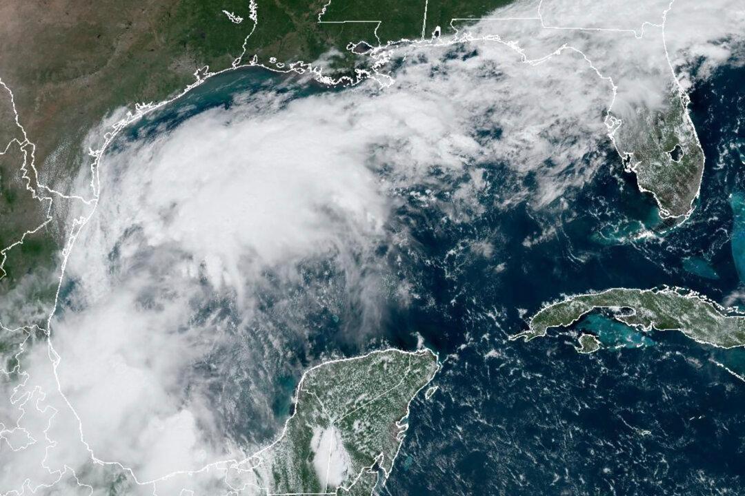
HOUSTON—A tropical system in the southwestern Gulf of Mexico was expected to strengthen this week into a tropical storm and dump heavy rains onto Mexico and Texas before reaching the United States as a potential hurricane, the National Weather Service said Sunday.
The system, about 340 miles south-southeast of the mouth of the Rio Grande, had maximum 50 mph wind speeds on Sunday and was forecast to drift slowly northwestward. Forecasters said it was too early to pinpoint the exact track of the storm and its potential impacts but warned that the upper Texas and Louisiana coastlines could see damaging winds and storm surges beginning Tuesday evening.
Texas Gov. Greg Abbott put state emergency responders on increased readiness and warned of the potential of flash flooding and heavy rains.
“Texas will continue to closely monitor weather conditions to protect the well-being of Texans,” Abbott said in a statement.
Donald Jones, a meteorologist with the National Weather Service in Lake Charles, Louisiana, said during a weather briefing Saturday night that parts of southeast Texas and southwest Louisiana should expect a “whole lot” of rain in the middle and later part of this week.
The tropical disturbance comes after an unusually quiet August and early September in the current Atlantic hurricane season, which runs through Nov. 30. The season was set to peak on Tuesday, Jones said.
So far, there have been five named storms this hurricane season, including Hurricane Beryl, which knocked out power to nearly 3 million homes and businesses in Texas—mostly in the Houston area—in July. Experts had predicted one of the busiest Atlantic hurricane seasons on record.
The next named storm would be called Francine.
Last month, the National Oceanic and Atmospheric Administration updated its outlook but still predicted a highly active Atlantic hurricane season. Forecasters tweaked the number of expected named storms from 17 to 25 to 17 to 24.