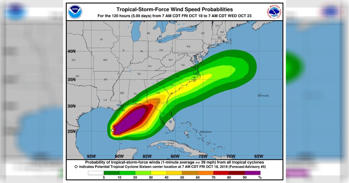
Tropical Storm Nestor is intensifying along the Gulf Coast and the National Hurricane Center is predicting a storm surge with tropical storm force winds for Florida starting Friday, Oct. 18. Maximum sustained winds are expected to reach 60 mph, with stronger gusts.
The cyclone is strengthening as it moves northeast across the Golf of Mexico at 22 mph, with storm-force winds expected to hit the Florida coast around 7 p.m. eastern time on Friday.
Their statement warned residents to take the necessary precautions: “This is a life-threatening situation. Persons located within these areas should take all necessary actions to protect life and property from rising water and the potential for other dangerous conditions. Promptly follow evacuation and other instructions from local officials. The combination of a dangerous storm surge and the tide will cause normally dry areas near the coast to be flooded by rising waters moving inland from the shoreline.”
Tropical storm-force winds are likely for the evening of Oct. 18, along portions of the central and eastern Gulf Coast, with strong winds across a wide area. The report said that isolated flash flooding is also possible along the central and eastern Gulf Coast and the southeast coast of the United States through the night of Oct. 19.
The system is expected to lose energy and, thus, its tropical characteristics after moving inland across Florida.