HONOLULU—Tropical Storm Hone was expected to deliver strong winds and heavy rain to Hawaii this weekend, particularly to the Big Island and Maui, as it passes south of the island chain. Forecasters believe it will strengthen to a Category 1 hurricane for part of the time it skirts past the state.
A tropical storm watch was in effect Friday for Hawaii County, which includes all of the Big Island, according to the Central Pacific Hurricane Center in Honolulu.
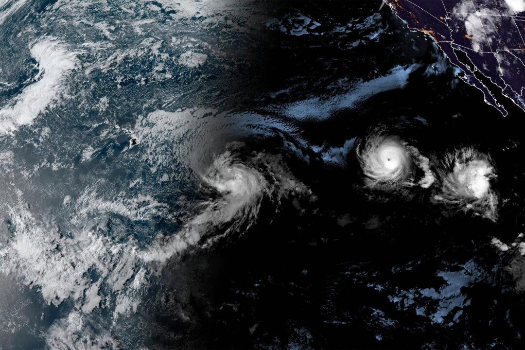
The August storm has evoked memories of the powerful hurricane south of Hawaii that helped fuel a deadly wildfire that destroyed Maui’s Lahaina town during a drought last summer, but the National Weather Service said Hone was not creating the same conditions.
Hone, which means “sweet and soft” in Hawaiian and is pronounced hoe-NEH, was expected to bring sustained winds of 20 to 30 mph (32 to 48 kph) and gusts of 50 mph (80 mph) to Maui and the Big Island. Oahu and Kauai were forecast to get slightly weaker winds.
The Big Island’s east coast and southeastern corner were due to get 4 to 8 inches (10 to 20 centimeters) of rain Saturday night through Sunday night, while Maui could get 2 to 4 inches (5 to 10 centimeters).
Those predictions could change depending on the storm’s course. As of Friday afternoon, the storm was about 470 miles (755 kilometers) east-southeast of Hilo and 680 miles (1,095 kilometers) east-southeast of Honolulu. It was moving west at 16 mph (26 kph) with maximum sustained winds of 50 mph (85 kph).
Conditions have been dry throughout Hawaii. The U.S. Drought Monitor says much of the state is in moderate drought, while parts of Maui and the Big Island are in extreme drought.
The Lahaina fire of Aug. 8, 2023, was fueled by powerful winds whipped up by a combination of a hurricane passing some 500 miles (800 kilometers) to the south and a very strong high pressure system to the north of the islands. The weather service issued a red flag warning at the time, something it does when warm temperatures, very low humidity and strong winds combine to raise fire danger.
Laura Farris, a weather service meteorologist in Honolulu, said some drier air was expected to move in to the western end of the state this weekend, which presents some concerns about fire risk.
“But it’s not even close to what we saw last year,” Farris said.
The pressure system to the north is not as strong now as last year and the system to the south is a tropical storm not a hurricane, said Pao-Shin Chu, a University of Hawaii professor and the state’s climatologist.
“We do see something similar but not as dramatic as the Lahaina case we saw last year,” Chu said.
Separately, to Hone’s east, Hurricane Gilma was moving west across the Pacific with maximum sustained winds of 105 mph (165 kph.) But forecasters said the Category 2 hurricane would likely weaken to a tropical depression by Wednesday as it got closer to the Big Island.
The cause of Lahaina blaze, the deadliest in the United States in over a century, hasn’t been determined, but it’s possible it was ignited by bare electrical wire and leaning power poles toppled by the strong winds.
To reduce the risk of wildfires, the state’s electric utilities, Hawaiian Electric and the Kauai Island Utility Cooperative, have since started shutting off power during high winds and dry conditions.
Last year, Maui County officials failed to activate outdoor sirens that would have warned people of the approaching flames. They instead relied on a series of sometimes confusing social media posts that reached a much smaller audience.
Amos Lonokailua-Hewett, who took over as the new administrator of the Maui Emergency Management Agency on Jan. 1, said in the event of a wildfire threat, his agency would send alerts over radio and television broadcasts, via cellphones and with the sirens.
The sirens sound a steady tone and no message.
“The outdoor warning siren is typically used when there is an imminent threat to public safety and the situation requires the public to seek more information,” Lonokailua-Hewett said in an emailed statement.