Tropical Storm Fay Moves Toward Mid-Atlantic, New England

Tropical Storm Fay slightly picked up speed and strength as it moved closer to land Friday.
Tropical Storm Fay Moves Toward Mid-Atlantic, New England
This GOES-16 satellite image taken at 9:30 UTC (5:30 a.m. EDT) on July 10, 2020 shows Tropical Storm Fay as it moves closer to land in the northeast of the United States. NOAA via AP
The Associated Press
Updated:

MIAMI—Tropical Storm Fay slightly picked up speed and strength as it moved closer to land Friday, and forecasters decreased projections for rain totals and flooding.

Fay was expected to bring 2 to 4 inches of rain, with the possibility of flash flooding in parts of the mid-Atlantic and southern New England, The U.S. National Hurricane Center said in its 5 a.m. advisory. That’s down from earlier forecasts of about 3 to 5 inches of rain.
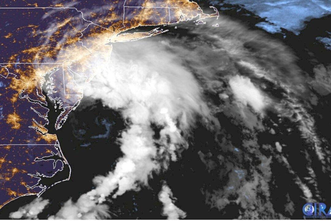
The storm picked up speed Friday morning, moving north around 10 mph and producing top sustained winds of 50 mph, forecasters said. Earlier observations showed it moving at 8 mph with top sustained winds of 45 mph.

Once the storm moves over land, it should weaken quickly.

A tropical storm warning remained in effect from Cape May, New Jersey, to Watch Hill, Rhode Island. The warning area includes Long Island and the Long Island Sound in New York, forecasters said.

Fay is the earliest sixth-named storm on record, according to Colorado State University hurricane researcher Phil Klotzbach. The previous record was Franklin on July 22, 2005, Klotzbach tweeted.

“Residents along the mid-Atlantic and Northeast coasts should expect conditions similar to a Nor'easter,” CNN meteorologist Taylor Ward says. “Bands of rain and gusty winds will bring the potential for coastal flooding, beach erosion and rip currents from Thursday to Saturday.”

Two named storms formed before the official June 1 start of the hurricane season. None of this season’s previous five named storms strengthened into hurricanes.

CNN Wire and Epoch Times staff contributed to this report.