NEW ORLEANS—Rain pounded the U.S. Gulf Coast on Sunday ahead of the arrival of Tropical Storm Cristobal, which has already spawned a tornado in Florida and threatened more twisters along with high winds and storm surge.
Roads flooded in coastal Louisiana and Mississippi, and thousands were without power even before the storm made landfall. It was expected to arrive on U.S. soil late Sunday, though it was not expected to grow into a hurricane.
Forecasters warned the storm would affect a wide area stretching roughly 180 miles east into Florida. But they forecast the worst impacts in southeast Louisiana and southern Mississippi, where some spots could get up to 12 inches of rain and storm surges of up to five feet.
“It’s very efficient, very tropical rainfall,” National Hurricane Center Director Ken Graham said in a Facebook video. “It rains a whole bunch real quick.”
The storm could also generate tornadoes in parts of Alabama, Louisiana, Mississippi and Florida.
Rain fell intermittently in New Orleans famed French Quarter Sunday afternoon, but the streets were nearly deserted, with many businesses already boarded up due to the coronavirus.
They seemed “resigned to whatever happens—happens,” he said.
The Sewerage & Water Board of New Orleans said the city’s drainage system had limits and was old, so residents should avoid underpasses and low-lying areas where water can pool during inevitable street flooding.
On evacuated Grand Isle in Louisiana, a highway was underwater and much of the island wasn’t passable, Jefferson Parish Councilman Ricky Templet told The Times-Picayune/New Orleans Advocate.
Templet plans to stay on the island during the storm and said he hasn’t seen water levels this high since a 2012 hurricane.
The Louisiana National Guard had dozens of high-water vehicles and rescue boats ready to go across south Louisiana. Three teams of engineers were also available to help assess potential infrastructure failures, the Guard said in a news release.
In Biloxi, Mississippi, a pier was almost submerged by Sunday morning. Squalls with tropical-force winds had reached the mouth of the Mississippi River and conditions were expected to deteriorate, the National Hurricane Center in Miami said. Cristobal’s maximum sustained winds remained at 50 mph, and it was moving north at 5 mph . On Sunday at 1 p.m. EDT, the storm was centered 90 miles south of New Orleans.
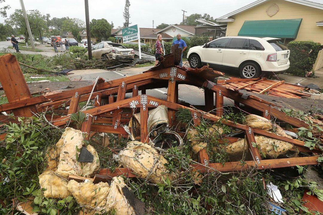
But the storm already made its presence felt Saturday evening with a tornado that touched down near downtown Orlando, the National Weather Service said. The twister just missed a group of protesters at Lake Eola at around 7:30 p.m. There appeared to be no injuries, but tree limbs were knocked down, and there were reports of power outages.
“Yes, it is related to the tropical storm that is well to our west,” said Scott Kelly, a meteorologist with the National Weather Service in Melbourne, Florida. “But the tropical storm provided a lot of low level shear and that has allowed for some tornadoes to form over Central Florida.”
A tropical storm warning was posted for the northern Gulf of Mexico coast from Intracoastal City, Louisiana, to the Alabama-Florida border.
Forecasters said the storm’s center will move inland across Louisiana late Sunday through early Monday and then head north across Arkansas and Missouri on Monday afternoon and into Tuesday.
In Louisiana, Gov. John Bel Edwards has declared a state of emergency to prepare for the storm’s possible arrival.
Jefferson Parish, a suburb of New Orleans, called for voluntary evacuations Saturday of Jean Lafitte, Lower Lafitte, Crown Point and Barataria because of the threat of storm surge, high tides and heavy rain. Residents were urged to move vehicles, boats and campers to higher ground.
A similar order was issued for several Plaquemines Parish communities, including Happy Jack, Grand Bayou, Myrtle Grove, Lake Hertiage, Harlem and Monsecour. The parish’s president, Kirk Lepine, said the order was issued as a precaution.