Tornadoes Hit Texas, Louisiana, Storm Warnings Issued for Parts of Southwest US

Tornadoes Hit Texas, Louisiana, Storm Warnings Issued for Parts of Southwest US
Debris flies through the air as howling winds accompanied by a line of storms approach the old Tarrant County Courthouse in downtown Fort Worth, Texas, on March 2, 2023. Tom Fox/The Dallas Morning News via AP
Updated:
0:00

Tornadoes hit Texas and Louisiana on Thursday, causing widespread power outages in the region and canceling hundreds of flights into and out of the Dallas area.

The weather conditions are part of a powerful storm system that had brought heavy snow to California earlier. It made its way to Texas and surrounding states late Thursday, bringing damaging winds over 70 mph (112 kph).
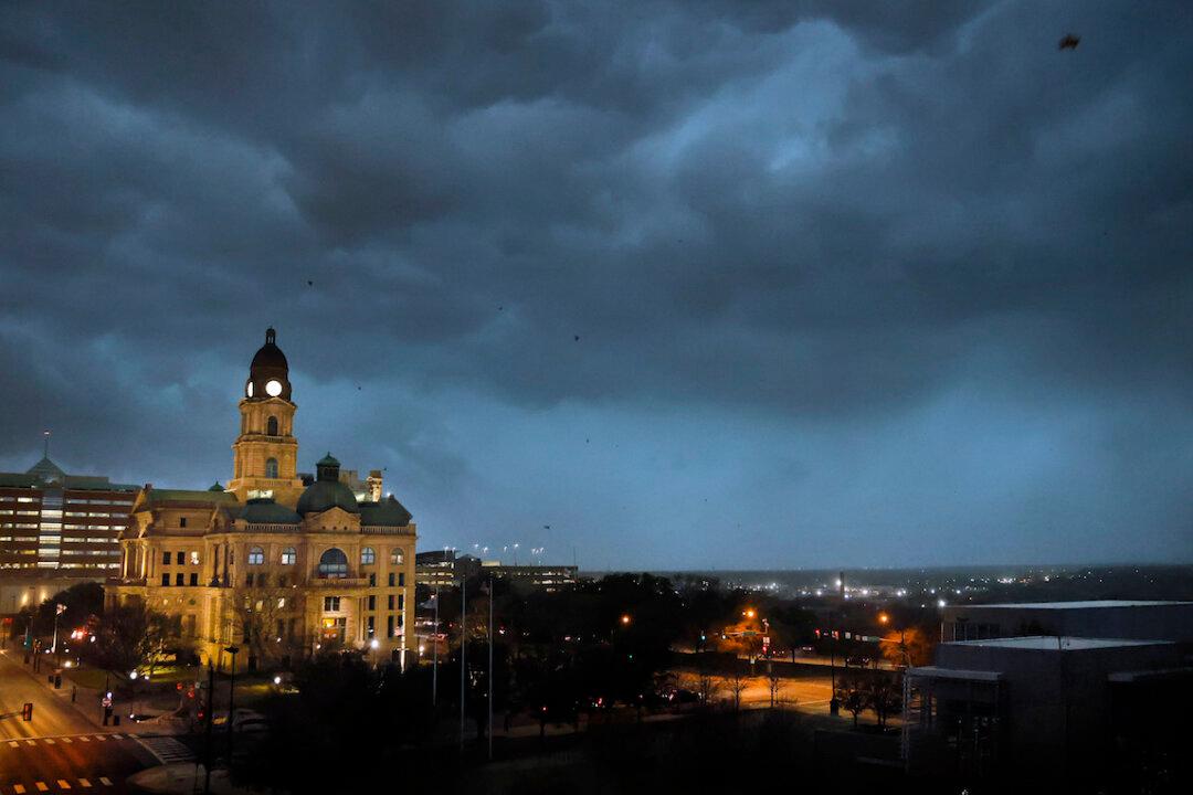
Tornado watches were issued into Thursday night in Texas’s Dallas-Fort Worth area.

“If your phones alerted and you hear sirens, that is for wind speeds as strong as a weak tornado! So treat it like one! Get inside, away from windows!” the NWS Fort Worth announced around 6 p.m. local time. “Widespread damaging winds will impact most everyone in Collin and Dallas counties.”

Dallas-Fort Worth International Airport and Dallas Love Field have reported more than 400 flight cancellations either to or from the airports, according to Flight Aware.

Meanwhile, more than 310,000 utility customers in Texas had no power as of Thursday night, according to utility tracker poweroutage.us. That was down from 346,000 early in the evening.

The storm system is working its way from southeast Oklahoma into Texas, as well as parts of Arkansas and Louisiana.

Several tornado reports were listed in Texas, and at least one tornado was reported in Louisiana, near Louisiana State University in Shreveport, per the NWS’s Storm Prediction Center.

Tornado Watch

The National Weather Service (NWS) issued a tornado watch for portions of Southern and central Arkansas, as well as Northern Louisiana effective from 5:40 p.m. until midnight CST.
By 11 p.m. CST, it said the severe weather threat for the tornado watch continues. Risk for damaging winds and “a tornado or two” continue across the region, it added, with the risk expected to persist or increase overnight.

The NWS also noted the risk of flash flooding in the region due to significant severe storms and heavy rain on Thursday. “Think now about what to do during a warning wherever you expect to be,” it warned residents.

Teams from the NWS planned to survey areas on Friday for likely tornado damage in the storm’s path.

Forecasters predict the storm system will proceed eastward on Friday, through Ohio and Tennessee River valleys, bringing threats of heavy rain and severe thunderstorms. The system will likely generate snow across the eastern Great Lakes and New England later in the day.

The Associated Press contributed to this report.
Related Topics