Chicago is expecting 8 to 12 inches of snow beginning late on Feb. 24 night, which would be the most snowfall from one storm since November 2018.
If totals top 10 inches, it would be the largest for the city since November 2015.
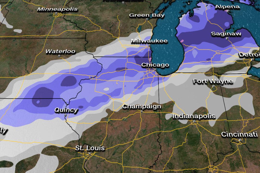
Widespread snowfall of 4 inches is expected from Iowa to Michigan with 8 to 12 inches for parts of northern Illinois and southern Wisconsin, including the Chicago area. Nearly 14 million people are under winter storm watches beginning early Tuesday morning.
A substantial band of snow will develop late Monday night from Iowa and Missouri to Michigan, with the heaviest snow expected Tuesday into Wednesday evening.
“The more impactful accumulating snowfall looks to be from late Tuesday morning through late Wednesday afternoon. The snow should end by early Wednesday evening,” the NWS Chicago office stated.
With inconsistency in the forecast models, it’s unclear how much snow each respective city will get.
It seems Detroit may only get a few inches but if the heavier snow band dips farther south, they could receive substantially more.
Snowfall rates could exceed more than one inch per hour Tuesday into Wednesday, leading to dangerous travel due to deteriorating road conditions and severely reduced visibility.
Strong winds with 35 mph wind gusts or higher could lead to further reduced visibility.
Expect impacts to air travel throughout the Midwest on Tuesday and Wednesday.
These strong northerly winds across Lake Michigan will gusts to 40 mph across Lake Michigan. Due to these strong northerly winds, lakeshore flooding is likely.