LOS ANGELES—The second of back-to-back atmospheric rivers battered California on Sunday, flooding roadways and knocking out power to nearly 850,000 people and prompting a rare warning for hurricane-force winds as the state braced for what could be days of heavy rains.
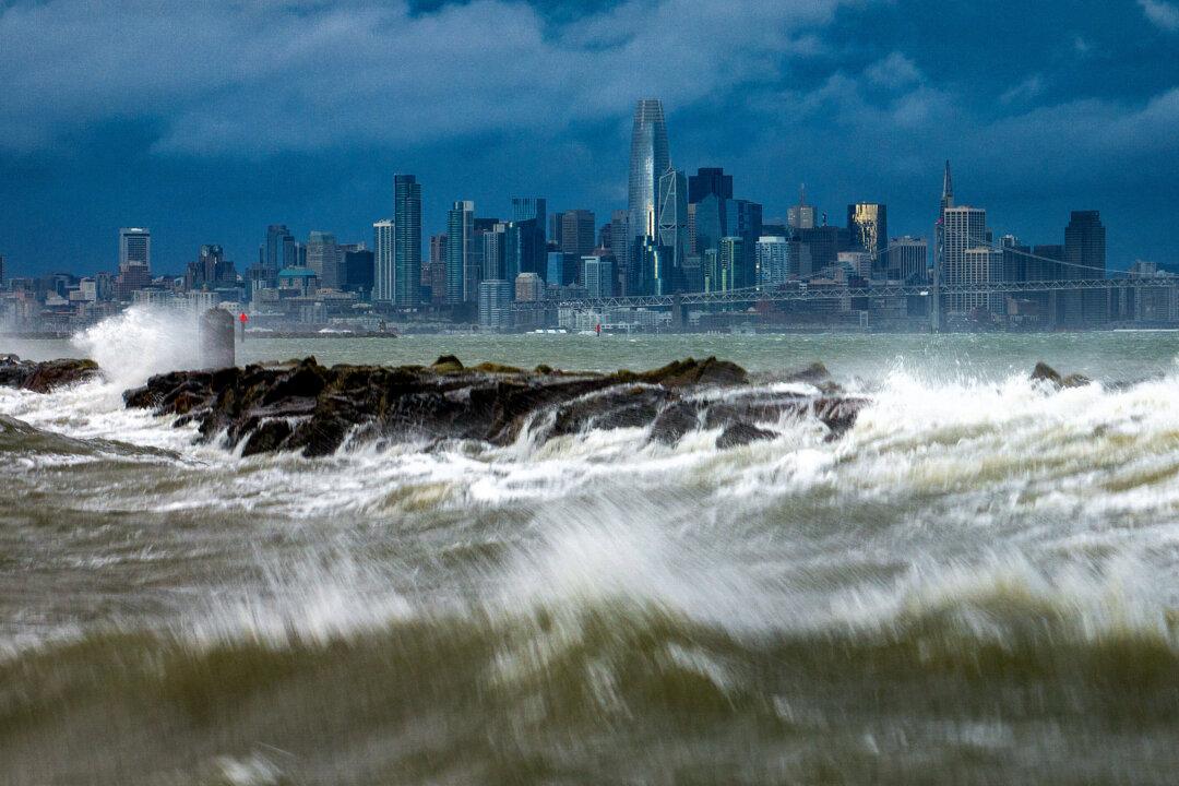
The storm inundated streets and brought down trees and electrical lines across the San Francisco Bay Area, where winds topped 60 mph (96 kph) in some areas. Gusts exceeding 80 mph (128 kph) were recorded in the mountains.
Just to the south in San Jose, emergency crews pulled occupants out of the windows of a car stranded by floodwaters and rescued people from a homeless encampment alongside a rising river.
In Southern California, officials warned of potentially devastating flooding and ordered evacuations for canyons that burned in recent wildfires that are at high risk for mud and debris flows. The National Weather Service office for Los Angeles warned that “all systems are go for one of the most dramatic weather days in recent memory.”
On Sunday, customers called the Santa Barbara Home Improvement Center inquiring about sandbags, flashlights and generators, said assistant manager Lupita Vital. Sandbags sold out on Saturday, so people were buying bags of potting soil and fertilizer instead, she said.
“People are trying to get anything they can get that’s heavy to use it as, you know, protection for their doors and everything,” Ms. Vital said Sunday.
“This storm is predicted to be one of the largest and most significant in our county’s history, and our goal is to get through it without any fatalities or any serious injuries,” Santa Barbara County Sheriff Bill Brown told reporters Saturday. Classes were canceled Monday for schools across the county, which was devastated by mudslides caused by powerful storms in 2018.
Strong winds and heavy rain brought treacherous conditions to the coastal city of Ventura, west of Los Angeles, said Alexis Herrera, who was trying to bail out his sedan which was filled with floodwater. “All the freeways are flooded around here,” Mr. Herrera said in Spanish. “I don’t know how I’m going to move my car.”
More than 847,000 customers were without electricity statewide by Sunday evening, with most of the outages concentrated in coastal regions, according to poweroutage.us.
Six San Francisco Bay Area counties were at low risk of waterspouts coming ashore and becoming tornadoes, said the Storm Prediction Center. The last time the center forecasted a tornado risk in the region was in February 2015, according to the San Francisco Chronicle.
Winds caused hours-long delays at San Francisco International Airport. By 2:30 p.m. Sunday, 155 departing flights were delayed and 69 had been canceled, according to the tracking website FlightAware.
Palisades Tahoe, a ski resort about 200 miles northeast of San Francisco, said it was anticipating the heaviest snowfall yet this season, with accumulations of 6 inches per hour for a total of up to two feet. Heavy snow was expected into Monday throughout the Sierra Nevada and motorists were urged to avoid mountain roads.
Much of the state had been drying out from the system that blew in last week, causing flooding and dumping welcome snow in mountains. The latest storm, also called a “Pineapple Express” because its plume of moisture stretches back across the Pacific to near Hawaii, arrived offshore in Northern California on Saturday, when most of the state was under some sort of wind, surf or flood watch.
The weather service on Sunday issued a rare “hurricane force wind warning” for the Central Coast, with wind gusts of up to 92 mph possible from the Monterey Peninsula to the northern section of San Luis Obispo County.
Meanwhile, Southern California was at risk of substantial flooding beginning late Sunday because of how slow the system was moving, said Ryan Kittell, a meteorologist at the weather service’s Los Angeles-area office.
“The core of the low pressure system is very deep, and it’s moving very slowly and it’s very close to us. And that’s why we have those very strong winds. And the slow nature of it is really giving us the highest rainfall totals and the flooding risk,” he said at a Sunday briefing.
Evacuation orders and warnings were in effect for mountain and canyon areas of Monterey, Santa Barbara, Ventura and Los Angeles counties. LA County Supervisor Lindsay Horvath urged residents near wildfire burn areas of Topanga and Soledad canyons to heed orders to get out ahead of possible mudslides.
“If you have not already left, please gather your family, your pets, your medications and leave immediately,” Ms. Horvath said at a Sunday briefing. The county set up shelters where evacuees could spend the night.
Gov. Gavin Newsom on Sunday declared a state of emergency for Los Angeles, Orange, Riverside, San Bernardino, San Diego, San Luis Obispo, Santa Barbara, and Ventura counties. The Governor’s Office of Emergency Services activated its operations center and positioned personnel and equipment in areas most at risk.
The storm was expected to move down the coast and bring heavy rain, possible flash-flooding and mountain snow to the Los Angeles area late Sunday, before moving on to hammer Orange and San Diego counties on Monday.
“This is a dangerous system with major risks to life and property,” the weather service’s LA-area office said. “Residents should heed any evacuation orders. Stay off the roads, especially the freeways, this afternoon through at least Monday morning.”
Organizers of the Grammy Awards in downtown Los Angeles were hoping the Sunday evening show would end before the fiercest rain moved in.
As of Sunday afternoon, the Los Angeles Unified School District, the nation’s second largest, said it was planning to open schools as usual Monday. The decision would be reevaluated at 6 a.m. Monday, said Superintendent Alberto Carvalho.
The weather service forecast up to 8 inches of rainfall across Southern California’s coastal and valley areas, with 14 inches possible in the foothills and mountains. Heavy to moderate rain is expected in Southern California until Tuesday.