One of the nation’s largest craters formed by volcanic eruption in California’s Eastern Sierra Nevada mountains could see significant seismic activity in the near future, but is not expected to erupt soon, according to a recent study by scientists at the California Institute of Technology.
Researchers used advanced imaging technology to analyze underground formations of the so-called Long Valley caldera, which sits atop a super volcano that last erupted approximately 100,000 years ago—with their findings published in the Science Advances journal on Oct. 18.
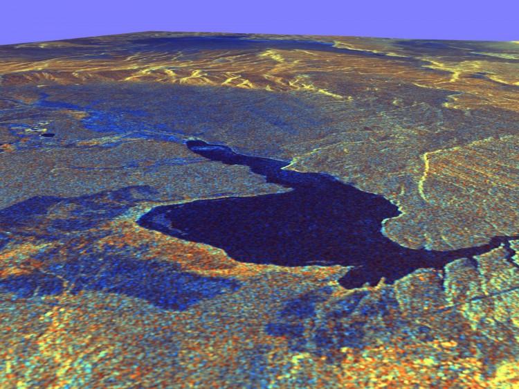
The caldera—a depression that is formed by the collapse of a volcano onto itself—occurred approximately 767,000 years ago by a massive eruption that spewed enough ash to cover Los Angeles more than one kilometer thick, according to the press release.
Over the past five decades, the area has experienced swarms of earthquakes, surface changes, and high levels of gases released, according to the scientists—though opinions differ as to why such is occurring and the potential for danger.
One theory suggests that a reservoir of molten material, known as magma, near the crust is responsible—like what exists at Yellowstone—while another posits that the reservoir is much lower underground and so-called “secondary boiling,” where pockets of magma are moving underground, is causing the changes.
The study sought to better understand the Long Valley caldera’s underground structures, as the presence of a large amount of molten material nearer the surface would create a much more dangerous situation, according to experts.
“To evaluate the risk of major eruptions, it is critical to characterize the connectivity between surface features and subsurface structures, especially to estimate the volume of potentially eruptible material,” the authors wrote.
Utilizing 100 kilometers of fiber optic cable, researchers documented more than 2,000 seismic events over an 18-month period using a new technique known as distributed acoustic sensing. Data collected was analyzed using artificial intelligence which was displayed in maps of the volcanic structure, according to the press release.
“We enhance the current understanding by presenting a comprehensive picture of the entire volcanic system, which was missing from previous tomographic results,” the authors wrote in the study.
Results revealed the likelihood of the “secondary boiling” hypothesis holding true, according to researchers, who noted a lack of evidence suggesting magma is present near the crust in high volumes, indicating a situation that is “still hazardous but not as dangerous” than if they had discovered a large reservoir near the upper crust.
The researchers hope to use a longer cable in the future—200 kilometers—to reach deeper into the Earth’s crust and further explore the caldera’s cooling magma.
By combining the abilities of scientists and machine learning to better understand complex formations like calderas, researchers said they are hopeful that similar applications will benefit other fields of study.
“This is one of the first demonstrations of how [distributed acoustic sensing] can change our understanding of [earth sciences],” Ettore Biondi, Caltech scientist specializing in the new technology and the paper’s lead author, said in the press release. “We’re excited to apply similar technology to other regions where we are curious about the subsurface environment.”