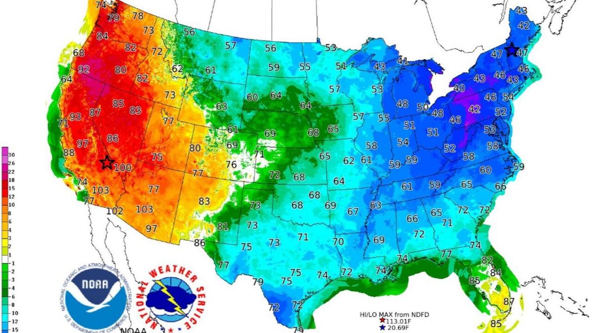
A snowstorm could hit parts of the East Coast this weekend, and it might bring historic mid-May totals for New England and the Northeast United States.
“A late-season snow event for the interior Northeast beginning on Friday” could occur as a low-pressure system intensifies while moving across the Tennessee Valley before heading to the Appalachians.
“Rain can be expected to change over to wet snow, possibly heavy, over the central Appalachians on Friday before blustery winds and colder air ushering in on the back side of the storm. By Friday night, the low-pressure system is forecast to further intensify as the storm center skirts the New England coast,” the weather agency said.
A “significant amount of wet snow” can then be expected in the interior portion of New England after that, starting late on Friday into early Saturday, according to the NWS.
Forecasters also say that heavy rain is also possible along the Interstate 95 corridor.
Other than snow, there will be record low temperatures across much of the East Coast due to a cold air mass being pushed southward into the United States behind the storm.
“This will be in stark contrast with near record heat across southern California, the Desert Southwest, and the southern Rockies. In addition, fire danger will be very high today over much of the southern Rockies as the low pressure system develops over the central Plains,” the agency said.