Nixon Fire Spreads Rapidly Near Northern San Diego County, Prompting Evacuation Warnings

Nixon Fire Spreads Rapidly Near Northern San Diego County, Prompting Evacuation Warnings
A firefighter works as the Nixon Fire burns with evacuation orders in the area, near Aguanga of Riverside County, Calif., on July 29, 2024. Mario Tama/Getty Images
City News Service
Updated:
0:00

SAN DIEGO—An out-of-control wildfire in the southern reaches of Southern California Riverside County has grown to over 4,900 acres, prompting evacuation warnings in the northeastern reaches of the San Diego area, authorities reported on July 31.

The blaze erupted about 12:30 p.m. July 29 in the area of Richard Nixon Boulevard—hence dubbed the Nixon Fire—and Tule Peak Road, according to the Riverside County Fire Department (RCFD).
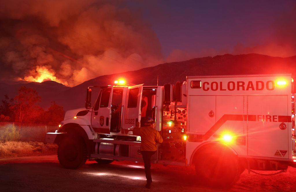
The agency said numerous engine and hand crews—numbering over 250 personnel—from the county, Cal Fire-San Diego County, and other agencies were sent to the location and encountered flames burning at a “dangerous rate” to the southeast through medium brush.

“Over the next three days, a change in the weather pattern shows an increasing chance of thunderstorms and lightning activity, firefighters will continue to work aggressively to gain additional control. Residents within the fire area are reminded to pay attention to evacuation warnings and orders,” Cal Fire and the RCFD said in a joint statement.

As of July 30 morning, the head of the blaze was well inside the Beauty Mountain Wilderness, near Iron Spring Mountain, maintained and protected by the U.S. Bureau of Land Management.

According to Cal Fire officials, the flames scorched more than 4,900 acres as of 8 a.m. July 31 as firefighters continued efforts to stop the progression of the fire throughout the night.

One flank of the conflagration briefly crossed into San Diego County, blackening about two open acres before firefighters extinguished that section of flames, according to Cal Fire.

The proximity of the blaze to that corner of the San Diego area prompted sheriff’s officials to warn residents of sparsely populated areas northeast of Oak Grove to prepare to evacuate on short notice if necessary.

Riverside County Supervisor Kevin Jeffries, a former firefighter, asked RCFD Chief Bill Weiser at July 30’s Board of Supervisors meeting if containment efforts might be complicated because of federal restrictions on using heavy machinery, such as bulldozers, to battle blazes in protected areas.

Weiser said he did not anticipate problems, and coordination with Bureau of Land Management administrators was “good.”

Four structures were damaged and one was destroyed July 30 afternoon, but it was still unclear whether those were only sheds and outbuildings, or may have included homes. There are 900 structures threatened, according to Cal Fire. No injuries have been reported.

An evacuation order was implemented for the scattered homes south of Highway 371, north of the county line, west of Terwilliger Road, and east of Foolish Pleasure Road.

An evacuation center was established at Temecula Valley High School. However, county Emergency Management Department Director Bruce Barton told the board there was no one utilizing the space, which is being managed by the Red Cross and Department of Public Social Services.

Properties in the remote location are spaced acres apart.

Shortly after 4 p.m. July 29, the blaze spread into the 2,300-acre burn scar from the Bonny Fire that crews battled for over a week last July and August in Aguanga. Weiser said the scar was aiding in slowing the growth of the brusher because there was less fuel to feed it.

The cause of the fire was under investigation.

City News Service
City News Service
Author
Breaking news gathering service based in West Sacramento, California, USA Gathering and distributing breaking news content via video, photographic and audio
twitter
Related Topics