Researchers with the USGS noted that 95 percent of Florida’s western coast sandy beaches are going to be “continuously covered by ocean water” as Milton slams into the state later Wednesday.
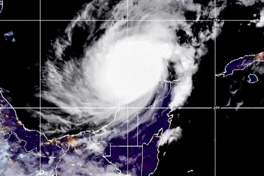
“This is the most severe level of coastal change,” the agency warned on Monday.
Milton’s storm surge and waves both have the potential to “cause both 100 percent of all ocean-facing beaches in Florida to experience erosion and overwash,” which means that water levels reach higher than the top of sand dunes.
“When a beach is overwashed, sand can be pushed and deposited inland, causing significant changes to coastal landscapes and blocking roadways,” the USGS said. “Overwash can reduce the height of protective sand dunes, alter beach profiles, and leave areas behind the dunes more vulnerable to future storms.”
Kara Doran, a USGS supervisory physical scientist, said that Milton’s impact on the Florida west coastline “cannot be overstated,” noting that some areas that were affected by Hurricane Helene could face more serious damage.
“Our initial analysis looking at imagery collected by the National Oceanic and Atmospheric Administration after Helene shows most of the west coast experienced overwash or inundation and complete erosion of dunes, so those protective dunes are no longer in place for many locations,” she added.
A large area of storm surge with 10-feet inundations or greater is expected across a part of the central-western Florida coast, the NHC said, adding that people who live in areas where a storm surge warning is in effect should leave as soon as possible. Some officials, including Tampa Mayor Jane Castor, have warned this week that people who remain in those areas face the possibility of death.
The Florida Highway Patrol also said that “heavy traffic patterns are flowing northbound and eastbound on all roadways” Tuesday afternoon as people continue to evacuate in advance of the hurricane.
“For those wishing to evacuate, the time is now,” the agency said in a statement. “Otherwise, finalize your storm preparations now.”
“Now is the time to rush to complete all preparations to protect life and property in accordance with your emergency plan. Ensure you are in a safe location before the onset of strong winds or possible flooding. Ensure you have multiple ways to receive weather warnings,” the NHC said.
Milton’s forecasted trajectory wobbled slightly Tuesday, which means it could make landfall Wednesday a bit south of Tampa Bay, according to the most recent forecast discussion from the NHC. Still, the whole region is expected to get slammed.
Meanwhile, people who don’t live near the coast but who live near a body of water are being advised to evacuate.
“We’ve seen a lot of questions about, ‘well I live on a creek,’ or ‘I live on a river, is it really going to get 10 to 15 feet where I live?’” Sarasota County Emergency Management Chief Sandra Tapfumaneyi said in a briefing on Wednesday.
“That storm surge is going to start at 10 or 15 feet near the coastline and then it’s going to travel,” she said. “And storm surge likes to go on the path of least resistance. So those of you that live near a river, that live near a creek, those river banks, their water will come up.”