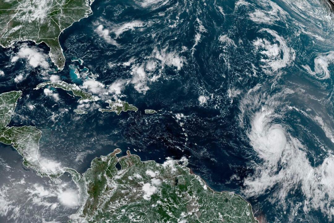
Hurricane Lee has become a Category 5 storm—the first of the Atlantic season—according to the National Hurricane Center (NHC).
It was moving west-northwest at 14 mph (22 km/h), and as of 11 p.m. AST was located about 705 miles (1,135 kilometers) east of the northern Leeward Islands of the Caribbean.
The storm had formed over the Atlantic Ocean roughly 1,300 miles east of the Leeward Islands. It had just been a Category 1 storm at 5 a.m. AST on Thursday, but had strengthened to a Category 4 storm by 5 p.m. AST, with maximum sustained winds of 130 mph.
“Lee continues to strengthen at an exceptional rate,” the NHC said in its 5 p.m. AST advisory.
In the 11 p.m. advisory, the center said that “additional strengthening is forecast overnight.” It added, “Fluctuations in intensity are likely over the next few days, but Lee is expected to remain a major hurricane through early next week.”
The NHC noted in the forecast discussion: “The question doesn’t appear to be if [rapid intensification] continues, but rather how strong Lee will get, and how quickly will it get there. Many of the models are calling for remarkable rates of intensification, beyond rates normally seen with model forecasts.”
Lee was not expected to make landfall while on a projected path that will take it near the northeast Caribbean. The NHC said, “While the core of Lee will likely bypass the northern Leeward Islands, Virgin Islands, and Puerto Rico in the coming days, vigilance is crucial.”
The NHC said that Lee is expected to cause “dangerous beach conditions” around the western Atlantic through early next week.
Specifically, starting Friday, the Leeward Islands will likely experience “[d]angerous surf and life-threatening rip currents.” Similar conditions will spread westward and northward to affect Puerto Rico, Hispaniola, Turks and Caicos, the Bahamas, and Bermuda over the weekend.
“We will see waves between 10 and 15 feet (3 and 5 meters), so we don’t want anyone on the beaches,” said Ernesto Morales with the National Weather Service in San Juan, Puerto Rico.
The impact and aftermath of Lee on regions like the U.S. East Coast, Atlantic Canada, or Bermuda by the end of next week remains uncertain. Because the hurricane is projected to decelerate over the southwestern Atlantic, people are advised to be cautious and brace for dangerous surf and rip conditions along most of the U.S. East Coast from Sunday.
Ahead of the storm, the Federal Emergency Management Agency has dispatched resources to Puerto Rico and the U.S. Virgin Islands and is liaising with local officials, according to the Biden administration.
Hurricane Lee comes just days after Hurricane Idalia hit Florida’s Big Bend area as a Category 3 storm, resulting in extensive flooding and destruction, before moving on to Georgia and the Carolinas.
Lee is the 12th named storm of the Atlantic hurricane season, which runs from June 1 to Nov. 30 and peaks in September. Tropical Storm Margot became the 13th named storm of the season after forming late on Thursday.
In August, the National Ocean and Atmospheric Administration (NOAA) predicted 14 to 21 named storms for this season. Out of these, six to 11 could transform into hurricanes, with two to five potentially evolving into significant hurricanes.