Satellite photos show Grand Bahama Island before and after Hurricane Dorian slammed into the island.
An ICEYE satellite captured a photo of the apparently inundated island, according to the firm.
Later, CNN’s Jake Tapper posted a comparison.
Hurricane warnings are still in effect for Grand Bahama and the Abacos Islands in the northwestern Bahamas as well as Jupiter Inlet, Florida, to Ponte Vedra Beach, Florida.
Hurricane warnings were also issued for north of Edisto Beach, South Carolina, to South Santee River, South Carolina.
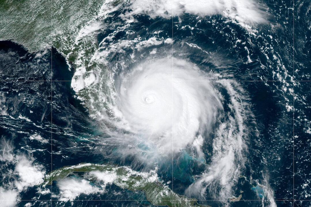
“A turn toward the north is forecast by Wednesday evening, followed by a turn toward the north-northeast Thursday morning. On this track, the core of extremely dangerous Hurricane Dorian will gradually move north of Grand Bahama Island through this evening. The hurricane will then move dangerously close to the Florida east coast late today through Wednesday evening,” the agency wrote.
Then, it will move “very near” Georgia and South Carolina on Wednesday, it added.
On Thursday, the storm will approach near the coast of North Carolina.
Dorian Weakened
On Tuesday, Hurricane Dorian lost some of its punch but grew in size on Tuesday, picking up speed and forecast to come “dangerously close” to Florida’s coast, Reuters reported.Dorian, which over the weekend had been one of the most powerful Atlantic hurricanes on record, inundated homes with floodwater in the Abaco Islands in the northern Bahamas ahead of its expected advance on the U.S. East Coast, where more than a million people had been ordered evacuated.
The hurricane weakened to a Category 2 on the five-step Saffir-Simpson Wind Scale early on Tuesday, with maximum sustained winds of 110 mph, the U.S. National Hurricane Center (NHC) said. It was moving northwest at 2 mph, below walking speed, and was about 105 miles east of Fort Pierce, Florida.
The storm hovered over the islands for almost 24 hours.