LOWVILLE, N.Y.—Heavy snowfall and numbing temperatures kept parts of the United States in a deep freeze Sunday as the Thanksgiving holiday weekend draws to a close. Despite the Arctic-type weather, however, snowmobilers and skiers are reveling in their respective wintry terrains, and weather forecasters gave possible good news ahead of the NFL game in Buffalo.
In the remote Tug Hill region of upstate New York, where lake-effect snow off Lake Ontario can dump several feet of snow at a time, there was up to 46 inches in the Barnes Corners area.
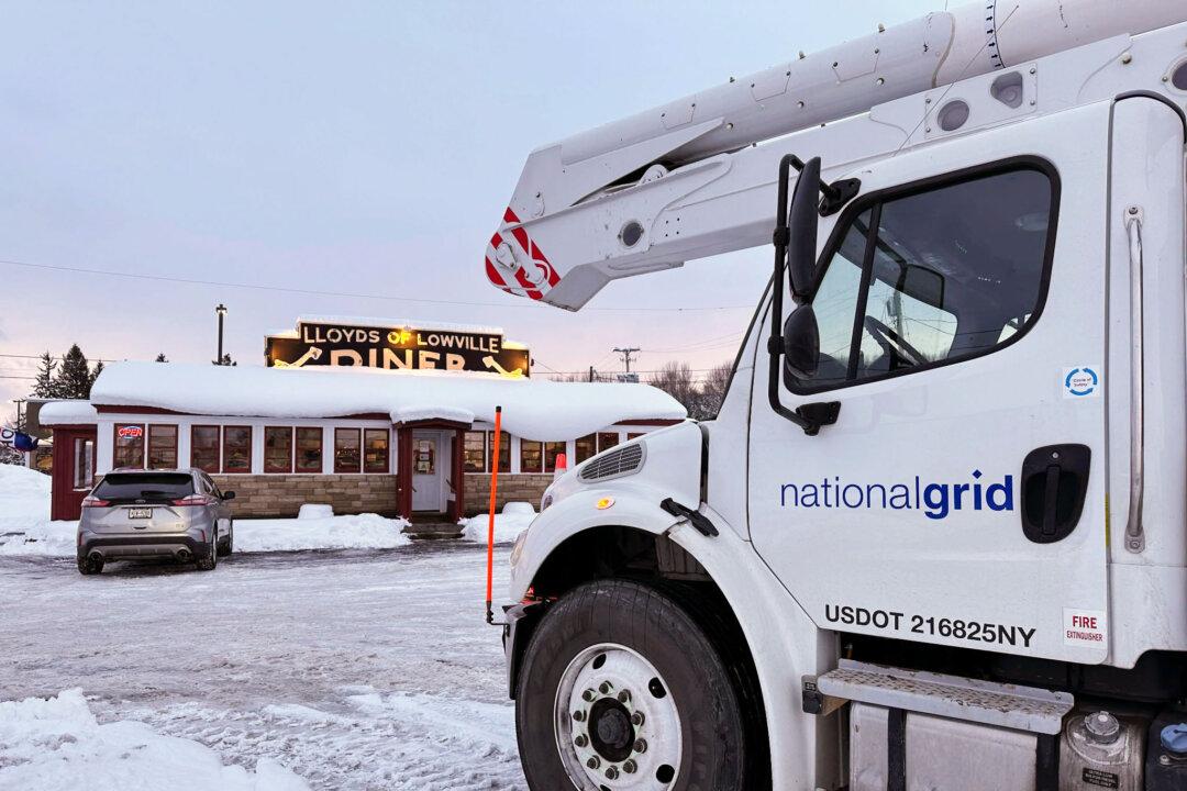
“We just keep digging out,” Kevin Tyo, a local businessman, said Sunday. “We were out all day yesterday, plowing.”
Like many locals, he has a plow attached to the front of his truck for much of the winter, “and I have a tractor with a bucket, and a snowblower.”
His advice? “If you’re not used to it, stay home. If you’re out, slow down.”
Buffalo Bills Kickoff Set for Sunday Night
In Buffalo, officials with the NFL’s Bills had sought stadium snow shovelers for the season, including ahead of Sunday night’s game against the San Francisco 49ers. The team said it would pay $20 per hour and provide food and hot drinks.A lake-effect storm began hitting the area Saturday near the Bills’ stadium in Orchard Park, New York. Snow was continuing to fall near the stadium just hours ahead of the game, according to the State Weather Risk Communication Center in New York.
“Snowfall totals will be highly dependent on whether the current lake effect snow shifts just south of the stadium, or remains in place over the stadium longer,” the center said in a post on the social media site X.
Some Motorists Stuck for Hours Along New York-Pennsylvania Border
Christine Schintzius, her 4- and 8-year-old sons and 12- and 15-year-old nieces had set out on clear roads Friday from Wales, New York, southeast of Buffalo. The family planned to attend a travel hockey tournament in Cleveland but instead found themselves snowbound for 19 hours, stuck inside Schintzius’ Honda Pilot.The family ran into seemingly endless lines of stopped traffic, first on Interstate 90 near the New York-Pennsylvania border for 9 hours, and again on Route 5 in Pennsylvania for 10 hours, until being plowed out by some residents.
“There were lines and lines of cars. It was packed, there was tons of people, tons,” Schintzius said by phone Sunday.
While stuck on Route 5, Schintzius never turned off her car, afraid it wouldn’t start again in the frigid cold. Two truckers stopped to check on them during the night. In the morning the police checked in, along with a local resident who walked the line of cars with a basket of muffins, handing them out and making sure the stranded drivers had water.
“Thankfully, all of my kids, my nieces, all travel well,” said Schintzius, who had packed a cooler with lunch meats, snacks, yogurt and fruit. “And luckily I had still basically a full tank of gas.”
When they were finally free of the backup Saturday, Schintzius turned around and took a roundabout route home, avoiding the worst of the snow that was still falling.
“We went completely around the storm because I was worried, like I’m not getting stuck in that ever again,” she said.
Arctic Air Late Last Week Brings Bitter Temperatures
A blast of Arctic air late last week brought bitter temperatures of 10 to 20 degrees Fahrenheit below average to the Northern Plains, the National Weather Service said, prompting cold advisories for parts of North Dakota. Frigid air was expected to move over the eastern third of the United States by Monday, with temperatures about 10 degrees below average.Officials in Erie, Pennsylvania, said Sunday that the heavy lake-effect snow has produced “treacherous” conditions that are causing even snowplows to get stuck as they work around the clock to try to clear city roads.
The city estimated Sunday morning that there were “about 100 cars throughout the city that are blocking roads and need to be towed out of the way so plows can get through.”
Commercial vehicles remained banned in both directions of I-90 in western New York along a nearly 134-mile stretch to the Pennsylvania line. The National Weather Service said lake-effect snow was expected to continue east of Lake Erie and Lake Ontario on Sunday, with additional snowfall of 1 to 2 feet possible.
New York, Pennsylvania Declare Emergencies
In a phone interview Saturday with WWNY-TV, New York Gov. Kathy Hochul said the state prepared for the storm for days by deploying snowplows and thousands of workers and consulting with utility providers. She also dispatched personnel from other parts of the state to assist.“I know it’s something they’re all accustomed to and they can handle, but I want to let them know we are there with reinforcements and to make sure everyone can travel safely, especially over this really busy holiday weekend,” she said.
Pennsylvania Gov. Josh Shapiro signed a disaster emergency proclamation Saturday and said parts of Erie County in the northwest received nearly 2 feet of snow with more expected through Monday night.
Michigan Battered by Lake-Effect Snow
Parts of Michigan were battered by lake-effect snow, which happens when warm, moist air rising from a body of water mixes with cold dry air overhead. Bands of snow rolling off Lake Superior buried parts of the Upper Peninsula under 2 feet or more, said Lily Chapman, a meteorologist with the National Weather Service office in Marquette, Michigan.Motorists were warned of potentially dangerous road conditions for holiday travel on Sunday.
“Expect rapid changes in traveling conditions in and out of snow bands, including snow covered, slick roads, and reduced visibility,” the National Weather Service said Sunday.
There were 27 inches of snow just northeast of Ironwood, in the Upper Peninsula’s western reaches, and another 2 feet in Munising, in the eastern area.
Lake-effect snow could add more than a foot over the eastern Upper Peninsula through Monday morning, with 6 to 10 inches or higher to the west, Chapman said Saturday.
Gaylord, Michigan, received 24.8 inches of snow Friday, setting a new single-day record for the city in a region dotted by ski resorts, said Keith Berger of the weather service’s Gaylord office. The previous record of 17 inches was set March 9, 1942.
Joseph Delizio, a weather service meteorologist based in Gaylord, said heavy snow, especially lake-effect snow, isn’t unusual this time year, “but that magnitude certainly is not.”
“We’ve got more snow in the forecast, believe it or not,” he added.
The snowfall was good news for Treetops Resort, which features 80 acres of ski hill terrain among its 2,000 acres. It boosted the base that snowmaking machines will increase before the resort’s season opening next weekend, Recreation Director Doug Hoeh said.
“Obviously when you get that much snowfall, it’s great for the snow hills, but it’s bad for the parking lots, so we’re kind of digging out,” Hoeh said.