Forecasters Issue Warning on ‘Extremely Active’ 2024 Hurricane Season

‘Coastal residents are reminded that it only takes one hurricane making landfall,’ they said.
Forecasters Issue Warning on ‘Extremely Active’ 2024 Hurricane Season
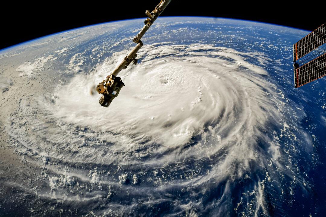
Hurricane Florence gains strength in the Atlantic Ocean as it moves west, as viewed from the International Space Station on Sept. 10, 2018. NASA via Getty Images
Jack Phillips
Updated:
0:00

The 2024 Atlantic hurricane season has been forecast to be “extremely active,” meteorologists at a prominent university say.

Researchers with Colorado State University (CSU) released their yearly Atlantic hurricane season forecast on April 4, calling for 23 named storms, including 12 tropical storms and 11 hurricanes. Of the hurricanes, five are predicted to become “major,” or Category 3 or higher on the Saffir-Simpson scale.
“Current El Niño conditions are likely to transition to La Niña conditions this summer/fall, leading to hurricane-favorable wind shear conditions,” the CSU report said, adding that “warmer-than-normal” Atlantic Ocean temperatures will provide a “more conducive dynamic and thermodynamic environment for hurricane formation and intensification.”

It added: “As with all hurricane seasons, coastal residents are reminded that it only takes one hurricane making landfall to make it an active season. Thorough preparations should be made every season, regardless of predicted activity.”

The average hurricane season has about 14 named storms with seven hurricanes and three major hurricanes.

A National Weather Service forecaster, Robbie Berg, said that because of “signals are that we’re heading toward a La Niña,” the forecast “would tend to support more storms” in the Atlantic basin.

The 2024 season could be quite active “but that doesn’t tell us anything about where those storms may move,” he told USA Today.

“So maybe we'd get lucky and have them stay out over the Atlantic,” he said. “But we don’t know that and that’s why every year we still have to be prepared because whether it’s 10 storms or 20 storms, where they form, where they move is what’s critically important.”

Phil Klotzbach, a senior research scientist with CSU, told Fox News that the La Niña transition creates “colder water in the eastern and central tropical Pacific, typically in the more hurricane-favorable upper-level wind patterns in the Atlantic.”

The 2024 Atlantic hurricane season runs from June 1 to Nov. 30. Peak activity usually occurs around early September.

“We’re still two months from the start of the season and about four months before it really ramps up. So there still are things that could potentially change,” Mr. Klotzbach told the outlet. “In 2022, we had no storms in August, but the season ended up with eight hurricanes. It got really busy late. Some of that may have been due to the subtropical Atlantic being a bit cooler, so we had a lot of like mid-latitude fronts and a lot of dry air that came in and really squashed stuff in August.”

Although CSU noted on April 4 that it made its “highest prediction” for hurricanes for 2024, the research team stressed that “the April outlook historically has the lowest level of skill of CSU’s operational seasonal hurricane forecasts, given the considerable changes that can occur in the atmosphere-ocean between April and the peak of the Atlantic hurricane season from August-October.”

‘Alarmist Messaging’

There has been alarmist messaging that the climate is responsible for an increase in hurricanes in recent years, but some scientists have said that “there has been no increase” in the number of named storms.
“If you hang around people constantly spouting negative stuff and how bad it is, guess what you’re going to believe,” WeatherBELL chief forecaster Joe Bastardi told The Epoch Times last month.

“It’s a great strategy for pushing this thing—if I wanted to argue the CO2 [carbon dioxide] argument, I'd do exactly what they’re doing.”

He said that this season will be the “hurricane season from hell.”

“The size of the storms is getting smaller. That’s the other thing: hurricanes are smaller and more compact,” he said.

Oceanographer Bob Cohen agreed, telling The Epoch Times that the transition from El Niño to La Niña is “correlated with higher-than-normal hurricane activity.”

“Right now, the subsurface temperatures are much cooler than during El Niño,” he added. “The immediate near-surface temperatures are still warmer, but the subsurface water pool and the warm water pool have dissipated, and so once that pops to the surface, it becomes La Niña.”

He said that he expects “we'll hear a lot more alarmist messaging” due to the recent 2024 forecasts.

Federal officials recently said that although El Niño has been in control of worldwide weather patterns since the summer of 2023, models have shown that it will transition to La Niña between July and September. As of April, the United States is still under an “El Niño advisory,” officials say.
“Anomalies across the main El Niño monitoring region haven’t been this cool since last June. Headed toward neutral conditions this spring and into a potential La Niña into the summer,” Michael Lowry, a WPLG-TV meteorologist, wrote on social media last week.
Another meteorologist, Ben Noll, said that currently, the region is showing the “most unusually cool value since January 2023 [and] marks an important step in the progression back toward La Niña.”
Jack Phillips
Jack Phillips
Breaking News Reporter
Jack Phillips is a breaking news reporter who covers a range of topics, including politics, U.S., and health news. A father of two, Jack grew up in California's Central Valley. Follow him on X: https://twitter.com/jackphillips5
twitter
Related Topics