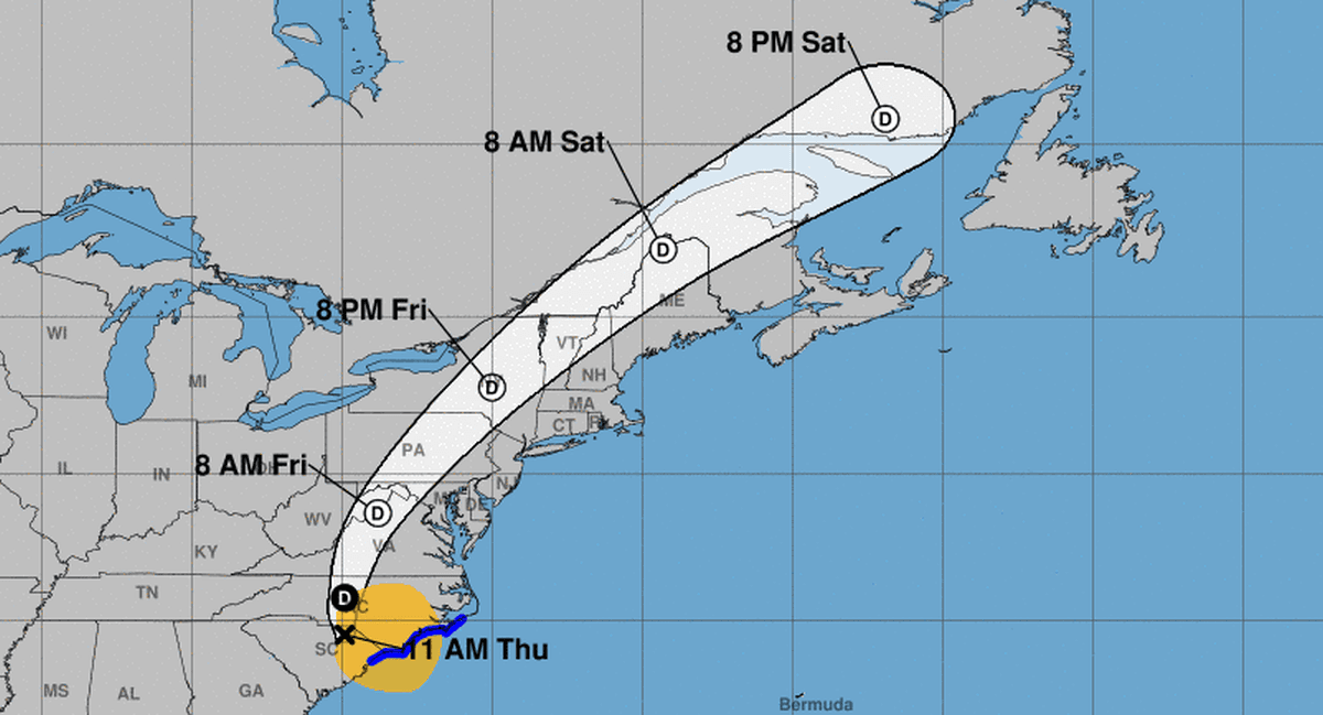
The storm is forecast to weaken as it moves into the Carolinas but will “produce an additional 4 to 8 inches of rainfall with locally higher amounts, across portions of southeastern North Carolina leading to maximum storm total amounts as high as 15 inches,” the agency said.
In Virginia, three to seven inches of rainfall with local amounts of up to 10 inches are expected through Aug. 9, it said. From portions of Maryland into upstate New York and Vermont, between two and four inches of rainfall, with local amounts of up to six inches, are expected through the evening of Aug. 9, according to the NWS.
“Rain, wind, and thunderstorms should come to an end on Saturday when Debby gets swept up into a powerful upper low propagating across southern Canada,” forecasters said.
While Debby produced less rain on Aug. 7 than the previous days, it could pick up again, according to Rich Bann, a meteorologist with the NWS.
“Moisture has pulsed back into Debby,” Bann said, as it spent the last day parked over the Atlantic Ocean. “As Debby makes its way inland ... the threat of heavy rains will lead to flooding concerns.”
More than 141,000 customers were without power in the Carolinas and Virginia on the morning of Aug. 8, according to the tracking site PowerOutage.us. About 17,000 remained without power in Florida, down from a peak of 350,000.
An apparent tornado killed one man when his house collapsed as it tore through eastern North Carolina and damaged at least 10 houses, a church, and a school in Wilson County early on Aug. 8, county officials reported on social media.
The system could spawn tornadoes in the region on Thursday, the National Hurricane Center (NHC) said.
Emergency management officials are keeping a close watch as rainwater drains into the numerous river systems in the Carolinas over the coming days, posing a risk of major flooding long after the storm exits.
The Virginia Department of Emergency Management posted on social media that locals should be alert for potential tornadoes on Thursday and Friday.
As Debby continues to churn its way up the East Coast, the NHC wrote on Aug. 8 that it will be monitoring a developing system near a grouping of islands east of the Caribbean Sea. There is a 30 percent chance that a named storm will be formed in the coming week, it said.
“An area of low pressure could form in the central or western tropical Atlantic Ocean early next week,” the NHC said. “Some development of this system is possible while it approaches the Lesser Antilles during the early to middle part of next week and moves generally west-northwestward toward the Greater Antilles thereafter.”