Federal Agency Reports More Than 400 Earthquakes Near Mount St. Helens

A large number of earthquakes has been reported near Washington’s Mount St. Helens, which erupted in 1980.
Federal Agency Reports More Than 400 Earthquakes Near Mount St. Helens
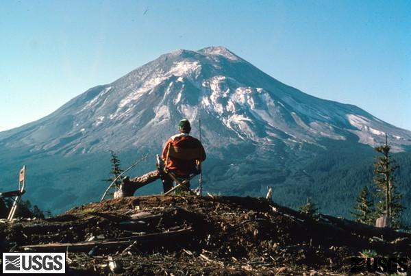
A USGS geologist at Coldwater II observation post watching Mount St. Helens. USGS
Jack Phillips
Updated:
0:00

More than 400 earthquakes have been recorded near Washington state’s Mount St. Helens since mid-July, although officials have said there are no signs of an imminent eruption.

According to the U.S. Geological Survey (USGS), most of the quakes over a three-month span beginning in mid-July were less than magnitude 1.0 and too small to be felt at the surface. Small magnitude earthquakes detected with sensitive equipment signal a volcano is “recharging” as magma flows through chambers and cracks deep underground, Wes Thelen, a volcano seismologist with the USGS’s Cascade Volcano Observatory told The Columbian newspaper this week.
“People think of background seismic activity as being a constant flat line,” he said. “This is an example that dispels that.”

In 1980, 57 people died when Mount St. Helens erupted, an event that permanently altered the area’s ecosystems. Before that event, only one seismometer was stationed at the volcano, the agency has said. Currently, there are at least 20 monitoring stations.

From late August to early September, scientists observed about 40 to 50 earthquakes a week, a number that has fallen to around 30 a week, according to the USGS. Since 2008, the volcano has averaged about 11 earthquakes per month.

The USGS report on the recent activity, published about a week ago, said that the largest quake in the recent period measured at about 2.4 magnitude on the Richter scale, occurring on Aug. 27. But most of the tremors have been much smaller than that, it noted.

“No changes have been detected in ground deformation, volcanic gas or thermal emissions at Mount St. Helens,” the report said. “No changes have been observed at other Cascade Range volcanoes,” it added, referring to the mountain range in which Mount St. Helens resides.

However, according to Mr. Thelen, it’s likely that Mount St. Helens will be the next to erupt in the region. The volcano is still classified as active by the USGS.

“I don’t have a crystal ball, so I can’t say what we’re going to see in the future,” he told the newspaper. “But (Mount St. Helens) is the most likely volcano to erupt next in the Cascades.”

The USGS’s report said that a spike in seismic activity in St. Helens appears to be typical. Before the famed 1980 eruption, a magnitude 5.0 earthquake was recorded at the time.

The most recent eruption took place from 2004 to 2008 and allowed scientists to learn more about how the volcano works and to develop new monitoring tools. In 2016, officials recorded about 120 earthquakes near the volcano, although most were under magnitude 1.0.

“The current seismicity represents the largest short-term increase in earthquake rates since the last eruption ended in 2008,” the federal agency said. “However, longer duration sequences with more events occurred in 1988-1992, 1995-1996 and 1997-1999. None of the sequences in the 1980s and 90s directly led to eruptions.”

The Cascade Range includes about 13 volcanoes between southern British Columbia, Canada, and Northern California. A previous report from the USGS says that Mount St. Helens, Washington states’ Mount Rainier, California’s Mount Shasta, and Oregon’s Mount Hood—all located in the Cascades—are considered the most dangerous volcanoes in the United States.
The Associated Press contributed to this report.
Jack Phillips
Jack Phillips
Breaking News Reporter
Jack Phillips is a breaking news reporter who covers a range of topics, including politics, U.S., and health news. A father of two, Jack grew up in California's Central Valley. Follow him on X: https://twitter.com/jackphillips5
twitter
Related Topics