Arthur, the First Named Storm of the Hurricane Season, Is Likely to Form Today or Tomorrow

Arthur, the First Named Storm of the Hurricane Season, Is Likely to Form Today or Tomorrow
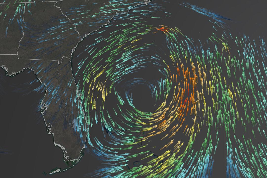
Arthur Formation. (Courtesy of CNN Weather)
Updated:
June 1 is the official start to the Atlantic hurricane season, but a weather system forming now may make this the sixth straight year with a tropical system forming before that date.

“This system is likely to become a tropical or subtropical storm by late Friday or Saturday when it is located near the northwestern Bahamas,” the National Hurricane Center said.
Areas of the Pacific Ocean have also had an interesting start to their tropical season. On April 25, Tropical Depression ONE-E formed south of Mexico’s Baja California region, marking the first tropical depression on record in the month of April for the Eastern Pacific Ocean.

This is quite the contrast to the Western Pacific, which just had its eighth latest start to a tropical season since 1950.

If this system in the Atlantic does get named, it will be Arthur, however, it may classify more as sub-tropical.

“A subtropical storm is a hybrid between a regular area of low pressure, which has a cold core, and pure tropical system which has warm core,” explained CNN meteorologist Dave Hennen.

For a subtropical storm to become a hurricane, it has to become fully tropical by establishing a warm core and then strengthen to hurricane-force winds.

“This potential storm is not likely to become a full hurricane,” CNN meteorologist Chad Myers said. “Still, with ocean temperatures above normal most of the year, the middle of May will likely become the new start of tropical storm season.”

Justin Dossett walks through a flooded street as Hurricane Matthew passes through the area, in St. Augustine, Fla., on Oct. 7, 2016. (Joe Raedle/Getty Images)

Conditions Are Becoming Favorable for Tropical Development

While the system is largely unorganized now, it is expected to move into an area of lower wind shear, which is a much more favorable environment. This will allow the storm to become more organized and strengthen.

Sea surface temperatures continue to remain above average across the Atlantic—except for the cooler North Atlantic.

According to the National Hurricane Center, an Air Force Reserve Hurricane Hunter aircraft is scheduled to investigate this system on Friday to determine how organized the storm is becoming and the strength.

Warm surface temperatures are the fuel needed for hurricane development.

There are over a dozen early forecasts published. And even though the official forecast from the National Oceanic and Atmospheric Administration won’t come until May 21, a strong consensus in the forecasts across the industry indicates the Atlantic is in for an active season.
The-CNN-Wire ™ & © 2020 Cable News Network, Inc., a WarnerMedia Company. All rights reserved.