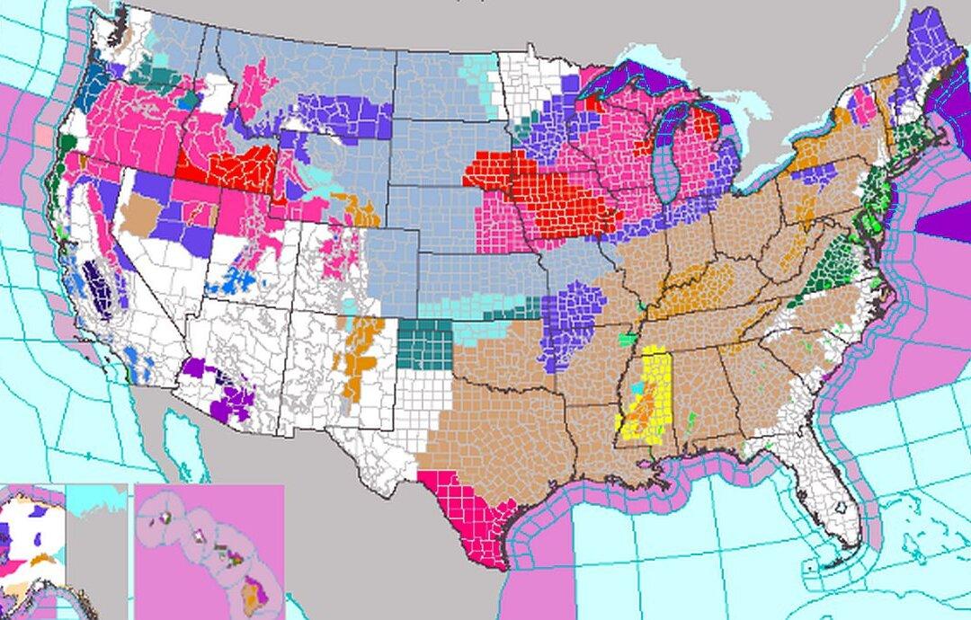
Multiple types of weather alerts were implemented in every U.S. state by the National Weather Service (NWS) on Friday, warning that “powerful winter storms” are slated to hit much of the country.
“A powerful winter storm will bring heavy snow, strong winds, and blizzard conditions from the mid-Missouri Valley, Midwest to the Great Lakes through Saturday,” another NWS alert said. “Behind this system, dangerous frigid temperatures are likely across the Rockies and Plains through this weekend. Severe thunderstorms are possible across the Southeast today, with strong winds, hail, and a few tornadoes possible.”
The agency said that “dangerously cold Arctic air” will then hit the U.S. heartland starting this weekend. Temperatures are expected to remain below zero for the northern Plains region starting Friday morning, while temperatures of minus-20 to minus-30 degrees F or more are slated to hit the Plains states on Saturday morning without factoring in wind chill.
With wind chills, temperatures may go as low as minus-35 to minus-50 degrees for parts of the Plains states, the agency said. It noted that such wind chills could lead to frostbite in a matter of only minutes.
Other than the NWS, several private forecasters such as AccuWeather warned that the upcoming frigid weather will be the “coldest air for the southern Plains” states since late 2022. “In addition to the cold, there is a risk of freezing rain, sleet and even snow in the region,” the forecaster said.
“The coldest air of the winter season thus far, transported directly from northwestern Canada, will surge across the northern Rockies and northern Plains by Saturday,” AccuWeather meteorologist Jon Porter wrote. “That air will then drive all the way south into Texas and other Southern states on Sunday.”
Before that, though, winter storm warnings are now in effect for Great Lakes and Midwest states due to a storm currently trekking across the United States. According to the NWS’s Des Moines office, “storms of this magnitude are fairly rare with recurrence around once or twice per decade.”
By Friday morning, road crews in Iowa and Nebraska were struggling to keep ahead of the fast-falling snow.
The Iowa Department of Transportation’s road conditions map showed that virtually every major highway and interstate was partially or completely covered. The agency said driver visibility was “near zero” in some places, and wind-fueled drifts were quickly erasing the work of plow drivers.
The Iowa State Patrol posted photos of an icy wreck. “Please, don’t put yourself or others in danger,” the agency wrote. “The road conditions are extremely dangerous!” Blizzard warnings were issued in southwestern Minnesota on Friday.
In Kansas City, Missouri, black ice caused dozens of wrecks as freezing rain created any icy sheen over the roads. Temperatures in the mid-teens combined with wind of more than 20 mph created a bitterly cold wind chill of around 9 below zero.
Earlier this week, multiple forecasters noted that the frigid air is due to the return of the Arctic mass of air known as the “polar vortex.”
The jet or Arctic air “will be pushed further south, and guess what that does? It opens up the freezer door,” said Fox Weather Meteorologist Kendall Smith. “All of that cold, arctic air that has been bottled up right over Canada, right over the Arctic, is going to be blasting its way right into the Lower 48.”
Frigid air is expected to inundate much of Texas and Oklahoma, too, starting this weekend and lasting into next week.