A Winter Storm Stretching Across the South Could Bring Dangerous Conditions for Drivers

A Winter Storm Stretching Across the South Could Bring Dangerous Conditions for Drivers
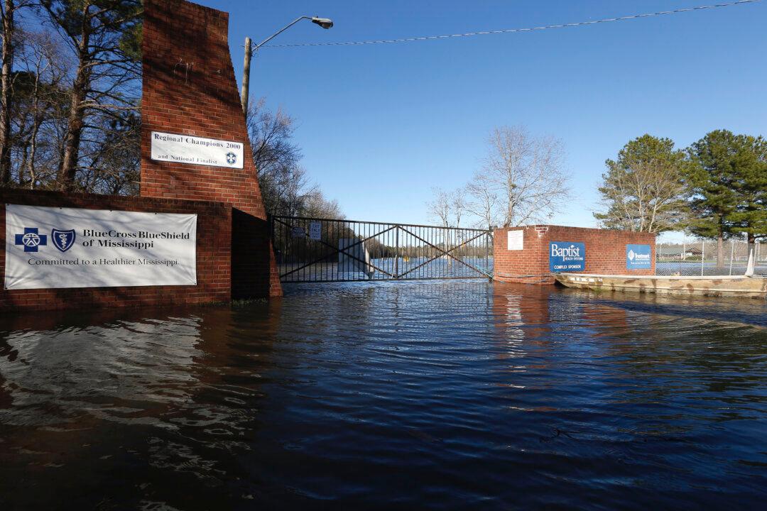
A soccer complex in northeast Jackson, Miss., on Feb. 14, 2020, is underwater from flooding. Rogelio V. Solis/AP Photo
Updated:

Much of the Southeast will see rain or snow as cold temperatures set in on Feb. 20.

A winter storm that stretches from the Smoky Mountains in Tennessee to parts of Georgia and North Carolina has left more than 12 million people under winter weather advisories, watches or warnings.
Snow will cover Georgia and Tennessee mountain tops Thursday morning with some areas in higher elevations forecast to receive up to 6 inches, CNN meteorologist Michael Guy said.

Areas of North Carolina, including Asheville and Charlotte, will also see one to three inches of snowfall, while portions of southern Virginia may see up to four inches.

The restrooms on the Madison County side of the Ross Barnett Reservoir Spillway Park are about the only structure still visible as floodwaters have covered both sides of the popular fishing and boat landing in central Mississippi, on Feb. 14, 2020. (Rogelio V. Solis/AP Photo)
The restrooms on the Madison County side of the Ross Barnett Reservoir Spillway Park are about the only structure still visible as floodwaters have covered both sides of the popular fishing and boat landing in central Mississippi, on Feb. 14, 2020. Rogelio V. Solis/AP Photo

“Temperatures will be 10 to 25 degrees below average over the Upper/Middle Mississippi Valley, Southern Plains, and parts of the Northern/Central Rockies into the Southeast,” the National Weather Service said.

“The snowfall should be over by the early hours of Friday morning,” Guy said.

With it, the storm brings dangerous conditions for drivers, with black ice and accumulating snow likely on the roads.

More Rain for the South

Parts of the South have been getting drenched for days. Areas around Atlanta recorded up to nearly 3 inches of rain Tuesday.

And they’re getting more water Thursday.

Crews work to replace drainage pipes at the Oktibbeha County Lake dam in Starkville, Miss., as heavy rains cause water levels to rise, on Feb. 11, 2020. (Ryan Phillips/The Starkville Daily News via AP)
Crews work to replace drainage pipes at the Oktibbeha County Lake dam in Starkville, Miss., as heavy rains cause water levels to rise, on Feb. 11, 2020. Ryan Phillips/The Starkville Daily News via AP

Up to two more inches of rain could pour over the Lower Mississippi Valley and Southeast Thursday, prompting forecasters to issue a “marginal risk of excessive rainfall” alert in the area, the weather service said.

“The marginal risk means isolated flash flooding is possible,” the weather service said.

More than four million were under a flash flood watch from central Mississippi through central Georgia early Thursday.

And moving east, coastal regions will also see powerful winds with gusts topping at 40 mph, Guy said.
The-CNN-Wire ™ & © 2020 Cable News Network, Inc., a WarnerMedia Company. All rights reserved.