1 Million Without Power as Hurricane Ian Officially Makes Landfall in Florida

1 Million Without Power as Hurricane Ian Officially Makes Landfall in Florida
A satellite image shows the eye of Hurricane Ian approaching the southwest coast of Florida at 2:10 p.m. ET on Sept. 28, 2022. NOAA
Jack Phillips
Updated:
0:00

Over 1 million people in Florida are without power as of Wednesday afternoon due to the impacts of Hurricane Ian, according to a power outage monitoring website.

Across the state, 1.03 million lost power as of 4 p.m. ET, Poweroutage.us says. The majority of outages are located in Lee, Collier, Sarasota, Charlotte, and Manatee counties, it shows. Lee County appears to have seen the worst impacts, with over 60 percent of all customers losing power.
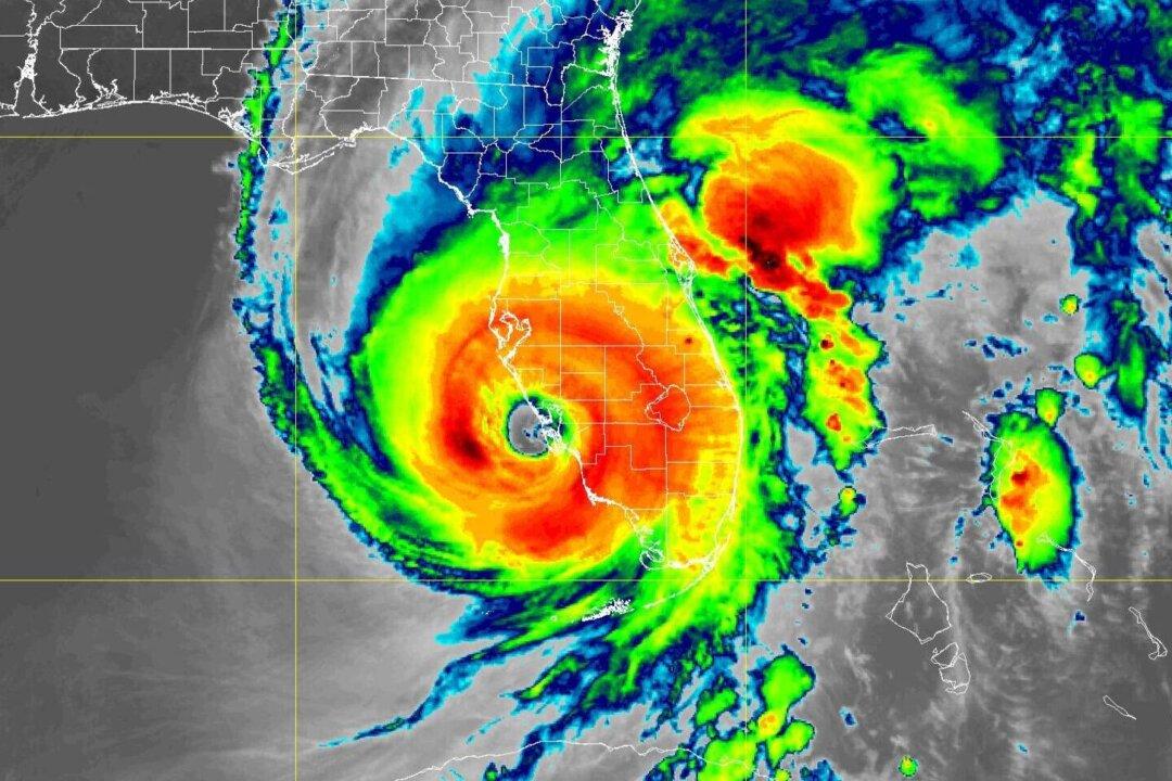
Hurricane Ian has made landfall in western Florida, according to the National Hurricane Center (NHC) in its latest update at 3:10 p.m. ET. As of 4 p.m., the storm has 140 mph winds, said the NHC.

“NOAA Doppler radar imagery indicates that the eye of Ian made landfall along the southwestern coast of Florida near Cayo Costa around” 3:05 p.m. ET, the NHC said. The storm has 150 mph winds, a slight decline from the 155 mph winds at its peak, according to the agency.

“There’s going to be widespread power outages, particularly in southwest Florida,” said at an afternoon news conference. He told people to avoid standing water, fallen trees, and downed power lines.

At around noon, the National Hurricane Center said the storm’s eyewall was moving on shore at Sanibel and Captiva islands.

Off the coast on Sanibel Island near Fort Myers, swirling water flooded streets and was halfway up mailbox posts by mid-morning. Seawater rushed out of Tampa Bay, leaving parts of the muddy bottom exposed, and waves crashed over the end of a wooden pier at Naples.

A Severe Studios camera on Sanibel Island, which has a height of about 9 feet, was completely inundated by storm surge flooding at around 2 p.m. ET. Some video footage showed water near the roof of homes in Fort Meyers.

The center of the massive Category 4 storm lingered offshore for hours, which was likely to mean more rain and damage from a hurricane that was trudging on a track that would have it making landfall north of the heavily populated Fort Myers area. Catastrophic storm surges could push 12 to 18 feet (3.6 to 5.5 meters) of water across more than 250 miles (400 kilometers) of coastline, from Bonita Beach to Englewood, forecasters warned.

During the night, Ian went through a natural cycle when it lost its old eye and formed a new one. The timing was bad for the Florida coast, because the storm got stronger and larger—120 mph (193 kph) to 155 mph (250 kph)—with landfall just a few hours away.

The size of the storm also grew, with tropical storm force winds extending 175 miles (280 kilometers) from the hurricane’s center.

AP contributed to this report.
Jack Phillips
Jack Phillips
Breaking News Reporter
Jack Phillips is a breaking news reporter who covers a range of topics, including politics, U.S., and health news. A father of two, Jack grew up in California's Central Valley. Follow him on X: https://twitter.com/jackphillips5
twitter
Related Topics