Tropical Storm Chantal Weakens to Tropical Depression

Tropical Storm Chantal Weakens to Tropical Depression
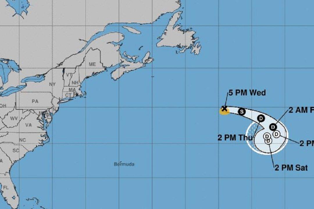
Tropical Storm Chantel's projected path. National Hurricane Center
Zachary Stieber
Updated:

Tropical Storm Chantel was formed in the North Atlantic on Aug. 21 and has weakened to a tropical depression.

“The cyclone should continue to move through a dry mid- to low-level air mass, with humidities less than 40 percent, during the next few days. This is likely to cause weakening, and it is expected that Chantal will become a tropical depression tomorrow and a remnant low by Friday,” the National Weather Service’s National Hurricane Center said in an Aug. 21 statement.
“Given the current appearance of the system, loss of tropical cyclone status and dissipation are now forecast to occur much sooner than earlier anticipated.”

The chance the storm will develop is pegged at near 0 percent in the next 48 hours and around 20 percent through five days, the center said. It is not expected to hit or affect any land.

Chantel is the third named storm of the Atlantic Ocean hurricane season and formed late Aug. 30, about 500 miles southeast of Halifax in Nova Scotia, Canada, NASA said.

A view of Tropical Storm Chantel from a NASA satellite. (NASA)
A view of Tropical Storm Chantel from a NASA satellite. NASA
“Chantal is moving toward the east near 20 mph (31 kph). A turn toward the southeast with a decrease in forward speed is expected by Thursday, Aug. 22. Chantal is forecast to slow further and turn southward on Friday. Maximum sustained winds are near 40 mph (65 kph) with higher gusts. The estimated minimum central pressure is 1009 millibars,” the agency stated.

“NOAA’s National Hurricane Center anticipates gradual weakening, and Chantal is forecast to become a tropical depression in a couple of days.”

At 10:32pm, the National Hurricane Center announced that Chantal has weakened to a depression.

The hurricane season, which runs from July 1 through Nov. 30, has remained quiet so far, with only one storm seriously affecting land: Hurricane Barry, which hit Louisiana on July 13.

Forecasters said on Aug. 20 that things were “still looking quiet across the tropical Atlantic in terms of tropical cyclone formation chances.”

“Widespread sinking motion remains across the basin and is helping to limit things, while wind shear should become more favorable late this week,” the National Weather Center stated.

FEMA Strategic Planner Michael Lowry said that the tropical Atlantic was “plagued by sinking air over the past month, which has inhibited storm development. Though still early, tropical activity is running ~30% of normal (to date) across the Atlantic.”

“Overall stability across the tropical Atlantic appears to be our greatest asset so far, but late Aug-Sep-Oct climo can negate that in a hurry,” he added on Twitter.

The National Oceanic and Atmospheric Administration said on May 23 that it predicted a “near-normal” hurricane season this year in the Atlantic.

It said there would be 9 to 15 named storms with winds 39 miles per hour or higher. Of those, 4 to 8 could become hurricanes (winds of 74 mph or higher), including 2 to 4 major hurricanes (category 3, 4 or 5; with winds of 111 mph or higher).

An average hurricane season produces 12 named storms, 6of which become hurricanes, including 3 major hurricanes.

“With the 2019 hurricane season upon us, NOAA is leveraging cutting-edge tools to help secure Americans against the threat posed by hurricanes and tropical cyclones across both the Atlantic and Pacific,” said Secretary of Commerce Wilbur Ross said in a statement. “Throughout hurricane season, dedicated NOAA staff will remain on alert for any danger to American lives and communities.”

The next names after Chantel are Dorian, Erin, Fernand, Gabrielle, and Humberto.

Zachary Stieber
Zachary Stieber
Senior Reporter
Zachary Stieber is a senior reporter for The Epoch Times based in Maryland. He covers U.S. and world news. Contact Zachary at [email protected]
twitter
truth
Related Topics