49th Parallel: The Years of War and Political Haggling It Took to Define the Canada-US Border

49th Parallel: The Years of War and Political Haggling It Took to Define the Canada-US Border
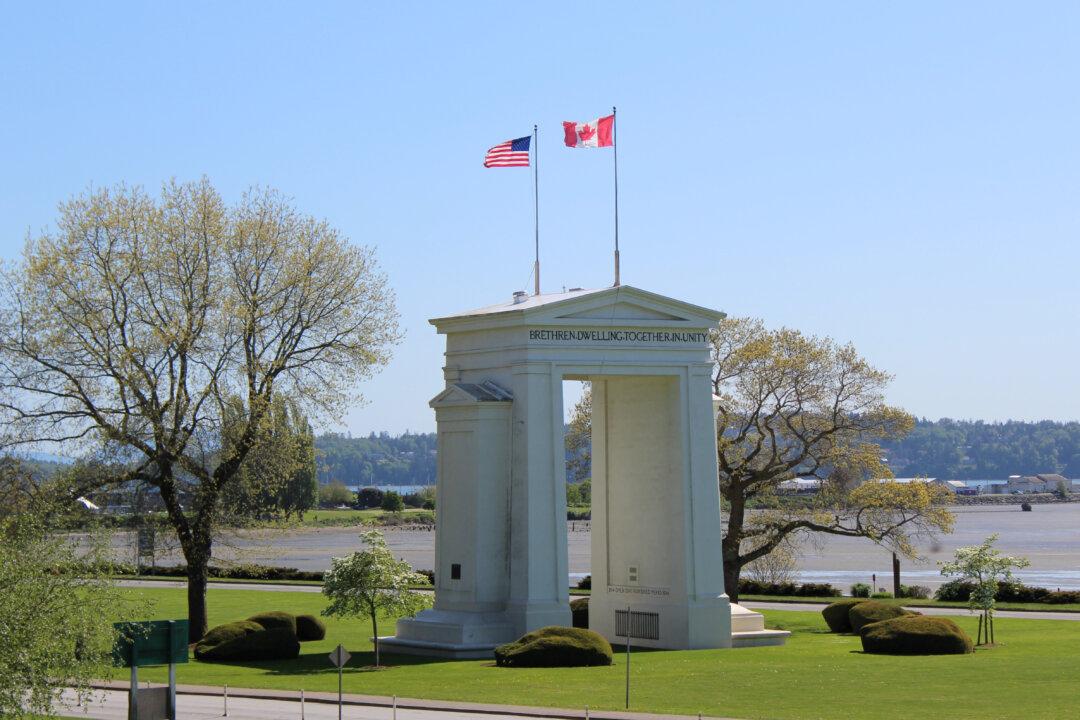
The Peace Arch marks the westernmost point of the Canada-U.S. border between the communities of Surrey, British Columbia, and Blaine, Washington. Aprilflower/Shutterstock
Gerry Bowler
Updated:
0:00
Commentary
The cooperation and friendliness that nowadays marks the “Special Relationship” between the United States and Great Britain was a long time in the making. It must be remembered that the USA had to fight a bloody war from 1775 to 1783 to secure the independence of the original 13 rebel British colonies, and that from 1812 to 1814 the two nations were at war again. In both cases, American armies invaded what is now Canada, hoping to carve yet more territory from the United Kingdom’s North American holdings.
The war for independence concluded with the Treaty of Paris, an article of which had set the border between British North America and the United States as a line stretching west from Lake of the Woods to the Mississippi River. This decision was taken in a fit of geographical ignorance because the Mississippi does not extend that far north, so uncertainty about the exact boundary remained until an 1818 agreement entitled “Convention respecting fisheries, boundary, and the restoration of slaves.”
This new treaty gave the United States certain fishing rights off the coast of Newfoundland, deferred talks on compensation to Americans for slaves who had fled to freedom in Canada or other British holdings, and fixed the border along the 49th parallel to the Rocky Mountains. This new line necessitated a transfer of territory, as old boundaries had been based on river systems. Britain surrendered land south of the 49th that had hitherto belonged to the Red River Colony and Rupert’s Land (these are now parts of North and South Dakota and Minnesota), while the USA ceded territory north of the 49th that it had claimed as part of the 1803 Louisiana Purchase from the French (now parts of Saskatchewan and Alberta).

This treaty helped to soothe tensions between Britain and the U.S., but it would be many years before America ceased to look northward and westward for land that belonged to someone else. Still to be determined was the control of the vast territories where migration from the United States brought would-be settlers and traders into conflict with the native tribes, the Spanish and Mexican governments, and the Hudson’s Bay Company.

The 1818 Convention had allowed both the United States and Britain to mutually exploit what was then the “Oregon Country” for a period of 10 years. This was an area which the Hudson’s Bay Company had penetrated and called the “Columbia Department”; HBC had spent years building a series of forts and trading posts in what is now Washington, Oregon, and Idaho. Based at Fort Vancouver, the HBC administered 34 interior outposts and 24 ports along the coast. The last thing the company wanted was a flood of settlers disrupting their trade.
However, waves of migrants from the east kept coming, bringing with them American ideas of self-government and making noises about this new territory joining the United States. Hard-liners in the U.S. called for a forcible annexation of land northward to the borders of Russian-colonized North America (what we now call Alaska.) “Fifty-four Forty or Fight!” was the battle cry of supporters of American President James K. Polk, who wanted to consume British territory up to latitude 54 degrees and 40 minutes north. Particularly valuable to the U.S. would be a deep-water port on the northwest coast.
Painting of U.S. President John Polk circa 1846. (Public Domain)
Painting of U.S. President John Polk circa 1846. Public Domain
This was the era of “Manifest Destiny,” the belief that the USA had been ordained by God as a nation with a special mission, one that involved expansion across the continent to the Pacific.
In his 1841 inaugural address, President John Tyler, who preceded Polk, laid out his claims to Oregon and in that same year, the slave-owning Republic of Texas was annexed as the newest American state. In 1846, the Mexican-American War broke out, resulting in another massive seizure of land by the U.S.—areas that are now California, Nevada, Utah, and New Mexico became part of the United States. The British government saw that war over rival claims in the northwest was a real possibility, so they began a negotiated settlement of the ownership of the lands west of the Rockies.
The Oregon Treaty of 1846 set the border along the 49th parallel to the coast with an offshore dip southward to allow the British to retain all of Vancouver Island as a colony, with the Hudson’s Bay Company charged with bringing in settlers. This colony would be joined to the mainland Colony of British Columbia in 1866, and when this entity joined the Confederation in 1871, the 49th parallel was recognized as the boundary between Canada and the United States.
Views expressed in this article are opinions of the author and do not necessarily reflect the views of The Epoch Times.
Gerry Bowler
Gerry Bowler
Author
Gerry Bowler is a Canadian historian and a senior fellow of the Frontier Centre for Public Policy.