100 Million People at Risk From Severe Storms

100 Million People at Risk From Severe Storms
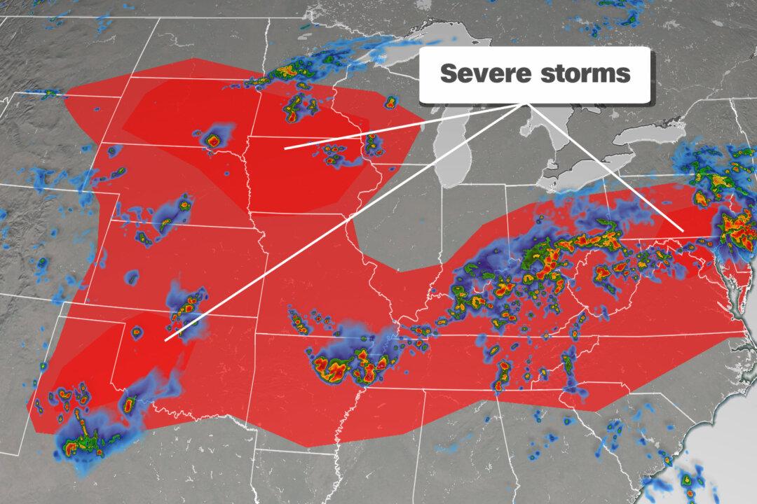
Severe storms are forecast on June 4, 2020. Courtesy of CNN Weather
Updated:

As above-average temperatures bake the nation’s midsection, another round of severe weather is forecast on June 4, potentially impacting cities where recent protests have unfolded.

Another round of severe storms will move through Thursday, with over 100 million people potentially impacted this afternoon and evening.
It comes as “over 325,000 remain without power [Thursday] morning,” mainly in Pennsylvania and New Jersey, following storms a day earlier, CNN meteorologist Dave Hennen said. Over 220 reports of damaging winds Wednesday were made from Wyoming to New Jersey.

Severe weather chances Thursday stretch across the eastern two-thirds of the country, with the highest likelihood of damaging winds and hail spreading across South Dakota, northeastern Nebraska, southern Minnesota, and Iowa.

This area is also the most likely to see tornadoes, although the threat for wind and hail is greater. Once again, this places Minneapolis, the epicenter of protests over the death in police custody of George Floyd, on the fringe of a level 2 of 5—slight risk—for strong thunderstorms.

Afternoon storms may also fire up across the Mid-Atlantic with a slight risk—also level 2 of 5—centered over populous Washington, Philadelphia, and Baltimore.

This area is most at risk for damaging wind gusts and storms rolling through the region.

A slight risk is also forecast between Oklahoma City and Amarillo, Texas, where large hail and damaging winds will be the main threats.

The threat of severe weather diminishes Friday but returns Saturday and Sunday to the Northern Plains.
The-CNN-Wire ™ & © 2020 Cable News Network, Inc., a WarnerMedia Company. All rights reserved.