Hurricane Ian formed in the Caribbean Sea on Monday morning as federal forecasters predicted the storm will strengthen before ultimately slamming into western Florida.
With 75 mph winds, the Category 1 storm is currently 90 miles west of the Cayman Islands and some 275 miles southeast of western Cuba, according to an 8 a.m. Monday update provided by the National Hurricane Center (NHC). Hurricane warnings were in effect for the Cuban provinces of Isla de Juventud, Pinar del Rio, and Artemisa as well as Grand Cayman island.
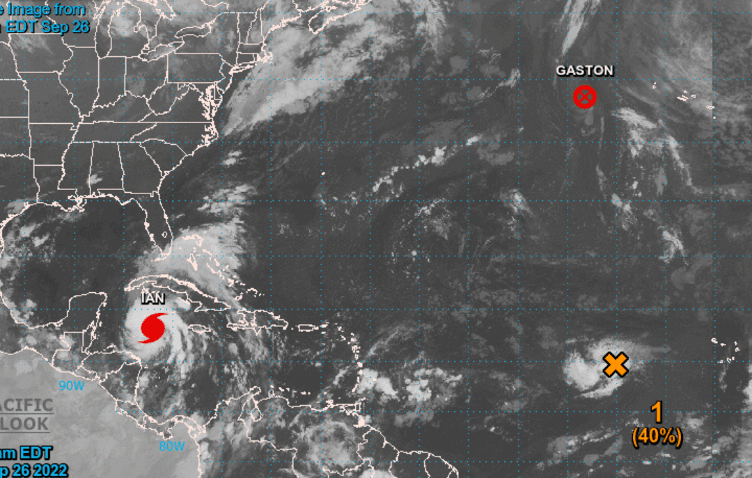
Officials said the system is expected to become a major hurricane—a storm system that is Category 3 or greater—by Monday evening. A Category 3 hurricane has 111 to 129 mph winds
Florida Gov. Ron DeSantis declared a state of emergency for every county in the state this past weekend, while President Joe Biden approved an emergency declaration that will free up federal resources to deal with the storm system. The president postponed a scheduled Sept. 27 trip to Florida because of the storm.
On Sunday, DeSantis urged residents to get food, water, medicine, fuel, and batteries due to possible power outages and widespread damage. Evacuations will likely be ordered in the coming days, the governor said, adding that it’s still not clear when Ian will strike the state.
Flash flooding is possible in the Florida Keys and Florida peninsula through midweek, and then heavy rainfall was possible for north Florida, the Florida panhandle, and the southeast United States later this week, officials said.