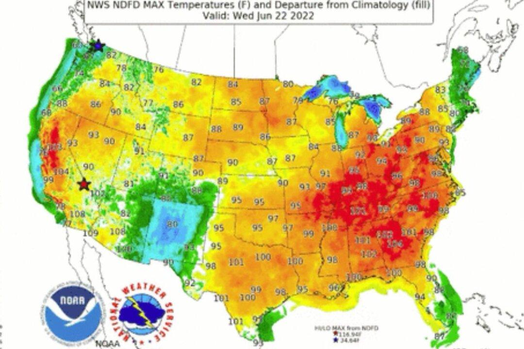
Weather forecasters said that a “dangerous” heat wave will shift eastward across the United States, with triple-digit temperatures expected for the Southeast U.S.
“Dangerous heat will continue to make headlines from the central U.S. to the Southeast,” said the National Weather Service in a Monday update. “One more day of well above normal, near-record, and record-breaking heat is expected from the central Plains to the Upper Midwest.”
As a result, it added, “excessive heat warnings” will stay in effect at Red River Valley and the greater Minneapolis area.
“The center of the heat wave begins to transition further east on Tuesday into the Great Lakes, with forecast highs in the mid- to upper 90s, up to 15-20 degrees above normal. In addition to hot high temperatures, very warm, near-record and record-breaking low temperatures in the 70s will provide little relief from the heat overnight,” said the agency.
“Temperatures will also warm up across the Southeast on Wednesday, with highs into the low 100s expected. Maximum heat indices may reach as high as 110 degrees along the central Gulf Coast when factoring in high humidity. High temperatures in general will be hot and a bit above normal across most of the central and eastern U.S. outside of the Northeast and Mid-Atlantic.”
But in the West, the Northeast, and Mid-Atlantic states, “well below average temperatures” are expected.
“Highs in the 70s will be common for the Interior Northeast and Mid-Atlantic on Monday and will remain in the low 70s through at least Wednesday for New England,” said the National Weather Service.
Above-average temperatures will likely increase the air-conditioning demand for consumers and businesses, which might strain power grids and trigger elevated electricity costs for millions of Americans.
“‘Extreme’ doesn’t mean ‘rare,’” John Moura, the head of reliability assessment and performance analysis at NERC, told reporters last month. “We know these conditions are not rare,” he added.