Homes Burned by California Fire; Teams Look for More Damage

Homes Burned by California Fire; Teams Look for More Damage
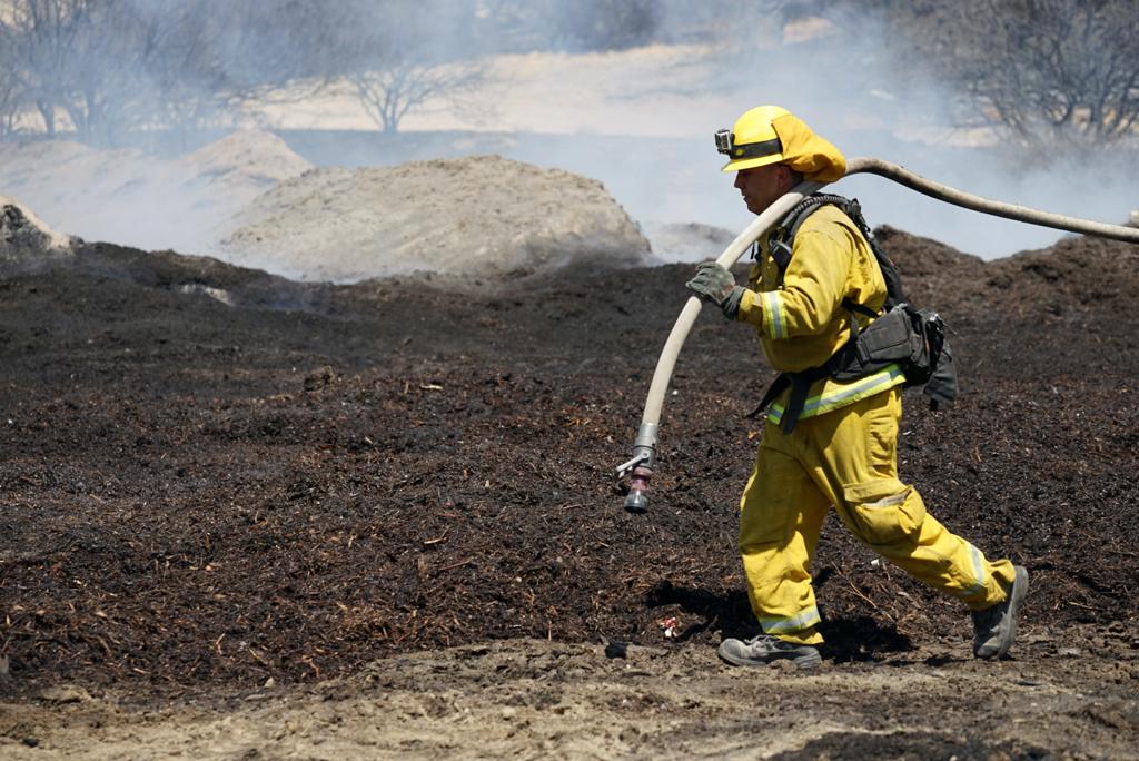
Firefighters water down scorched compost material at a property burned near Phelan, Calif., on Aug. 19, 2016. AP Photo/Christine Armario
The Associated Press
Updated:

PHELAN, Calif.—In the aftermath of a wildfire, somebody has to figure out exactly what burned. It’s painstaking and important work that helps evacuated residents know if they lost everything or have something waiting for them when they return home.

Officials estimate that at least 105 residences and 213 outbuildings have been destroyed in the massive fire that burned ferociously through Southern California mountain communities this week and was still smoldering Saturday.

Those numbers could rise as damage assessment teams pore through the aftermath of the blaze about 60 miles east of downtown Los Angeles, Fire Marshal Mike Horton of the San Bernardino County Fire Department said. Drought conditions in California have left plenty of fuel for wildfires.

The fire sparked Tuesday was 68 percent contained and firefighters who were on the offensive for days were finally transitioning to mop-up phase, officials said.

Operating from a mobile command center just south of the 58-square-mile blaze, Horton leads a team of 15 investigators, technicians, hazardous materials experts and others responsible for determining the extent and nature of the damages.

“We come in right on the heels of the fire,” Horton said. “Once it’s cool enough, we go parcel-by-parcel.”

Scorched cars and trailers burned by the Blue Cut fire line a residential street in Phelan, Calif., on Aug. 19, 2016. (AP Photo/Noah Berger)
Scorched cars and trailers burned by the Blue Cut fire line a residential street in Phelan, Calif., on Aug. 19, 2016. AP Photo/Noah Berger

Often properties are so decimated that it’s difficult to know if a smoking ash heap was a home, a trailer or a water tank, he said. Technicians consult mobile computer applications that can download geographic data and county assessors’ information to learn what might have been there before flames swept through. Numerous photos are taken and each “gets its own narrative” of what the team saw, Horton said.

Some evacuations remained in place but the majority of those ordered out were allowed to return Friday, when crews made huge gains against the blaze, fire spokesman Brad Pitassi said.

“Things are extremely positive,” said Pitassi, adding that officials expect more progress and more residents returning home throughout the weekend. At the height of the fire, some 82,000 people were under evacuation orders.

Even before they go back, anxious residents can sometimes get a sense of what awaits them thanks to reports filed swiftly by the damage assessment team. The goal is to compile the data even before the fire is fully extinguished and make them available online, via phone recordings and on postings at evacuation centers.

Maps are color-coded with red areas signifying “complete damage,” orange describing damage between 40 and 75 percent, yellow showing damage of less than 40 percent and green meaning no damage.

“Green, you’re in good shape,” Horton said Friday. “Any other color and you should be concerned.”

Johanna Santore was among those left homeless. She was running an errand Tuesday when the fire charged through her neighborhood. She tried to rush home to rescue the family’s four dogs, six cats and hamster but was blocked by closed roads.

A group of animal rescue volunteers found the house in smoldering ruins — with no signs of the pets.

“I’m actually feeling numb,” said Santore, who fled with her husband and granddaughter to an evacuation center. “It’s like a nightmare.”

A prolonged drought has transformed swaths of California into tinderboxes, ready to ignite. Several other wildfires were burning in the state, including a blaze in rural Santa Barbara County that prompted the evacuation of a pair of campgrounds.

In the southern Sierra Nevada, another blaze feeding on dense timber in Sequoia National Forest forced the evacuation of several tiny hamlets.

Another blaze burned in Santa Barbara County and forced the evacuation of a pair of campgrounds during the height of the summer season.

In mountains north of San Francisco, a 6-square-mile blaze was 80 percent contained after destroying 300 structures, including 189 homes and eight businesses, in the working-class community of Lower Lake. All evacuation orders have been canceled.

No deaths have been reported in the fire east of Los Angeles and the cause of the fire was under investigation. Crews continued to sift through burned regions to tally the damage.

The information collected by damage assessment teams is useful for the fire’s incident command, local offices of emergency services, the Federal Emergency Management Agency and insurance companies. But Horton knows it’s most important to evacuated residents, which is why his main goal is accuracy.

“We have to be so exact. We don’t release anything until it’s triple checked,” he said. “The last thing we want is people thinking, ‘oh my house is fine’ when it’s not.”