Central US Hit With Tornadoes and Winds up to 100 MPH, Bringing Severe Thunderstorms, Wildfires

Central US Hit With Tornadoes and Winds up to 100 MPH, Bringing Severe Thunderstorms, Wildfires
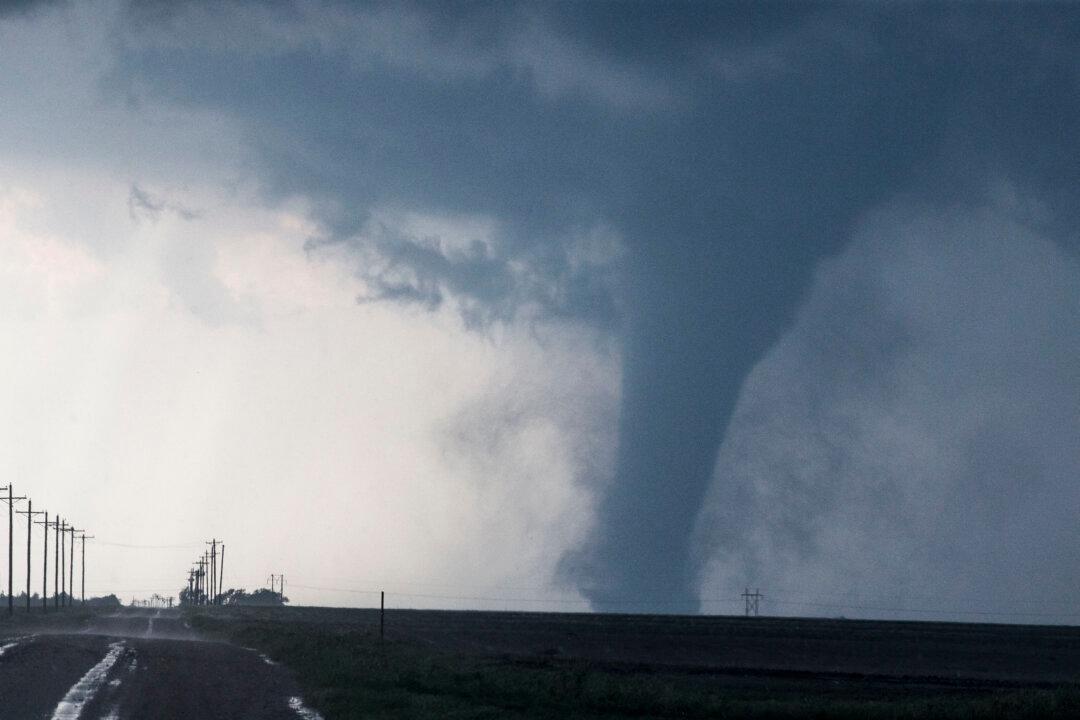
A tornado is seen south of Dodge City, Kansas, moving north on May 24, 2016. Brian Davidson/Getty Images
Katabella Roberts
Updated:

Tornadoes and winds of up to 100 mph hit the central United States on Wednesday, bringing with them record heat levels, wildfires, and dangerous dust storms.

The National Weather Service (NWS) Storm Prediction Center said Wednesday that a new record had been set for the most number of hurricane-force (75+ mph) thunderstorm wind gusts in a day since 2004, at 55 and counting, surpassing the Aug. 10, 2020 record of 53.
NWS has so far received reports of 20 tornadoes all in Iowa and Nebraska. No casualties have so far been reported.

The severe winds and dangerous weather left more than 77,791 homes and businesses without electricity across the state of Iowa and about 65,079 in Kansas as of about 10:37 a.m. CST, according to poweroutage.us. Meanwhile, Wisconsin saw about 106,394 homes and businesses without electricity.

Earlier power outages in other states including Texas and New Mexico had been mostly resolved by late Wednesday.

Severe winds reached 100 mph at the Russell Municipal Airport, the National Weather Service in Wichita reported.

Staff at the main air traffic control tower in Kansas City International Airport were forced to temporarily evacuate at about 5:50 p.m. CST.

“KCI Airport is at ‘Air Traffic Control (ATC) Zero,’” the airport said on Twitter. “For their safety FAA staff in the tower cab evacuated. This means there is no Air Traffic Control for flights at the airport. There will likely be diversions and delays. Anticipate 1 hour.”

The airport later said in an update that “the worst of the storm has passed by” and staff had returned to the tower cab while flights would resume after a visual sweep on the runways.

Elsewhere, high winds and tornadoes saw roofs ripped off buildings, while a two-story building in Norton, Kansas, partially collapsed.

Trees were also knocked down and the Colorado Springs Fire Department said it had received 635 calls for service over the course of five hours. Incidents ranged from fires in homes to grass fires and downed power lines, while the roof of their own headquarters had also suffered damage.

The NWS said in its Dec. 15 bulletin that the extremely powerful storm system was set to produce a “plethora of weather hazards across the Great Plains and Upper Midwest tonight, including severe thunderstorms, damaging winds, dangerous fire weather conditions, and moderate snowfall.”

Heavy snow was forecast over the Sierra Nevada through Thursday morning, while heavy rains and flash flooding were possible throughout parts of the Southern Plains, Middle/Lower Mississippi, and Ohio valleys on Thursday and Friday.

From Wednesday night into Thursday, “a strong, potentially record-breaking, low-pressure system is racing across the Upper Midwest and will eventually reach southern Canada on Thursday,” officials said.

“This robust storm system will create an extremely tight pressure gradient just to the south of the center and along an attached cold front. Thus, dangerously high winds are expected to impact much of the Central and Northern Plains this evening, as well as the Midwest and Upper Great Lakes overnight. Widespread wind gusts over 60 mph are forecast and could locally exceed 70 mph.”

Dangerous dust storms and power outages were likely to be found throughout the region, NWS said.

From the northern Texas Panhandle to north-central Kansas, extremely critical fire weather is occurring, and the high winds combined with the low relative humidity means wildfires are likely to spread rapidly.

The storm also set all-time high temperatures for the month of December, with readings up to 72 all the way to the Iowa–Minnesota border.

As of Thursday afternoon, a line of potentially severe thunderstorms is likely to develop, hitting Iowa and southern Minnesota, and could produce winds of up to 100 mph, as well as a strong tornado or two.

Meanwhile, portions of the Dakotas and northern/central Minnesota were likely to see snowfall of up to six inches, while winds blowing snow are set to create hazardous driving conditions.

By Thursday, light snow was “expected to continue across the Upper Midwest and Upper Great Lakes into the late afternoon as gusty winds slowly diminished,” according to NWS.

The latest severe weather comes less than a week after a string of more than 30 tornadoes tore through Kentucky and seven other states, killing at least 88 people, including 74 in Kentucky, and leaving thousands more without a home or power.
Katabella Roberts
Katabella Roberts
Author
Katabella Roberts is a news writer for The Epoch Times, focusing primarily on the United States, world, and business news.
Related Topics