CAL FIRE Employs Artificial Intelligence for Firefighting

CAL FIRE Employs Artificial Intelligence for Firefighting
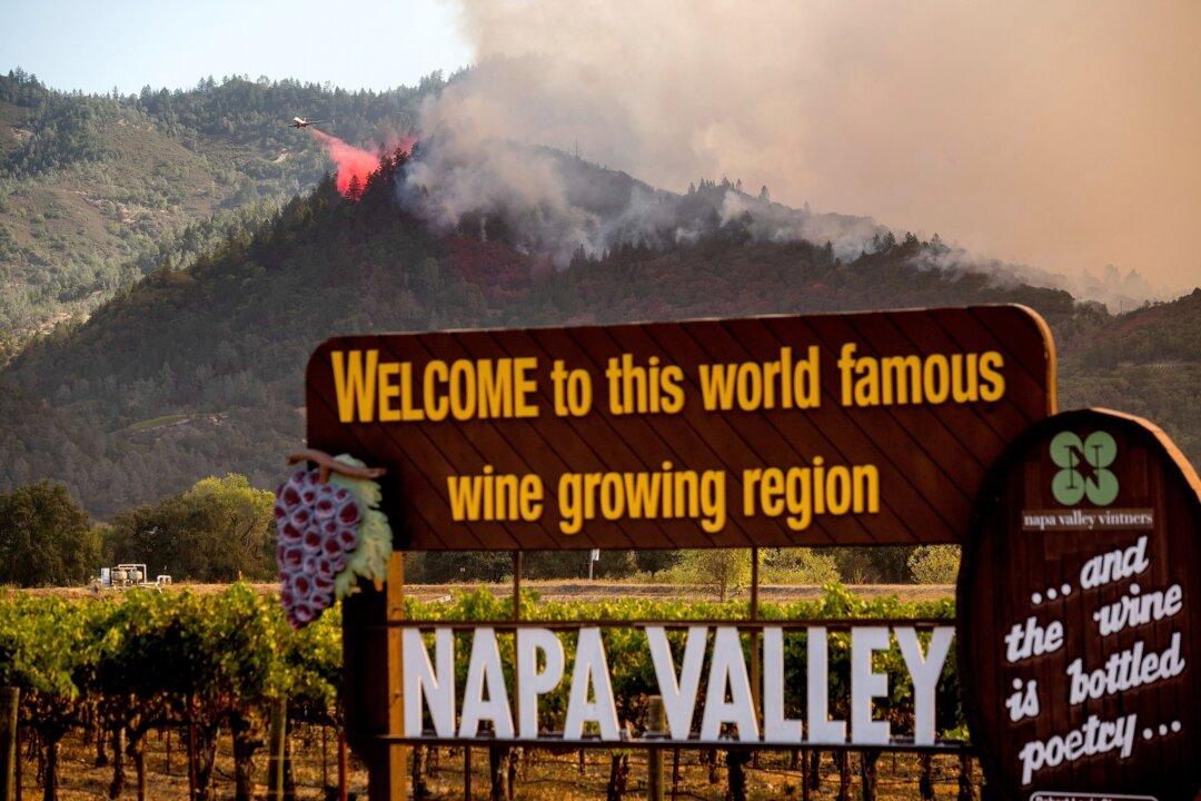
An air tanker drops retardant on the Glass Fire burning in Calistoga, Calif., on Sept. 27, 2020. Noah Berger/AP Photo
Keegan Billings
Updated:
0:00

With California moving into peak fire season, the California Department of Forestry and Fire Protection (CAL FIRE) has partnered with the University of California San Diego’s ALERTCalifornia program to use artificial intelligence for early detection of wildfires.

CAL FIRE stated in a news release on July 10 that its goal in the collaboration is to improve overall firefighting capabilities and to quicken the response time from the firefighters on the ground.
CAL FIRE is collaborating with ALERTCalifornia to launch its brand-new wireless camera network consisting of 1,032 high-definition pan-tilt-zoom cameras. The cameras as well as sensor arrays have been installed throughout California in strategic locations. They have created a 24-hour surveillance system with near infrared night vision.

The cameras will provide a 360-degree view with up to 60 miles detection on a clear day and up to 120 miles on a clear night.

The ALERTCalifornia website displays the high-resolution live camera feeds and more detailed network information.

In conjunction with the extensive camera system, ALERTCalifornia has created custom command centers and trained first responders at the local, regional, state, and federal government levels to monitor the camera feed.

The key to ALERTCalifornia’s upgraded AI tool is the capability to identify abnormalities in the camera feed. With large amounts of data being fed into the camera system, a machine-learned model has been created to tell the difference between smoke and other particles in the air.

Once the abnormalities are detected, the system will immediately alert the first responders on duty at the Emergency Command Centers.

“This is truly going to be a robust system that, right now, is just turning the corner into this AI technology to sense when an anomaly happens and let our command centers know—so a human being, a trained fire captain, or a trained communications operator can make that decision and send those resources,” said CAL FIRE Napa-Lake-Sonoma Unit Chief Mike Marcucci to FOX KTVU News.

A new helicopter leased by the Orange County Fire Authority to combat wildfires in Southern California demonstrates its capabilities in Los Alamitos, Calif., on Sept. 30, 2020. (John Fredricks/The Epoch Times)
A new helicopter leased by the Orange County Fire Authority to combat wildfires in Southern California demonstrates its capabilities in Los Alamitos, Calif., on Sept. 30, 2020. John Fredricks/The Epoch Times

The ALERTCalifornia team also made improvements by creating small platforms for the cameras and sensors that can be temporarily set up and broken down for the season. They will be used to monitor high-risk areas with very little impact to the surrounding habitat.

The program is now in a trial period and being utilized in the San Bernardino Unit, Sonoma-Lake-Napa Unit, Madera-Mariposa-Merced Unit, Nevada-Yuba-Placer Unit, Shasta-Trinity Unit, and San Luis Obispo Unit.

“From the Oregon border to the Mexican border and everywhere in between, cameras are being added as we speak,” Chief Marcucci told FOX KTVU News.

CAL FIRE has spent roughly $24 million on the ALERTCalifornia program so far.

Revolutionizing Firefighting

California has largely relied on citizens calling 911 to report wildfires in the past. Now, by utilizing AI, ALERTCalifornia is seizing the opportunity to revolutionize California’s firefighting capabilities by quickening response times.

Also, by analyzing large swathes of data with ALERTCalifornia’s new AI tool, they hope to advance fire prediction and provide real-time insight to the firefighters who are onsite fighting a fire.

The new system will be utilized not only for wildfires but for other natural disasters such as floods, atmospheric rivers, and landslides.

The program is also employing scientists to embark on an extensive data collection and processing program to gain a better understanding of natural disasters’ long-term impacts on air, water, and soil quality as well as the health of Californians.

“Data acquired in the highest fire-threat regions will significantly empower firefighters, first responders, legislators, city planners and scientists for years to come,” Neal Driscoll, director of ALERTCalifornia and geoscientist at UC San Diego’s Scripps Institution of Oceanography, stated in a news release from ALERTCalifornia.