More Rain to Soak Southern California Through Mid-Week

More Rain to Soak Southern California Through Mid-Week
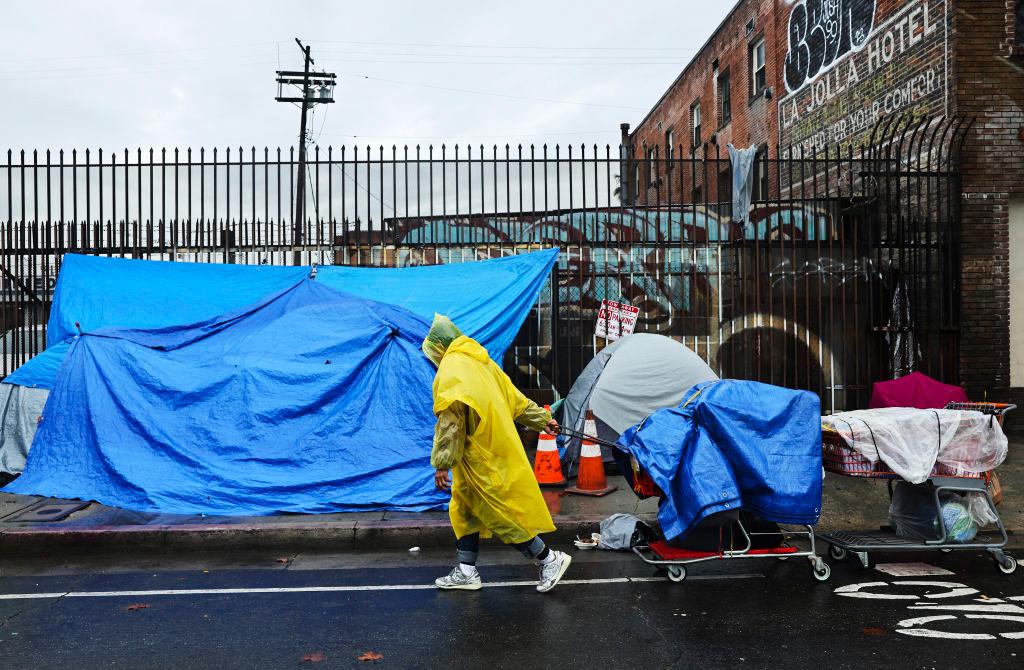
A person walks with carts in the rain near an encampment of unhoused people in Skid Row as a powerful long-duration atmospheric river storm, the second in less than a week, continues to impact Southern California in Los Angeles on Feb. 6, 2024. Mario Tama/Getty Images
City News Service
Updated:

LOS ANGELES—Another substantial storm is due in Southern California Feb. 18, bringing periods of heavy rain, snow and a slight chance of thunderstorms through Wednesday.

Although this system isn’t expected to pack the same punch as the area’s recent record-setting downpours, flood fears are still heightened due to the region’s soaked terrain, prompting Los Angeles city officials to put comprehensive measures in place to manage the effects of the winter storm.
“Over the past week, the City has worked to repair more than 4,000 potholes, reinforce hills that are at risk of mudslides and prevent power outages by making repairs to underground equipment and vaults that had flooded during the previous storm,” Mayor Karen Bass said Sunday on X.

The rain was expected to start falling in earnest Sunday evening, according to the National Weather Service (NWS). Forecasters said totals of 2 to 5 inches were expected across the coasts and valleys, and 4 to 8 inches across south and southwest-facing mountain slopes and foothills. Peak rainfall rates of 0.5 to 1 inch per hour are likely.

A flood watch will be in effect in most of Los Angeles County from early Monday through Wednesday morning, and from Monday evening through Wednesday morning in Orange County.

“Rapid rises in small streams and urban roadway flooding is likely during periods of heavier rainfall. Debris flows, mudslides, landslides, and swift water rescues could happen just about anywhere within the flood watch area,” the NWS said. “While LA County could see lower rainfall totals with this storm as compared to Ventura County northward, the current projected rainfall totals and rainfall rates will likely bring additional flooding/mudslide activity to LA County during the next few days as their risk level remains elevated due to the heavy rains from last week.”

LA County Public Works officials issued a “phase 2 debris flow forecast” Sunday for the Land Fire burn area east of Sun Valley. The alert was in effect from 9 a.m. Monday to 9 a.m. Wednesday, according to the Los Angeles Fire Department (LAFD), which said moderate flooding and mudflow/sediment deposition should be anticipated in the area of McDonald Creek, Del Arroyo Drive and La Tuna Canyon Road.

“If conditions worsen, evacuation orders may be issued and evacuation sites will be identified,” the LAFD said. “Take action now to be ready to quickly evacuate if you live on the streets along La Tuna Canyon Road with the borders of Horse Haven Street to the north, Martindale Avenue to the east, Penrose Street to the south, and Ledge Avenue to the west.”

Farther south, a portion of Benedict Canyon Road was restricted to local access only due to a collapsing roadway. The “soft closure” was in effect from Mulholland Drive to Hutton Drive, with Deep Canyon Drive suggested as an alternate route.

Also, a portion of Mulholland Drive remained closed to through traffic between Skyline Drive and Bowmont Drive due to severe road damage at four locations. That closure was expected to last weeks, officials said.

The storm is also expected to produce high surf and gusty winds in the mountains and foothills. Snow levels during the peak of the storm will be about 8,000 feet, lowering to around 7,000 feet Monday or Tuesday, with 5 to 10 inches possible between 6,500 and 8,000 feet.

A high surf advisory was issued for Sunday through Tuesday at all west and southwest facing beaches, with waves up to 10-15 feet expected.

“A very strong 170 mph jet streak and modest lapse rates will support a slight chance of thunderstorms building into the region around the same time frame,” the NWS said. “Any thunderstorms or convective showers may support dangerous cloud-to-ground lightning, gusty and damaging winds, and a brief water spout or tornado.”

Dry weather with warming temperatures is expected to return Thursday and Friday, before another possible bout of light rain next weekend.

City News Service
City News Service
Author
Breaking news gathering service based in West Sacramento, California, USA Gathering and distributing breaking news content via video, photographic and audio
twitter
Related Topics