")
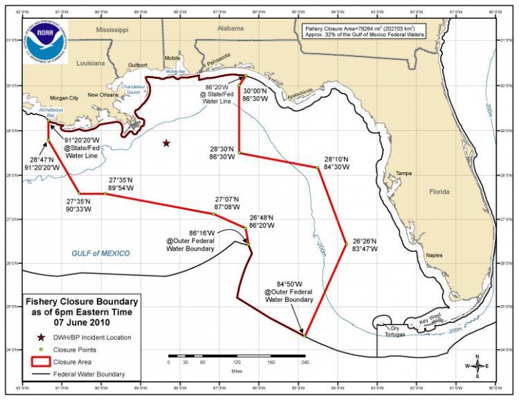
The consequences of the Gulf oil spill along the coast Florida are ongoing. As of 6 p.m. on June 7, 78,264 square miles, or 32.7 percent of the Gulf of Mexico federal waters were closed by the National Oceanic and Atmospheric Administration (NOAA).
The area of closure is 0.3 percent larger than two days ago. However, According to data from NOAA´s website, this figure represents a decrease of 4 percent from the spill coverage five days ago.
Closure updates are announced daily at 12 p.m. EDT at Sero.nmfs.noaa.gov, and can also be obtained by calling +1-800-627-NOAA. The Deepwater Horizon Unified Command (DHUC) also provides message service via e-mail and SMS to make sure that updated information of the closure will reach those concerned. Subscriptions to the text message alerts can be made on the DHUC´s official website.