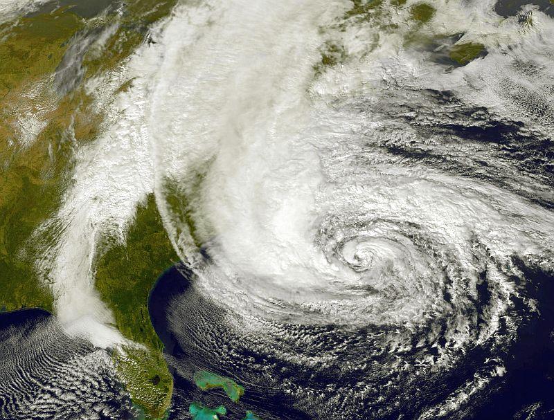
Climate change could cause a hurricane similar to Sandy to hit Western Europe by the end of this century, Dutch researchers say.
In a simulation, Reindert Haarsma of the Royal Netherlands Meteorological Institute used projected greenhouse gas emissions and rises in sea temperatures to show how future hurricanes could develop.
According to Haarsma, the rise in seawater temperatures will be capable of producing tropical cyclones that could reach Europe between 2094 and 2098.
“In our simulations, some of the hurricanes approaching Western Europe underwent a similar transition as Sandy and became large-scale severe storms,” said Haarsma in an email.
Three factors increase the chances of hurricanes reaching Western Europe before they dissipate, according to Haarsma.
Firstly, the intensity of the hurricanes is expected to increase in the future. Secondly, the hurricanes can move further northward due to warmer seawater. Thirdly, due to warmer seawater, they can also form more in the eastern part of the Atlantic Ocean.
The formation of hurricanes typically requires a water temperature of at least 80 degrees Fahrenheit (27 degrees Celsius).
With today’s climate, hurricanes usually occur during the wintertime, but with global warming and increased sea surface temperatures, storms could hit Western Europe in the early autumn, between August and October.
“When they reach Western Europe, they can change in a similar way as Sandy and re-intensify again,” Haarsma said.
According to Haarsma, the re-intensification of a hurricane occurs if the circumstances are favorable for mid-latitude storm development.
Mid-latitude storms get their energy from the temperature difference between north and south. Storms like Sandy can draw energy from both hurricane and mid-latitude storm mechanisms, and this is why they can become so powerful.
Re-intensified hurricanes can cause great damage. Near the cyclone’s eye wind speeds can reach about 180 mph (300 kph), which can cause buildings to collapse, cause floods, and decimate infrastructure.
The research that focused on four regions along the coast of Western Europe (Norway, the North Sea, the Western United Kingdom, and the Gulf of Biscay) was published earlier this month. The study noted a clear increase in the frequency of severe winds during autumn.
In Norway, the North Sea, and the Gulf of Biscay, the number of hurricane-force storms will increase from the two it currently gets on average every autumn to 13 over the 21st century, predict the researchers.
“Because these hurricanes will occur in autumn, the impact will be large for the flora and agriculture,” Haarsma said.
According to Haarsma, the only thing we can do to prevent this from happening is try to reduce global warming and also impose adaption strategies, to minimize the damage if such storms occur.


