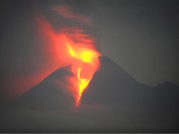
Mount Merapi, the Indonesian volcano, erupted in its largest explosion of the century, raining hot ash, toxic gas and molten rock on villagers outside the government–imposed danger zone, killing at least 78 and badly burning scores of others, AP reports.
The eruption sent a pyroclastic flow—an avalanche of rock and superheated gasses as hot as 1400 degrees F—rushing down the mountainside and into the village of Bronggang, nine miles from the volcano’s crater, burying the village in ash up to a foot deep.
The heat was so great that people’s clothing melted to their skin.
In terms of the amount of volcanic material released—1,765 million cubic feet (50 million cubic meter), “it was the biggest in at least a century,” state volcanologist Gede Swantika told AP. The eruption is the largest since the 1870’s, volcanologists report.
The government announced a danger zone of six miles from the crater on October 25, the day before the first eruption. The danger zone was increased to nine miles on November 3 as the eruptions grew stronger.
After Friday’s eruption, the government has expanded the danger zone to 12 miles from the crater.
Initially some 11,000 people were evacuated from the slopes of the mountain. That number has grown to 100,000 as the danger zone expands.
The eruption sent columns of smoke more than 30,000 feet into the sky. Earlier eruptions forced the closure of two Indonesia airports, and caused flights to be rerouted around the ash cloud. It is likely the latest eruption will again affect air travel.
Hopes for Fewer Eruptions Dashed
State volcanologist Gede Swantika had expressed some hope on October 27, after the second day of violent explosions, that Merapi might have vented sufficient pressure and would subside into dormancy. Instead, the eruptions have grown stronger with each passing day.
Thursday’s eruption had been the worst, but Friday’s was more powerful and much more deadly.
Volcanic activity is unusually high all across Indonesia with 22 of the nation’s 200 volcanoes at high or very high alert levels. According to Gede Swantika, five to ten on alert at a time would be considered normal.
“We can say this is quite extraordinary, about 20 at the same time,” Swantika said. “We have to keep an eye on those mountains ... But I cannot say or predict which will erupt. What we can do is monitor patterns.”
Indonesia lies in what is called the “Ring of Fire,” a zone of instability where several tectonic plates come together. The region is home to 75 percent of the planet’s volcanoes and the site of 90 percent of all earthquakes.