Modern Day Explorers Reach Norway’s Sea Bottom

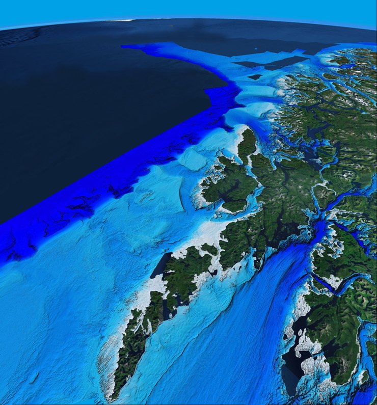
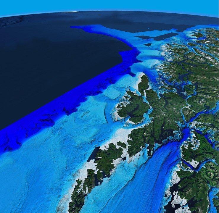
To date, the Norwegian MAREANO project has mapped almost 30,000 square miles of the ocean floor in the Barents Sea and the areas outside the Lofoten Islands in the Arctic Circle.
Modern Day Explorers Reach Norway’s Sea Bottom
Geological seabed map from mareano.no Geological Survey of Norway
Updated:
<a><img class="size-full wp-image-1783831" title="Lofoten-Svalbard" src="https://www.theepochtimes.com/assets/uploads/2015/09/Lofoten-Svalbard.jpg" alt="" width="740" height="795"/></a>

To date, the Norwegian MAREANO project has mapped almost 30,000 square miles of the ocean floor in the Barents Sea and the areas outside the Lofoten Islands in the Arctic Circle. The information being accessed for the first time ever, will be used to study the consequences of human activity on ocean ecosystems.

The mapping project offshore Norway started 10 years ago and in 2005, the MAREANO program was launched. By the end of 2012, they will have scanned almost 33,000 square miles off the northern coast of Norway, the Barents Sea, and the northern Norwegian Sea.

Six weeks per year, the program is out at sea, mapping depth, seabed conditions, biodiversity, biotopes, and pollution in the sediment. Among the techniques used, multi-beam echo sounders gather detailed information about the seabed’s topography. A box-corer collects seabed samples in order to study sediment composition.

“We know far more about the surface of the planet Mars than about the seabed right outside our coastline!” reads the project’s website, giving a sense of the scope of the discoveries.

A huge array of hitherto unknown creatures and cold-water coral reefs has already been discovered.
<a><img class=" wp-image-1783833   " title="TerjeThorsnes-1" src="https://www.theepochtimes.com/assets/uploads/2015/09/TerjeThorsnes-1.jpg" alt="" width="187" height="226"/></a>

Terje Thorsnes, responsible for geological mapping, says they are collecting a phenomenal amount of data.

“When we first began mapping, about 10 years ago, we were talking megabytes or gigabytes, now we are talking many terabytes of data. We are getting amazing amounts of good data,” he says.

The research team consists of biologists and geologists, and they are collaborating with universities in Norway and other geological surveys in Europe, Canada, the United States, Australia, and New Zealand.

One of the big challenges has been to find competent staff, since it is in direct competition for human resources with the Norwegian oil industry. As a result it must recruit internationally, so almost half the workforce comes from India, Britain, France, and Estonia.

The mapping team is a group of modern-day explorers, mapping and measuring places where no human being has ever been.

<a><img class="size-large wp-image-1783835" title="sea bed map" src="https://www.theepochtimes.com/assets/uploads/2015/09/sea-bed-map.jpg" alt="" width="590" height="382"/></a>

“It’s exciting! We are the first humans to ever get down there and actually see the seabed. We know that no one has been there before. The areas are so vast, and we can see it in such detail,” says Thorsnes.

The area being studied ranges in depth from 30 meters to 3,000 meters (98 feet to 9,843 feet), with the bulk being in the 100-meter and 400-meter range.

The mapping is intended to help industry and research, but primarily it’s to guide ocean management. Norway has been in the process of developing a management plan since 2000, mainly for the Barents Sea and the areas outside of Lofoten. This covers more than 386,000 square miles.

The management plan for the Barents Sea is one of the most advanced attempts at so-called ecosystem-based management. This is a method that seeks a holistic approach to the ecosystems and their relations to human activities.

Management plans for Skagerrak and the North Sea are also underway. The next area on the list is the Norwegian Sea, which has an area of about 540,000 square miles.

Kristine Gramstad, state secretary of the Norwegian Ministry of Fisheries and Coastal Affairs, says that the ministry is very much helped by the information the MAREANO program is collecting about seabed conditions, since her ministry makes decisions about human activities in the oceans.

“We can use them to decide the consequences of petroleum activities, for instance. The goal of the management is to provide a predictable frame for the activities, such as oil, shipping, and fishing. At the same time, we gain knowledge about the effects of human activities on nature and the ecosystem,” she said.

The MAREANO program is a collaboration between the Norwegian Institute of Marine Research, the Geological Survey of Norway, and the Norwegian Hydrographic Service.

The Epoch Times publishes in 35 countries and in 19 languages. Subscribe to our e-newsletter.

Related Topics