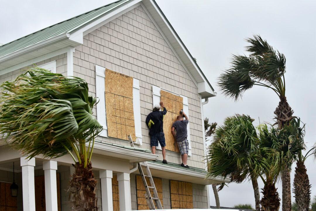
CAPE CANAVERAL, Fla.—Hurricane Matthew gained new fury as it hammered the central Bahamas early Thursday, and forecasters said the life-threatening storm is expected to strengthen as it approaches Florida’s heavily populated Atlantic coast.
The U.S. National Hurricane Center in Miami said Matthew, though still a dangerous Category 3 hurricane as the day dawned, was expected to regain status as an even more powerful Category 4 storm in coming hours. Top sustained winds ratcheted up from 115 mph to 125 mph overnight.
As the threat from the major hurricane rose along the Southeast seacoast, the center extended a hurricane warning area on a large swath of Florida’s east coast farther up to Altamaha Sound, Georgia. And it said a newly expanded hurricane watch area would now reach from the Altamaha Sound to the South Santee River in South Carolina.
As Matthew put the U.S. in its sights, about 2 million people were encouraged to head inland ahead of the most powerful storm to threaten the Atlantic coast in more than a decade. Matthew killed at least 16 people in the Caribbean as it cut through Haiti, Cuba and the Bahamas.
The storm is forecast to near the Florida coast starting Thursday night, potentially as a Category 4 storm with 130 mph winds. Any slight deviation could mean landfall or it heading farther out to sea. Either way, forecasters say it will come close enough to wreak havoc along the lower part of the East Coast, dumping up to 15 inches in rain in some spots. Storm surge of 5 feet to 8 feet was expected along the coast from central Florida into Georgia.
None of this mattered to John Long, who lives in the Florida town of Cape Canaveral.
“The hype is going to be worse than the actual storm. I feel I can do quite well,” said Long, who owns a bike shop and plans to ride out the storm with his cat in his 32-foot recreational vehicle a half-mile from the ocean. He has lived in the Space Coast area for three decades. “There’s always tremendous buildup and then it’s no stronger than an afternoon thunderstorm. I’m not anticipating that much damage,” he said Wednesday.
Florida Gov. Rick Scott has urged people to reconsider.
“This is a dangerous storm,” Scott said. “The storm has already killed people. We should expect the same impact in Florida.”
Similar warnings were issued in Georgia and the Carolinas, where the storm is expected to arrive by the weekend. The last Category 3 storm or higher to hit the United States was Wilma in October 2005. It made landfall with 120 mph winds in southwest Florida, killing five people as it slashed across the state.
[gallery size=“medium” ids=“2167964,2167963,2167962,2167961,2167960,2167959,2167958,2167957,2167956,2167955,2167954,2167953,2167952,2167951,2167950”]
In South Carolina, Gov. Nikki Haley reversed the lanes of Interstate 26 for the first time on Wednesday so that all lanes of traffic were headed west and out of Charleston. Plans to reverse the lanes were put in place after hourslong traffic jams during Hurricane Floyd in 1999.
Haley planned to call for more evacuations Thursday, which would bring the total to about 500,000 people in the state. Florida urged or ordered about 1.5 million to leave the coast, said Jackie Schutz, spokeswoman for Gov. Rick Scott. About 50,000 people were told to go in Georgia.
On Tybee Island, home to Georgia’s largest public beach, Loren Kook was loading up his pickup truck with suitcases and a computer late Wednesday afternoon. He and his wife were trying to decide whether to board up their windows overlooking the marsh grasses of Horsepen Creek before hitting the road to metro Atlanta.
“It seems like a lot of the longtime residents are staying,” said Kook, who moved to the coast four years ago. “I’ve never sat through a Category Whatever. I'll watch it on TV.”
Early Thursday, Matthew’s center was about 255 miles southeast of West Palm Beach, Florida, and slogging ever closer at a clip of 12 mph.
Yet despite evacuation orders and dire warnings, Robert and Georgette Tyler said they were staying put in their 500-square foot rental home in Cape Canaveral, undeterred that Matthew might soon be pounding at their door.
Taking a break from putting plywood on windows, Robert Tyler said he feared getting stuck in traffic and that it was too much trouble to pack up his motorcycles and firearms. He has two generators, 50 gallons of fuel and enough food and water for a week. Plus, he is a handyman and his phone will be ringing off the hook once the storm passes.
“It’s part of Florida life I guess, especially on the coast,” he said.


